
| ||||||
| ||||||
|
| Rwy | Rwy | |||||||
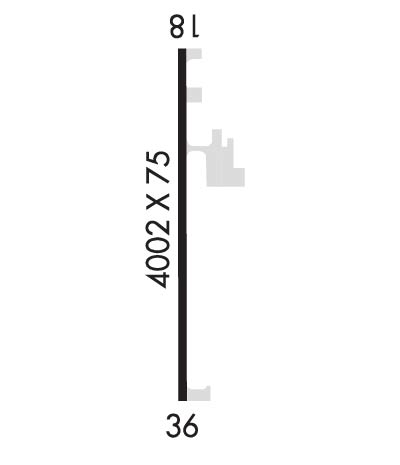
| 4002x75 | 4002' | 4002x75 | 4002' | |||||
| Runway ID | Single Wheel | Double Wheel | Double Tandem Wheel | Dual Double Wheel |
| 18/36 | 12,500 | N/A | N/A | N/A |
| These numbers are Advisory and are not limits. The Airport Manager should have more accurate Weight Limits | ||||
| FltPlan does not have IFR approach charts available for KM30. |
 Airport Diagram might not be current. | |
| Facility Name: | METROPOLIS MUNI |
| City Name: | METROPOLIS |
| County: | MASSAC |
| State abbrev: | IL |
| State Name: | ILLINOIS |
| Ownership: | PUBLICLY OWNED |
| Use: | OPEN TO THE PUBLIC |
| Owner's Name: | CITY OF METROPOLIS |
| Address: | CITY HALL, 106 W 5TH ST |
| METROPOLIS, IL 62960 | |
| Owner's Phone: | 618-524-4016 |
| Manager's Name: | WAYNE HELM |
| Address: | 751 AIRPORT RD |
| METROPOLIS, IL 62960 | |
| Phone: | 618-524-6765; EMAIL: METROPOLISMUNICIPALAIRPORT@GMAIL.COM |
| FAA Region: | GREAT LAKES |
| FAA Field Office: | CHI |
| Date | Sunrise | Sunset |
|---|---|---|
| 04/18/24 Thursday | 6:15 | 19:33 |
| 04/19/24 Friday | 6:14 | 19:34 |
| 04/20/24 Saturday | 6:13 | 19:35 |
| 04/21/24 Sunday | 6:12 | 19:36 |
| 04/22/24 Monday | 6:10 | 19:37 |
| 04/23/24 Tuesday | 6:09 | 19:38 |
| 04/24/24 Wednesday | 6:08 | 19:39 |
| 04/25/24 Thursday | 6:07 | 19:40 |
| 04/26/24 Friday | 6:05 | 19:41 |
| 04/27/24 Saturday | 6:04 | 19:41 |
| 04/28/24 Sunday | 6:03 | 19:42 |
| 04/29/24 Monday | 6:02 | 19:43 |
| 04/30/24 Tuesday | 6:01 | 19:44 |
| 05/01/24 Wednesday | 5:59 | 19:45 |
| Airport Attendance Schedule | 7 Days A Week IRREG |
| Airport Status | OPERATIONAL (This Status can change at any time - please check NOTAMS) |
| Airport Lighting Schedule | SS-SR |
| Airport Storage Available | Tie Downs, Hanger |
| Extra Services Available | Crop Dusting, Flight Instruction, Aircraft Rental, Aircraft Sales |
| Wind Indicator | YES - (lighted) |
| Control Tower | NO |
| CTAF Frequency | 122.800 |
| Unicom Frequency | 122.800 |
| Rotating Beacon Color | WG |
| Segmented Circle | NO |
| Landing Fee | NO |
| Airport Inspected | STATE - performed by STATE AERONAUTICAL PERSONNEL |
| Inspection Date | 06/08/2023 |
| Type of Fuel Available | Grade 100LL; -10SELF SVC FUEL AVBL 24 HRS WITH CREDIT CARD. |
| Airframe Repair Service | NONE |
| Power Plant Repair Service | NONE |
| Latitude | N3711.0 |
| Longitude | W08845.0 (ESTIMATED) |
| Arpt Elevation | 384ft (SURVEYED) |
| Magnetic Variation | 01E |
| 2 miles NW | of METROPOLIS |
| Traffic Pattern Altitude | |
| Sectional Chart | ST LOUIS |
| Operations (Reported) | Yearly | Avg. Daily |
|---|---|---|
| General Aviation Transient | 3000 | 8 |
| General Aviation Local | 9000 | 25 |
| Air Taxi | 1000 | 3 |
| Commerical | 0 | 0 |
| Commuter | 0 | 0 |
| Military | 0 | 0 |
| Aircraft based on Field | |
|---|---|
| General Aviation Singles | 12 |
| General Aviation Multi | 2 |
| Jet Aircraft | 0 |
| General Aviation Helicopters | 0 |
| Military Aircraft | 0 |
| Gliders | 0 |
| Ultralights | 0 |
| FSS on field | NO |
| FSS tie-in | SAINT LOUIS |
| FSS Phone | 1-800-WX-BRIEF |
| Who issues Notams | M30 |
| Notam D service at airport | YES |
| ARTCC Name | MEMPHIS |
| Airport Certification | |
| Aircraft Rescue & Firefighting Index | None |
| Airport of Entry | No |
| Custom Landing Rights | No |
| Joint Civil/Military | No |
| Military Landing rights | No |
| NATIONAL PLAN OF INTEGRATED AIRPORT SYSTEMS (NPIAS) |
| GRANT AGREEMENTS UNDER FAAP/ADAP/AIP |
| ASSURANCES PURSUANT TO TITLE VI, CIVIL RIGHTS ACT OF 1964 |
| AVOID FACTORY LCTD 4000 FT SW OF RY 18/36. |
| FOR CD CTC MEMPHIS ARTCC AT 901-368-8453/8449. |
| Runway: 18 | Runway: 36 | ||
| Mag heading: | N/A | Mag heading: | N/A |
| Rwy Slope: | -.26% Down | Rwy Slope: | .26% Up |
| Approach: | Approach: | ||
| Pattern: | Left Traffic | Pattern: | Left Traffic |
| Markings: | BASIC | Markings: | BASIC |
| Marking Condition: | FAIR | Marking Condition: | FAIR |
| Arresting Dev: | Arresting Dev: | ||
| Lat & Long: | N3711.3 W08845.0 | Lat. & Long.: | N3710.6 W08845.0 |
| Elev: | 382.3 ft. MSL | Elev: | 371.9 ft. MSL |
| TCH: | TCH: | ||
| Visual Glide Path: | Visual Glide Path: | ||
| Displaced Threshold: | No | Displaced Threshold: | No |
| Touchdown Zone: | YES | Touchdown Zone: | YES |
| Touchdown Elev.: | 384.3 feet | Touchdown Elev.: | 383.6 feet |
| Visual Glide Slope: | Visual Glide Slope: | ||
| RVR Equipment: | RVR Equipment: | ||
| RVV Equipment: | NO | RVV Equipment: | NO |
| Approach Lights: | Approach Lights: | ||
| REIL: | NO | REIL: | NO |
| Centerline Lights: | NO | Centerline Lights: | NO |
| Touchdown lights: | NO | Touchdown lights: | NO |
| Runway Category: | Runway with a Visual Approach | Runway Category: | Runway with a Visual Approach |
| Declared Distances: | Declared Distances: |
