Click here for more info on on SMS!

KM29

HASSELL FIELD
CLIFTON
TN
Time Zone: Central
Lat: N 3523.0
Long: W 08758.1
Elev: 407
Var: -01
Longest Runway: 4200
CTAF: 122.9

FBO & Flight Services info for KM29

FBOs: Update your Fuel Prices

CLIFTON AIRPORTPh: 931-676-7405
-
Freq: 122.9
Service
Jet
100LL
SAF
MoGas
Full        Last Update: 04/01/2024 13:33

Self  4.45    
If you are an FBO, call 1-203-262-1700 to update your info or email: FltPlan.Advertising@garmin.com
Advertise your FBO on FltPlan.com

Runway & Approach Info for KM29
Rwy
Length
Land Dist**
Approach*
  Rwy
Length
Land Dist**
Approach*
03
4200x75  4200'          
 
  
21
  4200x75  3500'          
 
 * only ILS, LOC, LDA, and SDF approaches to a specific runway are shown
** For any Declared Landing Distance Available, please see A/FD or Approach plates
Runway Weight Capability (lbs.) Help
Runway IDSingle WheelDouble WheelDouble Tandem WheelDual Double Wheel
03/2130,000N/AN/AN/A
These numbers are Advisory and are not limits.   The Airport Manager should have more accurate Weight Limits
Approach Charts
FltPlan does not have IFR approach charts available for KM29.
Current Weather/Notams
Customs Information Send updates to Support@FltPlan.com
Customs Not Available
Database effective 05/16/2024
Airport Diagram of KM29
Airport Diagram might not be current.

Facility Name: HASSELL FLD
City Name: CLIFTON
County: WAYNE
State abbrev: TN
State Name: TENNESSEE
   
Ownership: PUBLICLY OWNED
Use: OPEN TO THE PUBLIC
Owner's Name: CITY OF CLIFTON
Address: CITY HALL
 CLIFTON, TN 38425
Owner's Phone: 931-676-3370
  
Manager's Name: DOUG KIBBEY
Address: BOX 192
 CLIFTON, TN 38425
Phone: 931-676-3370
   
FAA Region: SOUTHERN
FAA Field Office: MEM


Sunrise / Sunset times for HASSELL FLD

DateSunriseSunset
04/24/24 Wednesday6:0719:33
04/25/24 Thursday6:0619:34
04/26/24 Friday6:0519:35
04/27/24 Saturday6:0419:35
04/28/24 Sunday6:0319:36
04/29/24 Monday6:0219:37
04/30/24 Tuesday6:0119:38
05/01/24 Wednesday6:0019:39
05/02/24 Thursday5:5919:40
05/03/24 Friday5:5819:40
05/04/24 Saturday5:5619:41
05/05/24 Sunday5:5619:42
05/06/24 Monday5:5519:43
05/07/24 Tuesday5:5419:44

Airport Facilities

Airport Attendance ScheduleUNATTENDED
Airport Status OPERATIONAL (This Status can change at any time - please check NOTAMS)
Airport Lighting Schedule
Airport Storage AvailableTie Downs
Extra Services AvailableNONE
Wind IndicatorYES - (unlit)
Control TowerNO
CTAF Frequency122.900
Unicom Frequency
Rotating Beacon Color
Segmented CircleYES
Landing FeeNO

Airport Inspection Data

Airport InspectedSTATE - performed by STATE AERONAUTICAL PERSONNEL
Inspection Date03/27/2024

Airport Services

Type of Fuel AvailableGrade 100LL; -10SELF SVC.
Airframe Repair ServiceNone
Power Plant Repair ServiceNone

Geographic Data

LatitudeN3523.0
LongitudeW08758.1 (ESTIMATED)
Arpt Elevation406ft (SURVEYED)
Magnetic Variation01E
1 miles Eof CLIFTON
Traffic Pattern Altitude
Sectional ChartATLANTA

Aircraft Data

Operations (Reported)YearlyAvg. Daily
General Aviation Transient 3001
General Aviation Local 2761
Air Taxi 00
Commerical 00
Commuter 00
Military 00
Aircraft based on Field
General Aviation Singles 10
General Aviation Multi 0
Jet Aircraft 0
General Aviation Helicopters 0
Military Aircraft 0
Gliders 0
Ultralights 0

FAA Services

FSS on field NO
FSS tie-in JACKSON
FSS Phone 1-800-WX-BRIEF
Who issues Notams MKL
Notam D service at airport YES
ARTCC Name MEMPHIS

Federal Status

Airport Certification
Aircraft Rescue & Firefighting IndexNone
Airport of EntryNo
Custom Landing RightsNo
Joint Civil/MilitaryNo
Military Landing rightsNo

Federal Agreements

NATIONAL PLAN OF INTEGRATED AIRPORT SYSTEMS (NPIAS)

Remarks

FOR CD CTC MEMPHIS ARTCC AT 901-368-8453/8449.
RWY 03/2 1 14 FT RAPIDLY RISING TRRN NE TO 400 FT PAST RWY END SW.
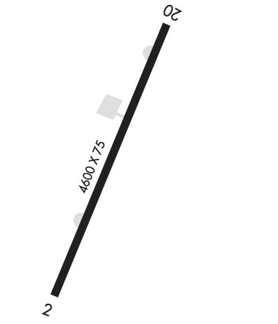
Runway Identifications
Runway Identification: 03/21
Length: 4200 ft
Width: 75 ft
Surface: ASPHALT-GOOD CONDITION
Edge lights:

Treatment: NONE

 Runway: 03   Runway: 21
Mag heading: 18°Mag heading: 198°
Rwy Slope: .31% UpRwy Slope: -.31% Down
Approach: Approach:
Pattern: Left TrafficPattern: Left Traffic
Markings: BASICMarkings: BASIC
Marking Condition: GOODMarking Condition: GOOD
Arresting Dev: Arresting Dev:
Lat & Long: N3522.7  W08758.2Lat. & Long.: N3523.3  W08758.0
Elev: 393.6 ft. MSLElev: 406.6 ft. MSL
TCH: TCH:
Visual Glide Path: Visual Glide Path:
Displaced Threshold: NoDisplaced Threshold: 700 feet
Touchdown Zone: YESTouchdown Zone: YES
Touchdown Elev.: 393.6 feetTouchdown Elev.: 397.1 feet
Visual Glide Slope: Visual Glide Slope:
RVR Equipment: RVR Equipment:
RVV Equipment: NORVV Equipment: NO
Approach Lights: Approach Lights:
REIL: NOREIL: NO
Centerline Lights: NOCenterline Lights: NO
Touchdown lights: NOTouchdown lights: NO
Runway Category: Runway with a Visual ApproachRunway Category: Runway with a Visual Approach
Declared Distances: Declared Distances:
Obstructions: TREESObstructions:
Marked: NOT Marked/LightedMarked:
Clearance slope: 20:1Clearance slope: 20:1; APCH RATIO 22:1 TO DTHR.
Obstruction height: 86 feet AGLObstruction height:
Dist. from runway: 1920 feetDist. from runway:
Centerline offset: 109 left of centerlineCenterline offset:
Comments: Comments:
C:/P: