Current Weather/Notams (Metars, TAFs, Notams, NWS Forecast, PIREPS, and nearby weather)
Customs Information Send updates to Support@FltPlan.com
Customs Not Available
Database effective 05/16/2024
Airport Diagram might not be current.
|
| Facility Name: | WILLIAM L WHITEHURST FLD |
| City Name: | BOLIVAR |
| County: | HARDEMAN |
| State abbrev: | TN |
| State Name: | TENNESSEE |
| | |
| Ownership: | PUBLICLY OWNED |
| Use: | OPEN TO THE PUBLIC |
| Owner's Name: | HARDEMAN COUNTY |
| Address: | HARDEMAN COUNTY COURTHOUSE, BOX 250 |
| | BOLIVAR, TN 38009 |
| Owner's Phone: | 731-658-3266 |
| | |
| Manager's Name: | SHELBY W. ISHAM |
| Address: | 800 AIRPORT RD |
| | BOLIVAR, TN 38008 |
| Phone: | 731-658-7556; AFT HR 731-658-4547. |
| | |
| FAA Region: | SOUTHERN |
| FAA Field Office: | MEM |
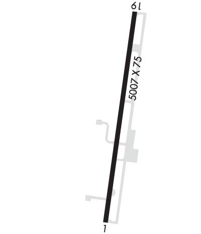
Runway Identifications
Runway Identification: 01/19Length: 5007 ft
Width: 75 ft
Surface: ASPHALT-FAIR CONDITION
Edge lights: Medium IntensityTreatment: NONE
Weight: PCN 11 /F/D/X/T
| | Runway: 01 | | Runway: 19 |
| Mag heading: | 8° | Mag heading: | 188° |
| Rwy Slope: | -.12% Down | Rwy Slope: | .12% Up |
| Approach: | | Approach: | |
| Pattern: | Left Traffic | Pattern: | Left Traffic |
| Markings: | NONPRECISION INSTRUMENT | Markings: | NONPRECISION INSTRUMENT |
| Marking Condition: | FAIR | Marking Condition: | FAIR |
| Arresting Dev: | | Arresting Dev: | |
| Lat & Long: | N3512.5 W08902.7 | Lat. & Long.: | N3513.3 W08902.5 |
| Elev: | 499.0 ft. MSL | Elev: | 493.0 ft. MSL |
| TCH: | 33 ft. AGL | TCH: | 29 ft. AGL |
| Visual Glide Path: | 3.05 degrees | Visual Glide Path: | 3.00 degrees |
| Displaced Threshold: | No | Displaced Threshold: | No |
| Touchdown Zone: | YES | Touchdown Zone: | YES |
| Touchdown Elev.: | 499.1 feet | Touchdown Elev.: | 497.0 feet |
| Visual Glide Slope: | 2-Light PAPI on LEFT side of Runway | Visual Glide Slope: | 2-Light PAPI on LEFT side of Runway |
| RVR Equipment: | | RVR Equipment: | |
| RVV Equipment: | NO | RVV Equipment: | NO |
| Approach Lights: | | Approach Lights: | |
| REIL: | YES | REIL: | YES |
| Centerline Lights: | NO | Centerline Lights: | NO |
| Touchdown lights: | NO | Touchdown lights: | NO |
| Runway Category: | Runway with a Non-precision Approach | Runway Category: | Runway with a Non-precision Approach |
| Declared Distances: | | Declared Distances: | |
| Obstructions: | TREES | Obstructions: | TREES |
| Marked: | NOT Marked/Lighted | Marked: | NOT Marked/Lighted |
| Clearance slope: | 19:1 | Clearance slope: | 20:1 |
| Obstruction height: | 43 feet AGL | Obstruction height: | 66 feet AGL |
| Dist. from runway: | 1043 feet | Dist. from runway: | 1534 feet |
| Centerline offset: | 34 left of centerline | Centerline offset: | 378 feet left of centerline |
| Comments: | | Comments: | |

