Click here for more info on on SMS!

KLWD

LAMONI MUNI
LAMONI
IA
Time Zone: Central
Lat: N 4037.9
Long: W 09354.1
Elev: 1131
Var: -03
Longest Runway: 3400
AWOS: 120.0
CTAF: 122.9

FBO & Flight Services info for KLWD

FBOs: Update your Fuel Prices

LAMONI MUNICIPALPh: 515-480-7289
-
Freq: 122.9
Service
Jet
100LL
SAF
MoGas
Fuel Avail: 24 /7 S SERV
Full        Last Update: 03/22/2024 09:19
PRICES GUARANTEED by FBO.
Self  5.89    
 Address: 28577 AIRPORT RD   LAMONI, IA 28577
ASOSPh: 641-784-8122
-
Freq: 120.0  
If you are an FBO, call 1-203-262-1700 to update your info or email: FltPlan.Advertising@garmin.com
Advertise your FBO on FltPlan.com

Runway & Approach Info for KLWD
Rwy
Length
Land Dist**
Approach*
  Rwy
Length
Land Dist**
Approach*
18
3400x60  3400'          
 
  
36
  3400x60  3400'          
 
 * only ILS, LOC, LDA, and SDF approaches to a specific runway are shown
** For any Declared Landing Distance Available, please see A/FD or Approach plates
Runway Weight Capability (lbs.) Help
Runway IDSingle WheelDouble WheelDouble Tandem WheelDual Double Wheel
18/36N/AN/AN/AN/A
These numbers are Advisory and are not limits.   The Airport Manager should have more accurate Weight Limits
Approach Charts
Approaches    
Current Weather/Notams
Customs Information Send updates to Support@FltPlan.com
Customs Not Available
Database effective 04/18/2024
Airport Diagram of KLWD
Airport Diagram might not be current.

Facility Name: LAMONI MUNI
City Name: LAMONI
County: DECATUR
State abbrev: IA
State Name: IOWA
   
Ownership: PUBLICLY OWNED
Use: OPEN TO THE PUBLIC
Owner's Name: CITY OF LAMONI
Address: 190 S. CHESTNUT
 LAMONI, IA 50140
Owner's Phone: 641-784-6311
  
Manager's Name: JORDAN OMSTEAD
Address: 190 SOUTH CHESTNUT STREET
 LAMONI, IA 50140
Phone: (719) 648-9924
   
FAA Region: CENTRAL
FAA Field Office: NONE


Sunrise / Sunset times for LAMONI MUNI

DateSunriseSunset
04/17/24 Wednesday6:3319:58
04/18/24 Thursday6:3119:59
04/19/24 Friday6:3020:00
04/20/24 Saturday6:2820:01
04/21/24 Sunday6:2720:02
04/22/24 Monday6:2520:03
04/23/24 Tuesday6:2420:04
04/24/24 Wednesday6:2320:05
04/25/24 Thursday6:2120:06
04/26/24 Friday6:2020:07
04/27/24 Saturday6:1920:08
04/28/24 Sunday6:1720:09
04/29/24 Monday6:1620:10
04/30/24 Tuesday6:1520:11

Airport Facilities

Airport Attendance ScheduleUNATTENDED
Airport Status OPERATIONAL (This Status can change at any time - please check NOTAMS)
Airport Lighting ScheduleACTVT MIRL RY 18/36 - 122.9.
Airport Storage AvailableTie Downs, Hanger
Extra Services AvailableNONE
Wind IndicatorYES - (lighted)
Control TowerNO
CTAF Frequency122.900
Unicom Frequency
Rotating Beacon ColorWG
Segmented CircleNO
Landing FeeNO

Airport Inspection Data

Airport InspectedSTATE - performed by STATE AERONAUTICAL PERSONNEL
Inspection Date06/03/2021

Airport Services

Type of Fuel AvailableGrade 100LL; -10SELF SERVICE FUEL 24 HRS. CREDIT CARD
Airframe Repair ServiceNONE
Power Plant Repair ServiceNONE

Geographic Data

LatitudeN4037.9
LongitudeW09354.1 (ESTIMATED)
Arpt Elevation1130ft (ESTIMATED)
Magnetic Variation03E
2 miles NEof LAMONI
Traffic Pattern Altitude
Sectional ChartCHICAGO

Aircraft Data

Operations (Reported)YearlyAvg. Daily
General Aviation Transient 389811
General Aviation Local 13524
Air Taxi 00
Commerical 00
Commuter 00
Military 00
Aircraft based on Field
General Aviation Singles 15
General Aviation Multi 2
Jet Aircraft 0
General Aviation Helicopters 0
Military Aircraft 0
Gliders 0
Ultralights 3

FAA Services

FSS on field NO
FSS tie-in FORT DODGE
FSS Phone 1-800-WX-BRIEF
Who issues Notams LWD
Notam D service at airport YES
ARTCC Name MINNEAPOLIS

Federal Status

Airport Certification
Aircraft Rescue & Firefighting IndexNone
Airport of EntryNo
Custom Landing RightsNo
Joint Civil/MilitaryNo
Military Landing rightsNo

Federal Agreements

NATIONAL PLAN OF INTEGRATED AIRPORT SYSTEMS (NPIAS)

Remarks

ULTRALIGHTS ON & INVOF ARPT.
FOR CD CTC MINNEAPOLIS ARTCC AT 651-463-5588.
Airport Communications & Frequencies:
CTAF Frequency:
122.900
Remarks
  • APCH/DEP SVC PRVDD BY MINNEAPOLIS ARTCC ON FREQS 125.65/306.95 (DES MOINES RCAG).
  • Runway Identifications
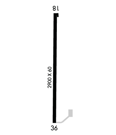
    Runway Identification: 18/36
    Length: 3400 ft
    Width: 60 ft
    Surface: CONCRETE-GOOD CONDITION
    Edge lights: Medium Intensity

    Treatment: NONE
    Weight: PCN 6 /R/D/W/U

     Runway: 18   Runway: 36
    Mag heading: 178°Mag heading: 358°
    Rwy Slope: .02% UpRwy Slope: -.02% Down
    Approach: Approach:
    Pattern: Left TrafficPattern: Left Traffic
    Markings: NONPRECISION INSTRUMENTMarkings: NONPRECISION INSTRUMENT
    Marking Condition: GOODMarking Condition: GOOD
    Arresting Dev: Arresting Dev:
    Lat & Long: N4038.2  W09354.1Lat. & Long.: N4037.7  W09354.1
    Elev: 1128.7 ft. MSLElev: 1129.3 ft. MSL
    TCH: TCH:
    Visual Glide Path: Visual Glide Path:
    Displaced Threshold: NoDisplaced Threshold: No
    Touchdown Zone: YESTouchdown Zone: YES
    Touchdown Elev.: 1130.6 feetTouchdown Elev.: 1130.6 feet
    Visual Glide Slope: Visual Glide Slope:
    RVR Equipment: RVR Equipment:
    RVV Equipment: NORVV Equipment: NO
    Approach Lights: Approach Lights:
    REIL: NOREIL: NO
    Centerline Lights: NOCenterline Lights: NO
    Touchdown lights: NOTouchdown lights: NO
    Runway Category: Runway with a Non-precision ApproachRunway Category: Runway with a Non-precision Approach
    Declared Distances: Declared Distances:
    Obstructions: TREEObstructions: TREES
    Marked: NOT Marked/LightedMarked: NOT Marked/Lighted
    Clearance slope: 20:1Clearance slope: 31:1
    Obstruction height: 7 feet AGLObstruction height: 32 feet AGL
    Dist. from runway: 340 feetDist. from runway: 1197 feet
    Centerline offset: Centerline offset: 81 feet left of centerline
    Comments: Comments:
    C:1/P: