
| ||||||||||||||||||||||||||||||||
| ||||||||||||||||||||||||||||||||
| ||||||||||||||||||||||||||||||||
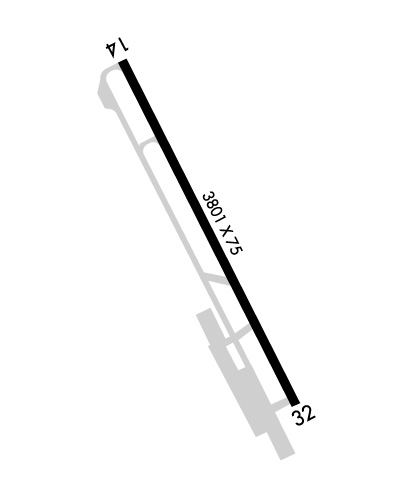
| Rwy | Rwy | |||||||
| 3801x75 | 3801' | 3801x75 | 3801' | |||||
| Runway ID | Single Wheel | Double Wheel | Double Tandem Wheel | Dual Double Wheel |
| 14/32 | 23,000 | N/A | N/A | N/A |
| These numbers are Advisory and are not limits. The Airport Manager should have more accurate Weight Limits | ||||
 Airport Diagram might not be current. | |
| Facility Name: | LOS BANOS MUNI |
| City Name: | LOS BANOS |
| County: | MERCED |
| State abbrev: | CA |
| State Name: | CALIFORNIA |
| Ownership: | PUBLICLY OWNED |
| Use: | OPEN TO THE PUBLIC |
| Owner's Name: | CITY OF LOS BANOS |
| Address: | 520 J STREET |
| LOS BANOS, CA 93635-4240 | |
| Owner's Phone: | 209-827-7034 |
| Manager's Name: | NIRORN THAN; DIRECTOR OF PUBLIC WORKS. MARK.FACHIN@LOSBANOS.ORG |
| Address: | 411 MADISON AVENUE |
| LOS BANOS, CA 93635-4214 | |
| Phone: | (209) 827-7056 |
| FAA Region: | WESTERN-PACIFIC |
| FAA Field Office: | SFO |
| Date | Sunrise | Sunset |
|---|---|---|
| 04/18/24 Thursday | 6:24 | 19:42 |
| 04/19/24 Friday | 6:23 | 19:43 |
| 04/20/24 Saturday | 6:21 | 19:44 |
| 04/21/24 Sunday | 6:20 | 19:44 |
| 04/22/24 Monday | 6:19 | 19:45 |
| 04/23/24 Tuesday | 6:18 | 19:46 |
| 04/24/24 Wednesday | 6:16 | 19:47 |
| 04/25/24 Thursday | 6:15 | 19:48 |
| 04/26/24 Friday | 6:14 | 19:49 |
| 04/27/24 Saturday | 6:13 | 19:50 |
| 04/28/24 Sunday | 6:12 | 19:51 |
| 04/29/24 Monday | 6:10 | 19:52 |
| 04/30/24 Tuesday | 6:09 | 19:53 |
| 05/01/24 Wednesday | 6:08 | 19:53 |
| Airport Attendance Schedule | UNATTENDED |
| Airport Status | OPERATIONAL (This Status can change at any time - please check NOTAMS) |
| Airport Lighting Schedule | MIRL RY 14/32 PRESET LOW INTST UNTIL 2400. TO INCR INTST AND ACTVT MIRL, REIL RY 14, RY 32 AND PAPI RY 14 AND RY 32 - CTAF. |
| Airport Storage Available | Tie Downs |
| Extra Services Available | NONE |
| Wind Indicator | YES - (lighted) |
| Control Tower | NO |
| CTAF Frequency | 122.800 |
| Unicom Frequency | 122.800 |
| Rotating Beacon Color | WG |
| Segmented Circle | YES |
| Landing Fee | NO |
| Airport Inspected | STATE - performed by STATE AERONAUTICAL PERSONNEL |
| Inspection Date | 04/04/2023 |
| Type of Fuel Available | Grade 100LL, JET A (freeze point -40C); -1024 HR AUTOMATED FUEL AVBL WITH MAJOR CREDIT CARD. CALL 209-827-7070 AFTER HRS FOR EMERG FULL SRV. |
| Airframe Repair Service | MINOR |
| Power Plant Repair Service | MINOR |
| Latitude | N3703.8 |
| Longitude | W12052.2 (ESTIMATED) |
| Arpt Elevation | 121ft (SURVEYED) |
| Magnetic Variation | 16E |
| 1 miles W | of LOS BANOS |
| Traffic Pattern Altitude | 800 |
| Sectional Chart | SAN FRANCISCO |
| Operations (Reported) | Yearly | Avg. Daily |
|---|---|---|
| General Aviation Transient | 6400 | 18 |
| General Aviation Local | 9600 | 26 |
| Air Taxi | 0 | 0 |
| Commerical | 0 | 0 |
| Commuter | 0 | 0 |
| Military | 0 | 0 |
| Aircraft based on Field | |
|---|---|
| General Aviation Singles | 17 |
| General Aviation Multi | 0 |
| Jet Aircraft | 1 |
| General Aviation Helicopters | 0 |
| Military Aircraft | 0 |
| Gliders | 1 |
| Ultralights | 0 |
| FSS on field | NO |
| FSS tie-in | RANCHO MURIETA |
| FSS Phone | 1-800-WX-BRIEF |
| Who issues Notams | RIU |
| Notam D service at airport | YES |
| ARTCC Name | OAKLAND |
| Airport Certification | |
| Aircraft Rescue & Firefighting Index | None |
| Airport of Entry | No |
| Custom Landing Rights | No |
| Joint Civil/Military | No |
| Military Landing rights | YES |
| NATIONAL PLAN OF INTEGRATED AIRPORT SYSTEMS (NPIAS) |
| GRANT AGREEMENTS UNDER FAAP/ADAP/AIP |
| ASSURANCES PURSUANT TO TITLE VI, CIVIL RIGHTS ACT OF 1964 |
| AVOID OVERFLIGHT OF HOUSES SOUTH OF ARPT. |
| NO DEPS OVER HOUSING AREAS TO EAST OF ARPT. |
| FOR CD CTC NORCAL APCH AT 916-361-0516. |
| RWY 14/3 2 WDSPR OPEN, UNSEALED CRACKS AND JOINTS. THERE ARE CRACKS OVER 2 INS WIDE WITH RAVELING IN 25 PCT OF THE CRACKS. CRACKS ARE GENLY SPACED 5 TO 50 FT APART WITH SFC AND SLAB SPALLING. ALLIGATOR CRACKING OR PATCHES ARE IN POOR COND AND COVER UP TO 20 PCT OF THE SFC, OR THERE IS VEGETATION THRU THE |
Airport Communications & Frequencies:
| |||||||||||||||||
| Runway: 14 | Runway: 32 | ||
| Mag heading: | 137° | Mag heading: | 317° |
| Rwy Slope: | .02% Up | Rwy Slope: | -.02% Down |
| Approach: | Approach: | ||
| Pattern: | Right Traffic | Pattern: | Left Traffic |
| Markings: | BASIC | Markings: | BASIC |
| Marking Condition: | FAIR | Marking Condition: | FAIR |
| Arresting Dev: | Arresting Dev: | ||
| Lat & Long: | N3704.1 W12052.4 | Lat. & Long.: | N3703.6 W12052.0 |
| Elev: | 120.8 ft. MSL | Elev: | 121.4 ft. MSL |
| TCH: | 30 ft. AGL | TCH: | 38 ft. AGL |
| Visual Glide Path: | 3.00 degrees | Visual Glide Path: | 3.00 degrees |
| Displaced Threshold: | No | Displaced Threshold: | No |
| Touchdown Zone: | YES | Touchdown Zone: | YES |
| Touchdown Elev.: | 120.8 feet | Touchdown Elev.: | 121.4 feet |
| Visual Glide Slope: | 2-Light PAPI on LEFT side of Runway | Visual Glide Slope: | 2-Light PAPI on LEFT side of Runway |
| RVR Equipment: | RVR Equipment: | ||
| RVV Equipment: | NO | RVV Equipment: | NO |
| Approach Lights: | Approach Lights: | ||
| REIL: | YES | REIL: | YES |
| Centerline Lights: | NO | Centerline Lights: | NO |
| Touchdown lights: | NO | Touchdown lights: | NO |
| Runway Category: | Runway with a Non-precision Approach | Runway Category: | Runway with a Non-precision Approach |
| Declared Distances: | Declared Distances: | ||
| Obstructions: | PLINE | Obstructions: | TREE |
| Marked: | NOT Marked/Lighted | Marked: | NOT Marked/Lighted |
| Clearance slope: | 33:1 | Clearance slope: | 21:1 |
| Obstruction height: | 40 feet AGL | Obstruction height: | 25 feet AGL |
| Dist. from runway: | 1500 feet | Dist. from runway: | 760 feet |
| Centerline offset: | 50 left of centerline | Centerline offset: | 25 feet right of centerline |
| Comments: | Comments: |
