Click here for more info on on SMS!

KLRY

LAWRENCE SMITH MEMORIAL
HARRISONVILLE
MO
Time Zone: Central
Lat: N 3836.6
Long: W 09420.6
Elev: 915
Var: -04
Longest Runway: 4000
AWOS: 119.97
CTAF: 123.0

FBO & Flight Services info for KLRY

FBOs: Update your Fuel Prices
Providing high quality fuel and services to you and your customers, from Phillips 66 Aviation.
Ph: 816-380-5039 Fax: 816-380-5142 Freq: 123.0WebsiteE-Mail
                                         
Service
Jet
100LL
SAF
MoGas
Fuel Avail: 24/7 SELF SERV
Full        Last Update: 04/05/2024 08:18

Self  4.48    
Misc. Info: Office Hours M-F 8-5 (call to verify attendance if needed)Address: 27503 STATE RTE 7 SOUTH   HARRISONVILLE, MO 64701

AWOSPh: 816-380-5936
-
Freq: 119.97  
If you are an FBO, call 1-203-262-1700 to update your info or email: FltPlan.Advertising@garmin.com
Advertise your FBO on FltPlan.com

Runway & Approach Info for KLRY
Rwy
Length
Land Dist**
Approach*
  Rwy
Length
Land Dist**
Approach*
17
4000x75  4000'          
 
  
35
  4000x75  4000'          
 
 * only ILS, LOC, LDA, and SDF approaches to a specific runway are shown
** For any Declared Landing Distance Available, please see A/FD or Approach plates
Runway Weight Capability (lbs.) Help
Runway IDSingle WheelDouble WheelDouble Tandem WheelDual Double Wheel
17/3512,500N/AN/AN/A
These numbers are Advisory and are not limits.   The Airport Manager should have more accurate Weight Limits
Approach Charts
Approaches    
Current Weather/Notams
Customs Information Send updates to Support@FltPlan.com
Customs Not Available
Database effective 04/18/2024
Airport Diagram of KLRY
Airport Diagram might not be current.

Facility Name: LAWRENCE SMITH MEML
City Name: HARRISONVILLE
County: CASS
State abbrev: MO
State Name: MISSOURI
   
Ownership: PUBLICLY OWNED
Use: OPEN TO THE PUBLIC
Owner's Name: CITY OF HARRISONVILLE
Address: PO BOX 367
 HARRISONVILLE, MO 64701
Owner's Phone: 816-380-8900
  
Manager's Name: MICHAEL NEWMAN
Address: PO BOX 367
 HARRISONVILLE, MO 64701
Phone: (660) 422-2090
   
FAA Region: CENTRAL
FAA Field Office: NONE


Sunrise / Sunset times for LAWRENCE SMITH MEML

DateSunriseSunset
04/17/24 Wednesday6:3719:57
04/18/24 Thursday6:3619:58
04/19/24 Friday6:3519:59
04/20/24 Saturday6:3320:00
04/21/24 Sunday6:3220:01
04/22/24 Monday6:3020:02
04/23/24 Tuesday6:2920:03
04/24/24 Wednesday6:2820:03
04/25/24 Thursday6:2720:04
04/26/24 Friday6:2520:05
04/27/24 Saturday6:2420:06
04/28/24 Sunday6:2320:07
04/29/24 Monday6:2220:08
04/30/24 Tuesday6:2020:09

Airport Facilities

Airport Attendance ScheduleMON-FRI 0800-1700, SAT-SUN IREG
Airport Status OPERATIONAL (This Status can change at any time - please check NOTAMS)
Airport Lighting ScheduleACTVT PAPI RWY 17 & 35; MIRL RWY 17/35 - CTAF.
Airport Storage AvailableTie Downs
Extra Services AvailableCrop Dusting, Air Ambulance, Charter, Flight Instruction, Aircraft Rental, Aircraft Sales
Wind IndicatorYES - (lighted)
Control TowerNO
CTAF Frequency123.000
Unicom Frequency123.000
Rotating Beacon ColorWG
Segmented CircleYES
Landing FeeNO

Airport Inspection Data

Airport InspectedSTATE - performed by STATE AERONAUTICAL PERSONNEL
Inspection Date08/12/2021

Airport Services

Type of Fuel AvailableGrade 100LL; -1024-HR SELF SVC FUEL.
Airframe Repair ServiceMINOR
Power Plant Repair ServiceMINOR

Geographic Data

LatitudeN3836.6
LongitudeW09420.6 (ESTIMATED)
Arpt Elevation915ft (SURVEYED)
Magnetic Variation04E
3 miles Sof HARRISONVILLE
Traffic Pattern Altitude
Sectional ChartKANSAS CITY

Aircraft Data

Operations (Reported)YearlyAvg. Daily
General Aviation Transient 508014
General Aviation Local 687019
Air Taxi 200
Commerical 00
Commuter 00
Military 300
Aircraft based on Field
General Aviation Singles 34
General Aviation Multi 2
Jet Aircraft 0
General Aviation Helicopters 1
Military Aircraft 0
Gliders 0
Ultralights 0

FAA Services

FSS on field NO
FSS tie-in COLUMBIA
FSS Phone 1-800-WX-BRIEF
Who issues Notams COU
Notam D service at airport YES
ARTCC Name KANSAS CITY

Federal Status

Airport Certification
Aircraft Rescue & Firefighting IndexNone
Airport of EntryNo
Custom Landing RightsNo
Joint Civil/MilitaryNo
Military Landing rightsNo

Federal Agreements

NATIONAL PLAN OF INTEGRATED AIRPORT SYSTEMS (NPIAS)
GRANT AGREEMENTS UNDER FAAP/ADAP/AIP
ASSURANCES PURSUANT TO TITLE VI, CIVIL RIGHTS ACT OF 1964

Remarks

ULTRALIGHTS ON & INVOF ARPT.
AIR AMBULANCE HELICOPTER OPS ON AND INVOF ARPT.
FOR CD CTC KANSAS CITY APCH AT 816-329-2710.
DEER AND OTHER WILDFLIFE ON AND INVOF ARPT.
RWY 17/3 5 RWY HAS EXTSV CRACKING.
Airport Communications & Frequencies:
CTAF Frequency:
123.000
Unicom Frequency:
123.000
Remarks
  • APCH/DEP SVC PRVDD BY KANSAS CITY ARTCC ON FREQS 125.55/327.0 (BUTLER RCAG).
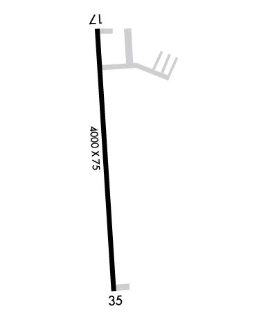
  • Runway Identifications
    Runway Identification: 17/35
    Length: 4000 ft
    Width: 75 ft
    Surface: ASPHALT-POOR CONDITION
    Edge lights: Medium Intensity

    Treatment: NONE

     Runway: 17   Runway: 35
    Mag heading: 173°Mag heading: 353°
    Rwy Slope: -1.02% DownRwy Slope: 1.02% Up
    Approach: Approach:
    Pattern: Left TrafficPattern: Left Traffic
    Markings: NONPRECISION INSTRUMENTMarkings: NONPRECISION INSTRUMENT
    Marking Condition: GOODMarking Condition: GOOD
    Arresting Dev: Arresting Dev:
    Lat & Long: N3836.9  W09420.6Lat. & Long.: N3836.3  W09420.6
    Elev: 915.4 ft. MSLElev: 874.6 ft. MSL
    TCH: 53 ft. AGLTCH: 47 ft. AGL
    Visual Glide Path: 4.00 degreesVisual Glide Path: 3.00 degrees
    Displaced Threshold: NoDisplaced Threshold: No
    Touchdown Zone: YESTouchdown Zone: YES
    Touchdown Elev.: 915.4 feetTouchdown Elev.: 899.9 feet
    Visual Glide Slope: 4-Light PAPI on LEFT side of RunwayVisual Glide Slope: 4-Light PAPI on LEFT side of Runway
    RVR Equipment: RVR Equipment:
    RVV Equipment: NORVV Equipment: NO
    Approach Lights: Approach Lights:
    REIL: NOREIL: NO
    Centerline Lights: NOCenterline Lights: NO
    Touchdown lights: NOTouchdown lights: NO
    Runway Category: Runway with a Non-precision Approach having visibility minimums greater than 3/4 mileRunway Category: Runway with a Non-precision Approach having visibility minimums greater than 3/4 mile
    Declared Distances: TORA:4000' TODA:4000' ASDA:4000' LDA:4000'Declared Distances: TORA:4000' TODA:4000' ASDA:4000' LDA:4000'
    Obstructions: TREESObstructions: TREES
    Marked: NOT Marked/LightedMarked: NOT Marked/Lighted
    Clearance slope: 12:1Clearance slope: 5:1
    Obstruction height: 73 feet AGLObstruction height: 27 feet AGL
    Dist. from runway: 1115 feetDist. from runway: 340 feet
    Centerline offset: 335 left of centerlineCenterline offset: 200 feet left of centerline
    Comments: Comments: RWY 35 SMALL TREES/BRUSH 7-10' TALL, 0-160' FROM RWY END AND 90-100' LEFT OF CNTRLN.
    C:1/P: