KLNS

LANCASTER
LANCASTER
PA
Time Zone: Eastern
Lat: N 4007.3
Long: W 07617.7
Elev: 403
Var: +09
Longest Runway: 6933
Dept. ATIS: 125.67
Arr. ATIS: 125.67
AWOS: 125.67
Ground: 121.8
Tower: 120.9

FBO & Flight Services info for KLNS

FBOs: Update your Fuel Prices

  click here  
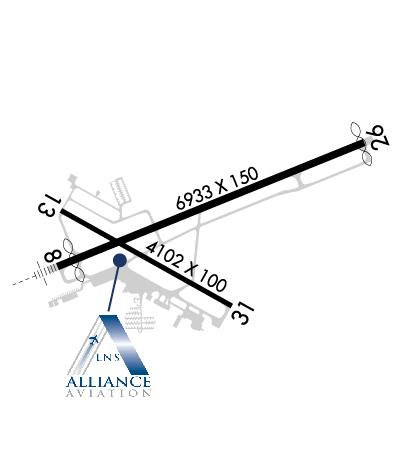
Located in the heart of Lancaster County, our skilled staff is committed to providing first-class customer service with a strong focus on safety. Our new, modern facility, adjacent to the terminal bulding, includes both a pilot's lounge and a passenger waiting area, along with many other amenities. Whether you're here for a quick turn or prolonged stay, we are ready to handle all your needs.
Ph: 717-735-9507 Fax: 717-735-9530 Freq: 122.95WebsiteE-Mail
                     
Service
Jet
100LL
SAF
MoGas
Fuel Avail: Open by Appointment ONLY on Thanksgiving & Christmas!! After Hours Available. Hours 0700 - 2000
Full7.237.17    Last Update: 04/03/2024 09:39

30 days
Self  6.87    
Misc. Info: FSII+$0.10/gal Please call for gallons to waive ramp fees.Address: 500 AIRPORT ROAD SUITE G,   LITITZ, PA 17543

ASOSPh: 717-569-8860
-
-
 
If you are an FBO, call 1-203-262-1700 to update your info or email: FltPlan.Advertising@garmin.com
Advertise your FBO on FltPlan.com

Runway & Approach Info for KLNS
Rwy
Length
Land Dist**
Approach*
  Rwy
Length
Land Dist**
Approach*
08
6933x150  6576'          
ILS
 108.70 - 076°  
  
26
  6933x150  6874'          
 
13
4102x100  4102'          
 
  
31
  4102x100  4102'          
 
 * only ILS, LOC, LDA, and SDF approaches to a specific runway are shown
** For any Declared Landing Distance Available, please see A/FD or Approach plates
Runway Weight Capability (lbs.) Help
Runway IDSingle WheelDouble WheelDouble Tandem WheelDual Double Wheel
08/2665,00092,000146,000N/A
13/3165,00092,000146,000N/A
These numbers are Advisory and are not limits.   The Airport Manager should have more accurate Weight Limits
Approach Charts
Approaches    
Current Weather/Notams
Customs Information Send updates to Support@FltPlan.com
Customs Not Available
Database effective 04/18/2024
Airport Diagram of KLNS
Airport Diagram might not be current.

Facility Name: LANCASTER
City Name: LANCASTER
County: LANCASTER
State abbrev: PA
State Name: PENNSYLVANIA
   
Ownership: PUBLICLY OWNED
Use: OPEN TO THE PUBLIC
Owner's Name: LANCASTER ARPT AUTHORITY
Address: 500 AIRPORT RD SUITE G
 LITITZ, PA 17543-9340
Owner's Phone: 717-569-1221
  
Manager's Name: ED FOSTER
Address: 500 AIRPORT RD SUITE G
 LITITZ, PA 17543-9340
Phone: 717-569-1221
   
FAA Region: EASTERN
FAA Field Office: HAR


Sunrise / Sunset times for LANCASTER

DateSunriseSunset
04/17/24 Wednesday6:2319:47
04/18/24 Thursday6:2219:48
04/19/24 Friday6:2019:49
04/20/24 Saturday6:1919:50
04/21/24 Sunday6:1719:51
04/22/24 Monday6:1619:52
04/23/24 Tuesday6:1519:53
04/24/24 Wednesday6:1319:54
04/25/24 Thursday6:1219:55
04/26/24 Friday6:1019:56
04/27/24 Saturday6:0919:57
04/28/24 Sunday6:0819:58
04/29/24 Monday6:0719:59
04/30/24 Tuesday6:0520:00

Airport Facilities

Airport Attendance ScheduleMON-FRI 0600-2100, SAT 0600-1800, SUN 0800-2100
Airport Status OPERATIONAL (This Status can change at any time - please check NOTAMS)
Airport Lighting ScheduleWHEN ATCT CLSD ACTVT MALSR RWY 08; REIL RWY 31; HIRL 08/26; MIRL RWY 13/31; TWY LGTS - CTAF.
Airport Storage AvailableTie Downs, Hanger
Extra Services AvailableAir Ambulance, Avionics, Charter, Flight Instruction, Aircraft Rental, Annual Surveying
Wind IndicatorYES - (lighted)
Control TowerYES
CTAF Frequency120.900
Unicom Frequency122.950
Rotating Beacon ColorWG
Segmented CircleNO
Landing FeeNO

Airport Inspection Data

Airport InspectedFEDERAL - performed by FAA AIRPORTS FIELD PERSONNEL
Inspection Date08/24/2022

Airport Services

Type of Fuel AvailableGrade 100LL, JET A (freeze point -40C)
Airframe Repair ServiceMAJOR
Power Plant Repair ServiceMAJOR

Geographic Data

LatitudeN4007.3
LongitudeW07617.7 (ESTIMATED)
Arpt Elevation402ft (SURVEYED)
Magnetic Variation09W
4 miles Nof LANCASTER
Traffic Pattern Altitude
Sectional ChartNEW YORK

Aircraft Data

Operations (Reported)YearlyAvg. Daily
General Aviation Transient 51251140
General Aviation Local 50099137
Air Taxi 552815
Commerical 00
Commuter 00
Military 17855
Aircraft based on Field
General Aviation Singles 99
General Aviation Multi 8
Jet Aircraft 11
General Aviation Helicopters 6
Military Aircraft 0
Gliders 1
Ultralights 0

FAA Services

FSS on field NO
FSS tie-in WILLIAMSPORT
FSS Phone 1-800-WX-BRIEF
Who issues Notams LNS
Notam D service at airport YES
ARTCC Name NEW YORK

Federal Status

Airport CertificationAIRPORT RECEIVING SCHEDULED AIR CARRIER SERVICE FROM CARRIERS CERTIFICATED BY THE CIVIL AERONAUTICS BOARD; PPR 24 HRS FOR ACR OPNS WITH MORE THAN 30 PSGR SEATS; CALL AMGR (717) 569-1221.
Aircraft Rescue & Firefighting IndexAIRPORT HAS A CERTIFICATE UNDER CFR PART 139
Airport of EntryNo
Custom Landing RightsNo
Joint Civil/MilitaryNo
Military Landing rightsYES

Federal Agreements

NATIONAL PLAN OF INTEGRATED AIRPORT SYSTEMS (NPIAS)
GRANT AGREEMENTS UNDER FAAP/ADAP/AIP
COMPLIANCE WITH ACCESSIBILITY TO THE HANDICAPPED
ASSURANCES PURSUANT TO TITLE VI, CIVIL RIGHTS ACT OF 1964

Remarks

RWY LGTS AND MALSR UNMONITORED WHEN TWR CLSD.
RWY/TWY CONDITIONS NOT MONITORED OUTSIDE OF ATTENDANCE HOURS.
FOR CD WHEN ATCT CLSD, CTC HARRISBURG APCH AT 800-932-0712.
Airport Communications & Frequencies:
ATIS Frequencies:   Hours(local) of Operation: CONTINUOUS
125.675
LANCASTER Tower Frequencies:   Hours(local) of operation: 0600-2300   
120.9
251.1
LANCASTER Ground Frequencies:
121.8
Emergency Frequencies:
121.5
243.0
CTAF Frequency:
120.900
Unicom Frequency:
122.950
HARRISBURG Primary Approach Frequencies:  
126.45
281.525
HARRISBURG Primary Departure Frequencies:  
126.45
281.525
Runway Identifications
Runway Identification: 08/26
Length: 6933 ft
Width: 150 ft
Surface: ASPHALT-GOOD CONDITION
Edge lights: High Intensity

Treatment: GROOVED

 Runway: 08   Runway: 26
Mag heading: 77°Mag heading: 257°
Rwy Slope: -.32% DownRwy Slope: .32% Up
Approach: ILSApproach:
Pattern: Left TrafficPattern: Left Traffic
Markings: PRECISION INSTRUMENTMarkings: NONPRECISION INSTRUMENT
Marking Condition: GOODMarking Condition: GOOD
Arresting Dev: Arresting Dev:
Lat & Long: N4007.2  W07618.2Lat. & Long.: N4007.6  W07616.9
Elev: 396.8 ft. MSLElev: 374.7 ft. MSL
TCH: 40 ft. AGLTCH: 47 ft. AGL
Visual Glide Path: 3.00 degreesVisual Glide Path: 3.00 degrees
Displaced Threshold: 357 feetDisplaced Threshold: 59 feet
Touchdown Zone: YESTouchdown Zone: YES
Touchdown Elev.: 399.0 feetTouchdown Elev.: 384.3 feet
Visual Glide Slope: 4-Light PAPI on RIGHT side of RunwayVisual Glide Slope: 4-Light PAPI on LEFT side of Runway
RVR Equipment: RVR Equipment:
RVV Equipment: NORVV Equipment: NO
Approach Lights: MALSR - 1,400 foot medium intensity approach lighting system with runway alignment indicator lightsApproach Lights:
REIL: NOREIL: NO
Centerline Lights: NOCenterline Lights: NO
Touchdown lights: NOTouchdown lights: NO
Runway Category: Precision Instrument RunwayRunway Category: Runway with a Non-precision Approach having visibility minimums greater than 3/4 mile
Declared Distances: TORA:6934' TODA:6934' ASDA:6475' LDA:6118'Declared Distances: TORA:6934' TODA:6934' ASDA:6177' LDA:6118'
Obstructions: ROADObstructions: TREE
Marked: NOT Marked/LightedMarked: NOT Marked/Lighted
Clearance slope: 20:1; RWY 08 APCH RATIO 50:1 TO DTHR.Clearance slope: 27:1; RWY 26 APCH RATIO 34:1 TO DTHR.
Obstruction height: 5 feet AGLObstruction height: 40 feet AGL
Dist. from runway: 297 feetDist. from runway: 1266 feet
Centerline offset: 380 left of centerlineCenterline offset: 276 feet right of centerline
Comments: Comments:
Runway Identification: 13/31
Length: 4102 ft
Width: 100 ft
Surface: ASPHALT-GOOD CONDITION
Edge lights: Medium Intensity

Treatment: NONE

 Runway: 13   Runway: 31
Mag heading: 128°Mag heading: 308°
Rwy Slope: .13% UpRwy Slope: -.13% Down
Approach: Approach:
Pattern: Left TrafficPattern: Left Traffic
Markings: NONPRECISION INSTRUMENTMarkings: NONPRECISION INSTRUMENT
Marking Condition: GOODMarking Condition: GOOD
Arresting Dev: Arresting Dev:
Lat & Long: N4007.4  W07618.2Lat. & Long.: N4007.1  W07617.5
Elev: 393.5 ft. MSLElev: 398.9 ft. MSL
TCH: 40 ft. AGLTCH:
Visual Glide Path: 3.00 degreesVisual Glide Path:
Displaced Threshold: NoDisplaced Threshold: No
Touchdown Zone: YESTouchdown Zone: YES
Touchdown Elev.: 402.2 feetTouchdown Elev.: 402.6 feet
Visual Glide Slope: 2-Light PAPI on RIGHT side of Runway; VGSI AND GLIDEPATH NOT COINCIDENT.Visual Glide Slope:
RVR Equipment: RVR Equipment:
RVV Equipment: NORVV Equipment: NO
Approach Lights: Approach Lights:
REIL: NOREIL: YES
Centerline Lights: NOCenterline Lights: NO
Touchdown lights: NOTouchdown lights: NO
Runway Category: Runway with a Non-precision Approach having visibility minimums greater than 3/4 mileRunway Category: Runway with a Non-precision Approach having visibility minimums greater than 3/4 mile
Declared Distances: TORA:4102' TODA:4102' ASDA:4102' LDA:4102'Declared Distances: TORA:4102' TODA:4102' ASDA:4102' LDA:4102'
Obstructions: TREEObstructions:
Marked: NOT Marked/LightedMarked:
Clearance slope: 21:1Clearance slope: 34:1
Obstruction height: 75 feet AGLObstruction height:
Dist. from runway: 1816 feetDist. from runway:
Centerline offset: 477 left of centerlineCenterline offset:
Comments: Comments: RWY 31 HAS 6 FT SHRUBS 58 FT FM RWY END, 204 FT RIGHT.
C:114/P: