Current Weather/Notams (Metars, TAFs, Notams, NWS Forecast, PIREPS, and nearby weather)
Customs Information Send updates to Support@FltPlan.com
Customs Not Available
Database effective 05/16/2024
Airport Diagram might not be current.
|
| Facility Name: | LITTLE RIVER |
| City Name: | LITTLE RIVER |
| County: | MENDOCINO |
| State abbrev: | CA |
| State Name: | CALIFORNIA |
| | |
| Ownership: | PUBLICLY OWNED |
| Use: | OPEN TO THE PUBLIC |
| Owner's Name: | MENDOCINO COUNTY |
| Address: | 340 LAKE MENDOCINO DRIVE |
| | UKIAH, CA 95482-9432 |
| Owner's Phone: | 707-463-4363 |
| | |
| Manager's Name: | HOWARD DASHIELL; DIRECTOR OF TRANSPORTATION |
| Address: | 340 LAKE MENDOCINO DRIVE |
| | UKIAH, CA 95482-9432 |
| Phone: | (707) 463-4363 |
| | |
| FAA Region: | WESTERN-PACIFIC |
| FAA Field Office: | SFO |
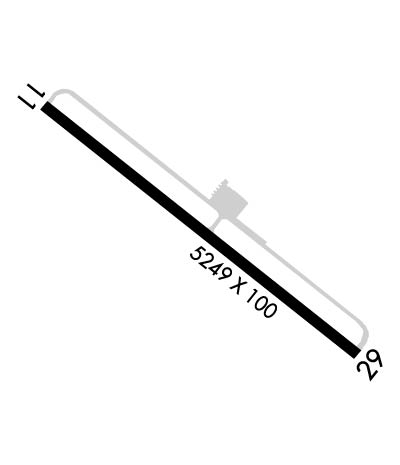
Runway Identifications
Runway Identification: 11/29Length: 5249 ft
Width: 100 ft
Surface: ASPHALT-GOOD CONDITION
Edge lights: Medium IntensityTreatment: NONE
| | Runway: 11 | | Runway: 29 |
| Mag heading: | 113° | Mag heading: | 293° |
| Rwy Slope: | .50% Up | Rwy Slope: | -.50% Down |
| Approach: | | Approach: | |
| Pattern: | Left Traffic | Pattern: | Left Traffic |
| Markings: | BASIC | Markings: | BASIC |
| Marking Condition: | GOOD | Marking Condition: | GOOD |
| Arresting Dev: | | Arresting Dev: | |
| Lat & Long: | N3916.0 W12345.7 | Lat. & Long.: | N3915.5 W12344.8 |
| Elev: | 547.6 ft. MSL | Elev: | 573.8 ft. MSL |
| TCH: | | TCH: | 42 ft. AGL |
| Visual Glide Path: | | Visual Glide Path: | 3.50 degrees |
| Displaced Threshold: | 200 feet | Displaced Threshold: | No |
| Touchdown Zone: | YES | Touchdown Zone: | YES |
| Touchdown Elev.: | 562.6 feet | Touchdown Elev.: | 573.8 feet |
| Visual Glide Slope: | | Visual Glide Slope: | 4-Light PAPI on LEFT side of Runway |
| RVR Equipment: | | RVR Equipment: | |
| RVV Equipment: | NO | RVV Equipment: | NO |
| Approach Lights: | | Approach Lights: | |
| REIL: | NO | REIL: | NO |
| Centerline Lights: | NO | Centerline Lights: | NO |
| Touchdown lights: | NO | Touchdown lights: | NO |
| Runway Category: | Runway with a Visual Approach | Runway Category: | Runway with a Non-precision Approach having visibility minimums greater than 3/4 mile |
| Declared Distances: | | Declared Distances: | |
| Obstructions: | BRUSH | Obstructions: | TREES |
| Marked: | NOT Marked/Lighted | Marked: | NOT Marked/Lighted |
| Clearance slope: | RWY 11 APCH RATIO 31:1 TO DSPLCD THR OVER +35' TREES @ 1200', 312' RIGHT FM EOR. | Clearance slope: | 28:1 |
| Obstruction height: | 6 feet AGL | Obstruction height: | 45 feet AGL |
| Dist. from runway: | 200 feet | Dist. from runway: | 1500 feet |
| Centerline offset: | | Centerline offset: | |
| Comments: | | Comments: | |

