| ||||||||||||||||||||||||||||||||||||||||||||||||||||||||||||||||||||
| ||||||||||||||||||||||||||||||||||||||||||||||||||||||||||||||||||||
| ||||||||||||||||||||||||||||||||||||||||||||||||||||||||||||||||||||
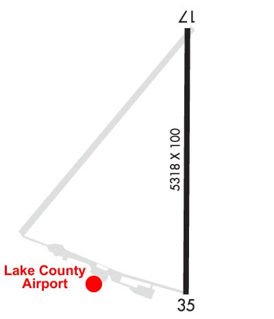
| Rwy | Rwy | |||||||
| 5318x100 | 5318' | 5318x100 | 5318' | |||||
| Runway ID | Single Wheel | Double Wheel | Double Tandem Wheel | Dual Double Wheel |
| 17/35 | 74,000 | 86,000 | N/A | N/A |
| These numbers are Advisory and are not limits. The Airport Manager should have more accurate Weight Limits | ||||
 Airport Diagram might not be current. | |
| Facility Name: | LAKE COUNTY |
| City Name: | LAKEVIEW |
| County: | LAKE |
| State abbrev: | OR |
| State Name: | OREGON |
| Ownership: | PUBLICLY OWNED |
| Use: | OPEN TO THE PUBLIC |
| Owner's Name: | LAKE COUNTY |
| Address: | LAKE COUNTY COURTHOUSE, 513 CENTER STREET |
| LAKEVIEW, OR 97630 | |
| Owner's Phone: | 541-947-6003 |
| Manager's Name: | TRISTAN WITHAM |
| Address: | 17819 AIRPORT ROAD |
| LAKE VIEW, OR 97630 | |
| Phone: | 541-947-4222 |
| FAA Region: | NORTHWEST MOUNTAIN |
| FAA Field Office: | SEA |
| Date | Sunrise | Sunset |
|---|---|---|
| 05/06/24 Monday | 5:50 | 20:07 |
| 05/07/24 Tuesday | 5:48 | 20:08 |
| 05/08/24 Wednesday | 5:47 | 20:09 |
| 05/09/24 Thursday | 5:46 | 20:10 |
| 05/10/24 Friday | 5:45 | 20:11 |
| 05/11/24 Saturday | 5:44 | 20:13 |
| 05/12/24 Sunday | 5:43 | 20:14 |
| 05/13/24 Monday | 5:42 | 20:15 |
| 05/14/24 Tuesday | 5:41 | 20:16 |
| 05/15/24 Wednesday | 5:40 | 20:17 |
| 05/16/24 Thursday | 5:39 | 20:18 |
| 05/17/24 Friday | 5:38 | 20:19 |
| 05/18/24 Saturday | 5:37 | 20:20 |
| 05/19/24 Sunday | 5:36 | 20:21 |
| Airport Attendance Schedule | APR-SEP 7 Days A Week 0900-1600, OCT-MAR 7 Days A Week 0700-1700 |
| Airport Status | OPERATIONAL (This Status can change at any time - please check NOTAMS) |
| Airport Lighting Schedule | ACTVT MIRL RWY 17/35, PAPI 17 & 35; REIL RWY 17 & 35 - CTAF. |
| Airport Storage Available | Tie Downs |
| Extra Services Available | NONE |
| Wind Indicator | YES - (lighted) |
| Control Tower | NO |
| CTAF Frequency | 122.800 |
| Unicom Frequency | 122.800 |
| Rotating Beacon Color | WG |
| Segmented Circle | YES |
| Landing Fee | NO |
| Airport Inspected | STATE - performed by STATE AERONAUTICAL PERSONNEL |
| Inspection Date | 02/09/2022 |
| Type of Fuel Available | Grade 100LL, JET A (freeze point -40C) |
| Airframe Repair Service | MAJOR |
| Power Plant Repair Service | MAJOR |
| Latitude | N4209.7 |
| Longitude | W12023.9 (ESTIMATED) |
| Arpt Elevation | 4734ft (SURVEYED) |
| Magnetic Variation | 14E |
| 3 miles SW | of LAKEVIEW |
| Traffic Pattern Altitude | |
| Sectional Chart | KLAMATH FALLS |
| Operations (Reported) | Yearly | Avg. Daily |
|---|---|---|
| General Aviation Transient | 3300 | 9 |
| General Aviation Local | 1500 | 4 |
| Air Taxi | 1200 | 3 |
| Commerical | 0 | 0 |
| Commuter | 0 | 0 |
| Military | 0 | 0 |
| Aircraft based on Field | |
|---|---|
| General Aviation Singles | 15 |
| General Aviation Multi | 2 |
| Jet Aircraft | 0 |
| General Aviation Helicopters | 0 |
| Military Aircraft | 0 |
| Gliders | 0 |
| Ultralights | 0 |
| FSS on field | NO |
| FSS tie-in | MC MINNVILLE |
| FSS Phone | 1-800-WX-BRIEF |
| Who issues Notams | LKV |
| Notam D service at airport | YES |
| ARTCC Name | SEATTLE |
| Airport Certification | |
| Aircraft Rescue & Firefighting Index | None |
| Airport of Entry | No |
| Custom Landing Rights | No |
| Joint Civil/Military | No |
| Military Landing rights | YES |
| NATIONAL PLAN OF INTEGRATED AIRPORT SYSTEMS (NPIAS) |
| GRANT AGREEMENTS UNDER FAAP/ADAP/AIP |
| SURPLUS PROPERTY AGREEMENT UNDER REGULATION 16-WAA |
| ASSURANCES PURSUANT TO TITLE VI, CIVIL RIGHTS ACT OF 1964 |
| AGREEMENT UNDER DLAND OR DCLA HAS EXPIRED. |
| FLOCKS OF LARGE WATERFOWL IN VICINITY NOV-MAY. |
| EXTENSIVE AIRTANKER OPNS IN FIRE SEASON. |
| DRAG STRIP ORIENTED NW-SE LOCATED 3000 FT SW OF RY 35. |
| POSSIBLE GLIDER OPERATIONS ON TWY. |
| TWY NE/SW USED FOR STRONG CROSS WIND LNDG. |
| WILDLIFE ON AND INVOF ARPT. |
| FOR CD IF UNA TO CTC ON FSS FREQ, CTC SEATTLE ARTCC AT 253-351-3694. |
Airport Communications & Frequencies:
| |||||||||
| Runway: 17 | Runway: 35 | ||
| Mag heading: | 166° | Mag heading: | 346° |
| Rwy Slope: | -.17% Down | Rwy Slope: | .17% Up |
| Approach: | Approach: | ||
| Pattern: | Left Traffic | Pattern: | Left Traffic |
| Markings: | NONPRECISION INSTRUMENT | Markings: | NONPRECISION INSTRUMENT |
| Marking Condition: | GOOD | Marking Condition: | GOOD |
| Arresting Dev: | Arresting Dev: | ||
| Lat & Long: | N4210.1 W12023.9 | Lat. & Long.: | N4209.2 W12023.9 |
| Elev: | 4734.1 ft. MSL | Elev: | 4725.1 ft. MSL |
| TCH: | 45 ft. AGL | TCH: | 45 ft. AGL |
| Visual Glide Path: | 3.00 degrees | Visual Glide Path: | 3.00 degrees |
| Displaced Threshold: | No | Displaced Threshold: | No |
| Touchdown Zone: | YES | Touchdown Zone: | YES |
| Touchdown Elev.: | 4734.1 feet | Touchdown Elev.: | 4729.4 feet |
| Visual Glide Slope: | 4-Light PAPI on RIGHT side of Runway | Visual Glide Slope: | 4-Light PAPI on LEFT side of Runway |
| RVR Equipment: | RVR Equipment: | ||
| RVV Equipment: | NO | RVV Equipment: | NO |
| Approach Lights: | Approach Lights: | ||
| REIL: | YES | REIL: | YES |
| Centerline Lights: | NO | Centerline Lights: | NO |
| Touchdown lights: | NO | Touchdown lights: | NO |
| Runway Category: | Runway with a Non-precision Approach having visibility minimums greater than 3/4 mile | Runway Category: | Runway with a Non-precision Approach having visibility minimums greater than 3/4 mile |
| Declared Distances: | Declared Distances: |