Click here for more info on on SMS!

KLAM

LOS ALAMOS
LOS ALAMOS
NM
Time Zone: Mountain
Lat: N 3552.8
Long: W 10616.1
Elev: 7171
Var: -10
Longest Runway: 6000
AWOS: 124.17
CTAF: 123.0

FBO & Flight Services info for KLAM

FBOs: Update your Fuel Prices

  click here  
Providing high quality fuel and services to you and your customers, from Phillips 66 Aviation.
Ph: 505-662-8420 Fax: 505-662-8418 Freq: 123.0WebsiteE-Mail
                                         
Service
Jet
100LL
SAF
MoGas
Fuel Avail: 24/7
Full        Last Update: 04/05/2024 11:12

Self  6.57    
Misc. Info: Member discounts available, see http://lamavgas.comAddress: 1040 AIRPORT RD 2   LOS ALAMSO, NM 87544

AWOSPh: 505-662-8423
-
Freq: 124.17  
If you are an FBO, call 1-203-262-1700 to update your info or email: FltPlan.Advertising@garmin.com
Advertise your FBO on FltPlan.com

Runway & Approach Info for KLAM
Rwy
Length
Land Dist**
Approach*
  Rwy
Length
Land Dist**
Approach*
09
6000x120  6000'          
 
  
27
  6000x120  6000'          
 
 * only ILS, LOC, LDA, and SDF approaches to a specific runway are shown
** For any Declared Landing Distance Available, please see A/FD or Approach plates
Runway Weight Capability (lbs.) Help
Runway IDSingle WheelDouble WheelDouble Tandem WheelDual Double Wheel
09/2743,000N/AN/AN/A
These numbers are Advisory and are not limits.   The Airport Manager should have more accurate Weight Limits
Approach Charts
Approaches    
Current Weather/Notams
Customs Information Send updates to Support@FltPlan.com
Customs Not Available
Database effective 05/16/2024
Airport Diagram of KLAM
Airport Diagram might not be current.

Facility Name: LOS ALAMOS
City Name: LOS ALAMOS
County: LOS ALAMOS
State abbrev: NM
State Name: NEW MEXICO
   
Ownership: PUBLICLY OWNED
Use: OPEN TO THE PUBLIC
Owner's Name: COUNTY OF LOS ALAMOS
Address: 1000 CENTRAL AVE SUITE 350
 LOS ALAMOS, NM 87544
Owner's Phone: 505-663-1750
  
Manager's Name: BOBBI HUSEMAN
Address: 1040 AIRPORT RD
 LOS ALAMOS, NM 87544
Phone: 505-709-8687
   
FAA Region: SOUTHWEST
FAA Field Office: LNM


Sunrise / Sunset times for LOS ALAMOS

DateSunriseSunset
04/23/24 Tuesday6:2119:46
04/24/24 Wednesday6:2019:47
04/25/24 Thursday6:1919:48
04/26/24 Friday6:1719:49
04/27/24 Saturday6:1619:49
04/28/24 Sunday6:1519:50
04/29/24 Monday6:1419:51
04/30/24 Tuesday6:1319:52
05/01/24 Wednesday6:1219:53
05/02/24 Thursday6:1119:54
05/03/24 Friday6:1019:54
05/04/24 Saturday6:0919:55
05/05/24 Sunday6:0819:56
05/06/24 Monday6:0719:57

Airport Facilities

Airport Attendance ScheduleMON-FRI 0800-1700; CLOSED HOL; AFT HRS - 505-709-8687.
Airport Status OPERATIONAL (This Status can change at any time - please check NOTAMS)
Airport Lighting ScheduleACTVT REILS RWY 27; MIRL RWY 09/27 - CTAF.
Airport Storage AvailableTie Downs
Extra Services AvailableNONE
Wind IndicatorYES - (lighted)
Control TowerNO
CTAF Frequency123.000
Unicom Frequency123.000
Rotating Beacon ColorWG
Segmented CircleYES
Landing FeeNO

Airport Inspection Data

Airport InspectedSTATE - performed by PRIVATE CONTRACT PERSONNEL
Inspection Date04/28/2022

Airport Services

Type of Fuel AvailableGrade 100LL; -10SELF SERV H24 WITH CREDIT CARD.
Airframe Repair ServiceMINOR
Power Plant Repair ServiceMINOR

Geographic Data

LatitudeN3552.8
LongitudeW10616.1 (ESTIMATED)
Arpt Elevation7170ft (SURVEYED)
Magnetic Variation10E
1 miles Eof LOS ALAMOS
Traffic Pattern Altitude
Sectional ChartDENVER

Aircraft Data

Operations (Reported)YearlyAvg. Daily
General Aviation Transient 23006
General Aviation Local 1123031
Air Taxi 600
Commerical 00
Commuter 00
Military 500
Aircraft based on Field
General Aviation Singles 45
General Aviation Multi 0
Jet Aircraft 0
General Aviation Helicopters 1
Military Aircraft 0
Gliders 0
Ultralights 0

FAA Services

FSS on field NO
FSS tie-in ALBUQUERQUE
FSS Phone 1-800-WX-BRIEF
Who issues Notams LAM
Notam D service at airport YES
ARTCC Name ALBUQUERQUE

Federal Status

Airport Certification
Aircraft Rescue & Firefighting IndexARFF INDEX B AVBL; 24 HR PPR.
Airport of EntryNo
Custom Landing RightsNo
Joint Civil/MilitaryNo
Military Landing rightsNo

Federal Agreements

NATIONAL PLAN OF INTEGRATED AIRPORT SYSTEMS (NPIAS)

Remarks

WILDLIFE ON & INVOF ARPT.
ARFF INDEX B AVBL; 24 HR PPR.
FOR CD CTC ALBUQUERQUE ARTCC AT 505-856-4861.
RADIO COMM REQ BFR ENTERING TFC PAT; STRONG GUSTY CROSSWINDS. TGL NA.
RSTRD AREA ADJ TO S SIDE OF ARPT.
RWY 09/2 7 LND W; TKOF E.
RWY 27 VFR TFC RMN 5 MI E OF ARPT TIL TURNING FINAL; R TURN ON GO AROUND OR MISSED APCH.
Airport Communications & Frequencies:
CTAF Frequency:
123.000
Unicom Frequency:
123.000
Remarks
  • APCH/DEP SVC PRVDD BY ALBUQUERQUE ARTCC (ZAB) ON FREQS 132.8/346.35 (TESUQUE PEAK RCAG).
  • Runway Identifications
    Runway Identification: 09/27
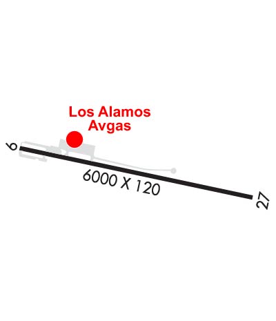
    Length: 6000 ft
    Width: 120 ft
    Surface: ASPHALT-GOOD CONDITION
    Edge lights: Medium Intensity

    Treatment: GROOVED
    Weight: PCN 35 /F/C/X/T

     Runway: 09   Runway: 27
    Mag heading: 92°Mag heading: 272°
    Rwy Slope: -1.52% DownRwy Slope: 1.52% Up
    Approach: Approach:
    Pattern: Left TrafficPattern: Right Traffic
    Markings: BASICMarkings: NONPRECISION INSTRUMENT
    Marking Condition: FAIRMarking Condition: FAIR
    Arresting Dev: Arresting Dev:
    Lat & Long: N3552.9  W10616.7Lat. & Long.: N3552.7  W10615.5
    Elev: 7170.9 ft. MSLElev: 7079.6 ft. MSL
    TCH: TCH: 45 ft. AGL
    Visual Glide Path: Visual Glide Path: 3.00 degrees
    Displaced Threshold: NoDisplaced Threshold: No
    Touchdown Zone: YESTouchdown Zone: YES
    Touchdown Elev.: 7170.9 feetTouchdown Elev.: 7125.6 feet
    Visual Glide Slope: Visual Glide Slope: 2-Light PAPI on LEFT side of Runway
    RVR Equipment: RVR Equipment:
    RVV Equipment: NORVV Equipment: NO
    Approach Lights: Approach Lights:
    REIL: NOREIL: YES
    Centerline Lights: NOCenterline Lights: NO
    Touchdown lights: NOTouchdown lights: NO
    Runway Category: Runway with a Visual ApproachRunway Category: Runway with a Non-precision Approach
    Declared Distances: Declared Distances:
    Obstructions: FENCEObstructions:
    Marked: NOT Marked/LightedMarked:
    Clearance slope: 1:1Clearance slope: 50:1
    Obstruction height: 8 feet AGLObstruction height:
    Dist. from runway: 201 feetDist. from runway:
    Centerline offset: 145 left of centerlineCenterline offset:
    Comments: +8 FT BLAST BARRIER 75 FT FM THR 50 FT L & R OF CNTRLN; +25 FT LIGHT POLE 198 FT FM THR 135 FT L OF CNTRLN; +4-15 FT BRUSH & TREES 80-200 FT FM THR 125 FT L & R OF CNTRLN.Comments:
    C:2/P: