
| ||||||||||||||||||||||||||||||||||||||||||||
| ||||||||||||||||||||||||||||||||||||||||||||
| Rwy | Rwy | |||||||
| 4000x75 | 4000' | 4000x75 | 4000' | |||||
| Runway ID | Single Wheel | Double Wheel | Double Tandem Wheel | Dual Double Wheel |
| 16/34 | 20,000 | N/A | N/A | N/A |
| These numbers are Advisory and are not limits. The Airport Manager should have more accurate Weight Limits | ||||
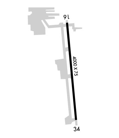 Airport Diagram might not be current. | |
| Facility Name: | BAKERSFIELD MUNI |
| City Name: | BAKERSFIELD |
| County: | KERN |
| State abbrev: | CA |
| State Name: | CALIFORNIA |
| Ownership: | PUBLICLY OWNED |
| Use: | OPEN TO THE PUBLIC |
| Owner's Name: | CITY OF BAKERSFIELD |
| Address: | 1501 TRUXTUN AVE |
| BAKERSFIELD, CA 93301 | |
| Owner's Phone: | 661-326-3781 |
| Manager's Name: | KEVIN PEOPLES |
| Address: | 4101 TRUXTUN AVENUE |
| BAKERSFIELD, CA 93309 | |
| Phone: | 661-326-3781; EMERGENCY 661-327-7111 |
| FAA Region: | WESTERN-PACIFIC |
| FAA Field Office: | LAX |
| Date | Sunrise | Sunset |
|---|---|---|
| 04/18/24 Thursday | 6:19 | 19:32 |
| 04/19/24 Friday | 6:18 | 19:33 |
| 04/20/24 Saturday | 6:16 | 19:34 |
| 04/21/24 Sunday | 6:15 | 19:35 |
| 04/22/24 Monday | 6:14 | 19:35 |
| 04/23/24 Tuesday | 6:13 | 19:36 |
| 04/24/24 Wednesday | 6:11 | 19:37 |
| 04/25/24 Thursday | 6:10 | 19:38 |
| 04/26/24 Friday | 6:09 | 19:39 |
| 04/27/24 Saturday | 6:08 | 19:39 |
| 04/28/24 Sunday | 6:07 | 19:40 |
| 04/29/24 Monday | 6:06 | 19:41 |
| 04/30/24 Tuesday | 6:05 | 19:42 |
| 05/01/24 Wednesday | 6:04 | 19:43 |
| Airport Attendance Schedule | 7 Days A Week 0700-1700 |
| Airport Status | OPERATIONAL (This Status can change at any time - please check NOTAMS) |
| Airport Lighting Schedule | ACTVT REIL RWY 16 AND RWY 34; MIRL RWY 16/34 - CTAF. PAPI RWY 34 OPER CONSLY. ACTVT MIRL RWY 16/34 THREE CLICKS FOR ON; LGTS GO OUT AFTER 15 MINS. |
| Airport Storage Available | Tie Downs |
| Extra Services Available | Charter, Flight Instruction, Aircraft Rental |
| Wind Indicator | YES - (lighted) |
| Control Tower | NO |
| CTAF Frequency | 122.800 |
| Unicom Frequency | 122.800 |
| Rotating Beacon Color | WG |
| Segmented Circle | YES |
| Landing Fee | NO |
| Airport Inspected | STATE - performed by STATE AERONAUTICAL PERSONNEL |
| Inspection Date | 07/20/2023 |
| Type of Fuel Available | Grade 100LL, JET A (freeze point -40C); -A FULL SERVICE USING FUELING TRUCK. |
| Airframe Repair Service | MAJOR |
| Power Plant Repair Service | MAJOR |
| Latitude | N3519.5 |
| Longitude | W11859.8 (ESTIMATED) |
| Arpt Elevation | 378ft (SURVEYED) |
| Magnetic Variation | 14E |
| 3 miles S | of BAKERSFIELD |
| Traffic Pattern Altitude | 800 |
| Sectional Chart | LOS ANGELES |
| Operations (Reported) | Yearly | Avg. Daily |
|---|---|---|
| General Aviation Transient | 15000 | 41 |
| General Aviation Local | 10000 | 27 |
| Air Taxi | 0 | 0 |
| Commerical | 0 | 0 |
| Commuter | 0 | 0 |
| Military | 0 | 0 |
| Aircraft based on Field | |
|---|---|
| General Aviation Singles | 68 |
| General Aviation Multi | 5 |
| Jet Aircraft | 0 |
| General Aviation Helicopters | 1 |
| Military Aircraft | 0 |
| Gliders | 0 |
| Ultralights | 0 |
| FSS on field | NO |
| FSS tie-in | RANCHO MURIETA |
| FSS Phone | 1-800-WX-BRIEF |
| Who issues Notams | RIU |
| Notam D service at airport | YES |
| ARTCC Name | LOS ANGELES |
| Airport Certification | |
| Aircraft Rescue & Firefighting Index | None |
| Airport of Entry | No |
| Custom Landing Rights | No |
| Joint Civil/Military | No |
| Military Landing rights | No |
| NATIONAL PLAN OF INTEGRATED AIRPORT SYSTEMS (NPIAS) |
| GRANT AGREEMENTS UNDER FAAP/ADAP/AIP |
| ASSURANCES PURSUANT TO TITLE VI, CIVIL RIGHTS ACT OF 1964 |
| +100 FT POLE LINE 1/2 MILE SOUTH OF ARPT. |
| (E98) ALSO ONE HEX HANGER & 20 OPEN - SHADE HANGARS. |
| FOR CD CTC LOS ANGELES ARTCC AT 661-575-2079. |
| RWY 16/3 4 150 FT PAVED STOPWAY AT EACH END OF RWY. |
Airport Communications & Frequencies:
| |||||||||||||||||
| Runway: 16 | Runway: 34 | ||
| Mag heading: | 161° | Mag heading: | 341° |
| Rwy Slope: | -.15% Down | Rwy Slope: | .15% Up |
| Approach: | Approach: | ||
| Pattern: | Right Traffic | Pattern: | Left Traffic |
| Markings: | NONPRECISION INSTRUMENT | Markings: | NONPRECISION INSTRUMENT |
| Marking Condition: | GOOD | Marking Condition: | GOOD |
| Arresting Dev: | Arresting Dev: | ||
| Lat & Long: | N3519.8 W11859.8 | Lat. & Long.: | N3519.2 W11859.7 |
| Elev: | 378.3 ft. MSL | Elev: | 372.3 ft. MSL |
| TCH: | TCH: | 53 ft. AGL | |
| Visual Glide Path: | Visual Glide Path: | 4.10 degrees | |
| Displaced Threshold: | No | Displaced Threshold: | No |
| Touchdown Zone: | YES | Touchdown Zone: | YES |
| Touchdown Elev.: | 378.3 feet | Touchdown Elev.: | 376.9 feet |
| Visual Glide Slope: | Visual Glide Slope: | 2-Light PAPI on LEFT side of Runway | |
| RVR Equipment: | RVR Equipment: | ||
| RVV Equipment: | NO | RVV Equipment: | NO |
| Approach Lights: | Approach Lights: | ||
| REIL: | YES | REIL: | YES |
| Centerline Lights: | NO | Centerline Lights: | NO |
| Touchdown lights: | NO | Touchdown lights: | NO |
| Runway Category: | Runway with a Visual Approach | Runway Category: | Runway with a Non-precision Approach having visibility minimums greater than 3/4 mile |
| Declared Distances: | Declared Distances: | ||
| Obstructions: | ROAD | Obstructions: | PLINE |
| Marked: | NOT Marked/Lighted | Marked: | MARKED |
| Clearance slope: | 30:1 | Clearance slope: | 22:1 |
| Obstruction height: | 15 feet AGL | Obstruction height: | 103 feet AGL |
| Dist. from runway: | 650 feet | Dist. from runway: | 2500 feet |
| Centerline offset: | 170 left of centerline | Centerline offset: | |
| Comments: | Comments: |
