Click here for more info on on SMS!

KK38

WASHINGTON COUNTY MEMORIAL
WASHINGTON
KS
Time Zone: Central
Lat: N 3944.1
Long: W 09702.9
Elev: 1437
Var: -06
Longest Runway: 3406
CTAF: 122.9

FBO & Flight Services info for KK38

FBOs: Update your Fuel Prices

WASHINGTON APTPh: 785-325-2318
-
Freq: 122.9
Service
Jet
100LL
SAF
MoGas
Fuel Avail: NO FUEL AVAILABLE
Full        Last Update: 04/25/2024 05:27:31

Self        
If you are an FBO, call 1-203-262-1700 to update your info or email: FltPlan.Advertising@garmin.com
Advertise your FBO on FltPlan.com

Runway & Approach Info for KK38
Rwy
Length
Land Dist**
Approach*
  Rwy
Length
Land Dist**
Approach*
17
3406x60  3186'          
 
  
35
  3406x60  3406'          
 
 * only ILS, LOC, LDA, and SDF approaches to a specific runway are shown
** For any Declared Landing Distance Available, please see A/FD or Approach plates
Runway Weight Capability (lbs.) Help
Runway IDSingle WheelDouble WheelDouble Tandem WheelDual Double Wheel
17/35N/AN/AN/AN/A
These numbers are Advisory and are not limits.   The Airport Manager should have more accurate Weight Limits
Approach Charts
Approaches    
Current Weather/Notams
Customs Information Send updates to Support@FltPlan.com
Customs Not Available
Database effective 05/16/2024
Airport Diagram of KK38
Airport Diagram might not be current.

Facility Name: WASHINGTON COUNTY VETERAN'S MEML
City Name: WASHINGTON
County: WASHINGTON
State abbrev: KS
State Name: KANSAS
   
Ownership: PUBLICLY OWNED
Use: OPEN TO THE PUBLIC
Owner's Name: WASHINGTON COUNTY
Address: CO CMSNRS, WASH CO COURTHOUSE
 WASHINGTON, KS 66968
Owner's Phone: 785-325-2974
  
Manager's Name: BRAD FORTENIER
Address: 303 C ST.
 WASHINGTON, KS 66968
Phone: (785) 747-6640
   
FAA Region: CENTRAL
FAA Field Office: NONE


Sunrise / Sunset times for WASHINGTON COUNTY VETERAN'S MEML

DateSunriseSunset
04/24/24 Wednesday6:3720:16
04/25/24 Thursday6:3520:17
04/26/24 Friday6:3420:18
04/27/24 Saturday6:3320:19
04/28/24 Sunday6:3220:20
04/29/24 Monday6:3020:21
04/30/24 Tuesday6:2920:22
05/01/24 Wednesday6:2820:23
05/02/24 Thursday6:2720:24
05/03/24 Friday6:2520:25
05/04/24 Saturday6:2420:26
05/05/24 Sunday6:2320:27
05/06/24 Monday6:2220:28
05/07/24 Tuesday6:2120:29

Airport Facilities

Airport Attendance ScheduleUNATTENDED
Airport Status OPERATIONAL (This Status can change at any time - please check NOTAMS)
Airport Lighting ScheduleACTVT MIRL RWY 17/35 - CTAF.
Airport Storage AvailableTie Downs
Extra Services AvailableCrop Dusting
Wind IndicatorYES - (unlit)
Control TowerNO
CTAF Frequency122.900
Unicom Frequency
Rotating Beacon ColorWG
Segmented CircleNO
Landing FeeNO

Airport Inspection Data

Airport InspectedSTATE - performed by STATE AERONAUTICAL PERSONNEL
Inspection Date07/29/2021

Airport Services

Type of Fuel AvailableNone
Airframe Repair ServiceNone
Power Plant Repair ServiceNone

Geographic Data

LatitudeN3944.1
LongitudeW09702.9 (ESTIMATED)
Arpt Elevation1436ft (SURVEYED)
Magnetic Variation06E
5 miles Sof WASHINGTON
Traffic Pattern Altitude
Sectional ChartWICHITA

Aircraft Data

Operations (Reported)YearlyAvg. Daily
General Aviation Transient 8002
General Aviation Local 9002
Air Taxi 00
Commerical 00
Commuter 00
Military 00
Aircraft based on Field
General Aviation Singles 3
General Aviation Multi 0
Jet Aircraft 0
General Aviation Helicopters 0
Military Aircraft 0
Gliders 0
Ultralights 0

FAA Services

FSS on field NO
FSS tie-in WICHITA
FSS Phone 1-800-WX-BRIEF
Who issues Notams ICT
Notam D service at airport YES
ARTCC Name KANSAS CITY

Federal Status

Airport Certification
Aircraft Rescue & Firefighting IndexNone
Airport of EntryNo
Custom Landing RightsNo
Joint Civil/MilitaryNo
Military Landing rightsNo

Remarks

24 HR PHONE AVBL FOR PUBLIC USE WITH PHONE CARD.
FOR CD CTC KANSAS CITY ARTCC AT 913-254-8508.
Airport Communications & Frequencies:
CTAF Frequency:
122.900
Remarks
  • APCH/DEP CTL SVC PRVDD BY KANSAS CITY ARTCC (ZKC) ON FREQS 127.35/257.975 (MANHATTAN RCAG).
  • Runway Identifications
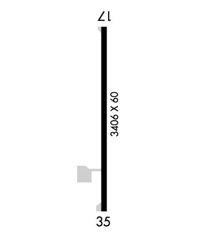
    Runway Identification: 17/35
    Length: 3406 ft
    Width: 60 ft
    Surface: CONCRETE-GOOD CONDITION
    Edge lights: Medium Intensity

    Treatment: NONE

     Runway: 17   Runway: 35
    Mag heading: 174°Mag heading: 354°
    Rwy Slope: -.31% DownRwy Slope: .31% Up
    Approach: Approach:
    Pattern: Left TrafficPattern: Left Traffic
    Markings: NONPRECISION INSTRUMENTMarkings: NONPRECISION INSTRUMENT
    Marking Condition: GOODMarking Condition: GOOD
    Arresting Dev: Arresting Dev:
    Lat & Long: N3944.4  W09702.9Lat. & Long.: N3943.8  W09702.9
    Elev: 1436.5 ft. MSLElev: 1425.9 ft. MSL
    TCH: TCH:
    Visual Glide Path: Visual Glide Path:
    Displaced Threshold: 220 feetDisplaced Threshold: No
    Touchdown Zone: YESTouchdown Zone: YES
    Touchdown Elev.: 1435.6 feetTouchdown Elev.: 1434.8 feet
    Visual Glide Slope: Visual Glide Slope:
    RVR Equipment: RVR Equipment:
    RVV Equipment: NORVV Equipment: NO
    Approach Lights: Approach Lights:
    REIL: NOREIL: NO
    Centerline Lights: NOCenterline Lights: NO
    Touchdown lights: NOTouchdown lights: NO
    Runway Category: Runway with a Non-precision ApproachRunway Category: Runway with a Non-precision Approach
    Declared Distances: Declared Distances:
    Obstructions: ROADObstructions: PLINE
    Marked: NOT Marked/LightedMarked: MARKED
    Clearance slope: 6:1; RWY 17 APPROACH SLOPE 34:1 TO THE DISP THLD.Clearance slope: 20:1
    Obstruction height: 15 feet AGLObstruction height: 68 feet AGL
    Dist. from runway: 300 feetDist. from runway: 1562 feet
    Centerline offset: Centerline offset:
    Comments: Comments:
    C:/P: