Click here for more info on on SMS!

KK06

GREATER BEARDSTOWN
BEARDSTOWN
IL
Time Zone: Central
Lat: N 3958.4
Long: W 09024.2
Elev: 465
Var: -02
Longest Runway: 4000
CTAF: 122.9

FBO & Flight Services info for KK06

FBOs: Update your Fuel Prices

AIRPORTPh: 217-491-0061
-
Freq: 122.9

If you are an FBO, call 1-203-262-1700 to update your info or email: FltPlan.Advertising@garmin.com
Advertise your FBO on FltPlan.com

Runway & Approach Info for KK06
Rwy
Length
Land Dist**
Approach*
  Rwy
Length
Land Dist**
Approach*
18
4000x60  4000'          
 
  
36
  4000x60  4000'          
 
 * only ILS, LOC, LDA, and SDF approaches to a specific runway are shown
** For any Declared Landing Distance Available, please see A/FD or Approach plates
Runway Weight Capability (lbs.) Help
Runway IDSingle WheelDouble WheelDouble Tandem WheelDual Double Wheel
18/3612,500N/AN/AN/A
These numbers are Advisory and are not limits.   The Airport Manager should have more accurate Weight Limits
Approach Charts
FltPlan does not have IFR approach charts available for KK06.
Current Weather/Notams
Customs Information Send updates to Support@FltPlan.com
Customs Not Available
Database effective 04/18/2024
Airport Diagram of KK06
Airport Diagram might not be current.

Facility Name: GREATER BEARDSTOWN
City Name: BEARDSTOWN
County: CASS
State abbrev: IL
State Name: ILLINOIS
   
Ownership: PUBLICLY OWNED
Use: OPEN TO THE PUBLIC
Owner's Name: CITY OF BEARDSTOWN
Address: CITY HALL 105 W. 3RD ST
 BEARDSTOWN, IL 62618
Owner's Phone: 217-323-3261
  
Manager's Name: MIKE COOPER
Address: CITY HALL 105 W. 3RD ST
 BEARDSTOWN, IL 62618-1142
Phone: (217) 323-3261
   
FAA Region: GREAT LAKES
FAA Field Office: CHI


Sunrise / Sunset times for GREATER BEARDSTOWN

DateSunriseSunset
04/19/24 Friday6:1719:45
04/20/24 Saturday6:1519:46
04/21/24 Sunday6:1419:47
04/22/24 Monday6:1319:48
04/23/24 Tuesday6:1119:49
04/24/24 Wednesday6:1019:50
04/25/24 Thursday6:0819:51
04/26/24 Friday6:0719:52
04/27/24 Saturday6:0619:53
04/28/24 Sunday6:0519:54
04/29/24 Monday6:0319:55
04/30/24 Tuesday6:0219:56
05/01/24 Wednesday6:0119:57
05/02/24 Thursday6:0019:58

Airport Facilities

Airport Attendance ScheduleUNATTENDED
Airport Status OPERATIONAL (This Status can change at any time - please check NOTAMS)
Airport Lighting ScheduleLIRL RY 18/36 PRESET ON LOW INTST; TO INCR INTST ACTVT - CTAF.
Airport Storage AvailableTie Downs
Extra Services AvailableNONE
Wind IndicatorYES - (lighted)
Control TowerNO
CTAF Frequency122.900
Unicom Frequency
Rotating Beacon ColorWG
Segmented CircleNO
Landing FeeNO

Airport Inspection Data

Airport InspectedSTATE - performed by STATE AERONAUTICAL PERSONNEL
Inspection Date06/10/2021

Airport Services

Type of Fuel AvailableNone
Airframe Repair ServiceNone
Power Plant Repair ServiceNone

Geographic Data

LatitudeN3958.4
LongitudeW09024.2 (ESTIMATED)
Arpt Elevation465ft (ESTIMATED)
Magnetic Variation02E
3 miles SEof BEARDSTOWN
Traffic Pattern Altitude
Sectional ChartST LOUIS

Aircraft Data

Operations (Reported)YearlyAvg. Daily
General Aviation Transient 10003
General Aviation Local 20005
Air Taxi 00
Commerical 00
Commuter 00
Military 00
Aircraft based on Field
General Aviation Singles 13
General Aviation Multi 0
Jet Aircraft 0
General Aviation Helicopters 0
Military Aircraft 0
Gliders 0
Ultralights 1

FAA Services

FSS on field NO
FSS tie-in SAINT LOUIS
FSS Phone 1-800-WX-BRIEF
Who issues Notams STL
Notam D service at airport YES
ARTCC Name KANSAS CITY

Federal Status

Airport Certification
Aircraft Rescue & Firefighting IndexNone
Airport of EntryNo
Custom Landing RightsNo
Joint Civil/MilitaryNo
Military Landing rightsYES

Federal Agreements

NATIONAL PLAN OF INTEGRATED AIRPORT SYSTEMS (NPIAS)
GRANT AGREEMENTS UNDER FAAP/ADAP/AIP
ASSURANCES PURSUANT TO TITLE VI, CIVIL RIGHTS ACT OF 1964

Remarks

(E81) TWY LGTS AT ENTRANCE ONLY.
FOR CD CTC ST LOUIS APCH 314-890-1017.
Runway Identifications
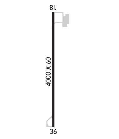
Runway Identification: 18/36
Length: 4000 ft
Width: 60 ft
Surface: ASPHALT-FAIR CONDITION
Edge lights: Low Intensity

Treatment: NONE

 Runway: 18   Runway: 36
Mag heading: N/AMag heading: N/A
Rwy Slope: .03% UpRwy Slope: -.03% Down
Approach: Approach:
Pattern: Left TrafficPattern: Left Traffic
Markings: BASICMarkings: BASIC
Marking Condition: GOODMarking Condition: GOOD
Arresting Dev: Arresting Dev:
Lat & Long: N3958.7  W09024.3Lat. & Long.: N3958.1  W09024.4
Elev: 464.0 ft. MSLElev: 465.0 ft. MSL
TCH: TCH:
Visual Glide Path: Visual Glide Path:
Displaced Threshold: NoDisplaced Threshold: No
Touchdown Zone: NOTouchdown Zone: NO
Touchdown Elev.: Touchdown Elev.:
Visual Glide Slope: Visual Glide Slope:
RVR Equipment: RVR Equipment:
RVV Equipment: NORVV Equipment: NO
Approach Lights: Approach Lights:
REIL: NOREIL: NO
Centerline Lights: NOCenterline Lights: NO
Touchdown lights: NOTouchdown lights: NO
Runway Category: Runway with a Visual ApproachRunway Category: Runway with a Visual Approach
Declared Distances: Declared Distances:
Obstructions: TREESObstructions:
Marked: NOT Marked/LightedMarked:
Clearance slope: 20:1Clearance slope: 20:1
Obstruction height: 22 feet AGLObstruction height:
Dist. from runway: 640 feetDist. from runway:
Centerline offset: Centerline offset:
Comments: Comments:
C:/P: