Current Weather/Notams (Metars, TAFs, Notams, NWS Forecast, PIREPS, and nearby weather)
Customs Information Send updates to Support@FltPlan.com
Customs Not Available
Database effective 04/18/2024
Airport Diagram might not be current.
|
| Facility Name: | JASPER COUNTY/BELL FLD |
| City Name: | JASPER |
| County: | JASPER |
| State abbrev: | TX |
| State Name: | TEXAS |
| | |
| Ownership: | PUBLICLY OWNED |
| Use: | OPEN TO THE PUBLIC |
| Owner's Name: | JASPER COUNTY |
| Address: | 121 N. AUSTIN STREET |
| | JASPER, TX 75951 |
| Owner's Phone: | 409-384-2612 |
| | |
| Manager's Name: | MARK ALLEN; COUNTY JUDGE/AMGR. |
| Address: | JASPER COUNTY COURTHOUSE, 121 N. AUSTIN ST. |
| | JASPER, TX 75951 |
| Phone: | 409-384-2612; ARPT FONE 409-381-8151. KEVIN HOLLOWAY, COUNTY COMMISSIONER |
| | |
| FAA Region: | SOUTHWEST |
| FAA Field Office: | TEX |
Runway Identifications
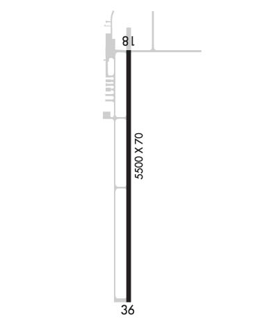
Runway Identification: 18/36Length: 5500 ft
Width: 70 ft
Surface: ASPHALT-GOOD CONDITION
Edge lights: Medium IntensityTreatment: NONE
| | Runway: 18 | | Runway: 36 |
| Mag heading: | 177° | Mag heading: | 357° |
| Rwy Slope: | -.63% Down | Rwy Slope: | .63% Up |
| Approach: | | Approach: | |
| Pattern: | Left Traffic | Pattern: | Left Traffic |
| Markings: | NONPRECISION INSTRUMENT | Markings: | NONPRECISION INSTRUMENT |
| Marking Condition: | GOOD | Marking Condition: | GOOD |
| Arresting Dev: | | Arresting Dev: | |
| Lat & Long: | N3053.6 W09402.1 | Lat. & Long.: | N3052.7 W09402.1 |
| Elev: | 212.5 ft. MSL | Elev: | 177.6 ft. MSL |
| TCH: | 41 ft. AGL | TCH: | 45 ft. AGL |
| Visual Glide Path: | 3.50 degrees | Visual Glide Path: | 3.50 degrees |
| Displaced Threshold: | No | Displaced Threshold: | No |
| Touchdown Zone: | YES | Touchdown Zone: | YES |
| Touchdown Elev.: | 212.6 feet | Touchdown Elev.: | 192.0 feet |
| Visual Glide Slope: | 2-Light PAPI on LEFT side of Runway | Visual Glide Slope: | 2-Light PAPI on LEFT side of Runway |
| RVR Equipment: | | RVR Equipment: | |
| RVV Equipment: | NO | RVV Equipment: | NO |
| Approach Lights: | | Approach Lights: | |
| REIL: | NO | REIL: | NO |
| Centerline Lights: | NO | Centerline Lights: | NO |
| Touchdown lights: | NO | Touchdown lights: | NO |
| Runway Category: | Runway with a Non-precision Approach having visibility minimums greater than 3/4 mile | Runway Category: | Runway with a Non-precision Approach having visibility minimums greater than 3/4 mile |
| Declared Distances: | | Declared Distances: | |
| Obstructions: | TREES | Obstructions: | TREES |
| Marked: | NOT Marked/Lighted | Marked: | NOT Marked/Lighted |
| Clearance slope: | 26:1 | Clearance slope: | 21:1 |
| Obstruction height: | 89 feet AGL | Obstruction height: | 79 feet AGL |
| Dist. from runway: | 2515 feet | Dist. from runway: | 1890 feet |
| Centerline offset: | 800B | Centerline offset: | 740B |
| Comments: | | Comments: | |

