Click here for more info on on SMS!

KIIY

WASHINGTON-WILKES COUNTY
WASHINGTON
GA
Time Zone: Eastern
Lat: N 3346.7
Long: W 08248.9
Elev: 646
Var: +07
Longest Runway: 5020
AWOS: 118.37
CTAF: 122.7

FBO & Flight Services info for KIIY

FBOs: Update your Fuel Prices

BRAVO AIRPh: 706-678-2662
-
Freq: 122.7
Service
Jet
100LL
SAF
MoGas
Fuel Avail: Self serve fuel available 24/7
Full        Last Update: 04/19/2024 11:43

Self5.005.00    
 Address: 351 AIRPORT RD   WASHINGTON, GA 30673
AWOSPh: 706-678-3647
-
Freq: 118.37  
If you are an FBO, call 1-203-262-1700 to update your info or email: FltPlan.Advertising@garmin.com
Advertise your FBO on FltPlan.com

Runway & Approach Info for KIIY
Rwy
Length
Land Dist**
Approach*
  Rwy
Length
Land Dist**
Approach*
13
5020x75  5020'          
 
  
31
  5020x75  4020'          
 
 * only ILS, LOC, LDA, and SDF approaches to a specific runway are shown
** For any Declared Landing Distance Available, please see A/FD or Approach plates
Runway Weight Capability (lbs.) Help
Runway IDSingle WheelDouble WheelDouble Tandem WheelDual Double Wheel
13/3130,000N/AN/AN/A
These numbers are Advisory and are not limits.   The Airport Manager should have more accurate Weight Limits
Approach Charts
Approaches    
Current Weather/Notams
Customs Information Send updates to Support@FltPlan.com
Customs Not Available
Database effective 04/18/2024
Airport Diagram of KIIY
Airport Diagram might not be current.

Facility Name: WASHINGTON/WILKES COUNTY
City Name: WASHINGTON
County: WILKES
State abbrev: GA
State Name: GEORGIA
   
Ownership: PUBLICLY OWNED
Use: OPEN TO THE PUBLIC
Owner's Name: WILKES COUNTY
Address: 23 COURT STREET, ROOM 222
 WASHINGTON, GA 30673
Owner's Phone: 706-678-2511
  
Manager's Name: DANN STANDARD
Address: 351 AIRPORT ROAD
 WASHINGTON, GA 30673
Phone: 706-678-2662; ALT PHONE: 706-836-0442
   
FAA Region: SOUTHERN
FAA Field Office: ATL


Sunrise / Sunset times for WASHINGTON/WILKES COUNTY

DateSunriseSunset
04/18/24 Thursday6:5620:05
04/19/24 Friday6:5520:06
04/20/24 Saturday6:5420:07
04/21/24 Sunday6:5320:08
04/22/24 Monday6:5120:08
04/23/24 Tuesday6:5020:09
04/24/24 Wednesday6:4920:10
04/25/24 Thursday6:4820:11
04/26/24 Friday6:4720:11
04/27/24 Saturday6:4620:12
04/28/24 Sunday6:4520:13
04/29/24 Monday6:4420:14
04/30/24 Tuesday6:4320:15
05/01/24 Wednesday6:4220:15

Airport Facilities

Airport Attendance ScheduleMON-FRI 0900-1700
Airport Status OPERATIONAL (This Status can change at any time - please check NOTAMS)
Airport Lighting ScheduleACTVT PAPI RWY 13 & 31; MIRL RWY 13/31 - CTAF.
Airport Storage AvailableTie Downs
Extra Services AvailableFlight Instruction, Aircraft Rental
Wind IndicatorYES - (lighted)
Control TowerNO
CTAF Frequency122.700
Unicom Frequency122.700
Rotating Beacon ColorWG
Segmented CircleYES
Landing FeeNO

Airport Inspection Data

Airport InspectedSTATE - performed by STATE AERONAUTICAL PERSONNEL
Inspection Date03/08/2024

Airport Services

Type of Fuel AvailableGrade 100LL, JET A (freeze point -40C), JET A
Airframe Repair ServiceMAJOR
Power Plant Repair ServiceMAJOR

Geographic Data

LatitudeN3346.7
LongitudeW08248.9 (ESTIMATED)
Arpt Elevation646ft (SURVEYED)
Magnetic Variation07W
4 miles NWof WASHINGTON
Traffic Pattern Altitude
Sectional ChartATLANTA

Aircraft Data

Operations (Reported)YearlyAvg. Daily
General Aviation Transient 700019
General Aviation Local 700019
Air Taxi 00
Commerical 00
Commuter 00
Military 00
Aircraft based on Field
General Aviation Singles 9
General Aviation Multi 5
Jet Aircraft 1
General Aviation Helicopters 0
Military Aircraft 0
Gliders 0
Ultralights 0

FAA Services

FSS on field NO
FSS tie-in MACON
FSS Phone 1-800-WX-BRIEF
Who issues Notams IIY
Notam D service at airport YES
ARTCC Name ATLANTA

Federal Status

Airport Certification
Aircraft Rescue & Firefighting IndexNone
Airport of EntryNo
Custom Landing RightsNo
Joint Civil/MilitaryNo
Military Landing rightsYES

Federal Agreements

NATIONAL PLAN OF INTEGRATED AIRPORT SYSTEMS (NPIAS)
GRANT AGREEMENT HAS EXPIRED; HOWEVER, AGREEMENT REMAINS IN EFFECT FOR THIS FACILITY AS LONG AS IT IS PUBLIC USE.

Remarks

FOR CD CTC AUGUSTA APCH AT 706-771-1777, WHEN APCH CLSD CTC ATLANTA ARTCC AT 770-210-7692.
Airport Communications & Frequencies:
CTAF Frequency:
122.700
Unicom Frequency:
122.700
Remarks
  • APCH/DEP SVC PRVDD BY AUGUSTA APCH CTL 0645-2300 ON FREQS 126.8/270.3 OTHER TIMES BY ATLANTA ARTCC ON FREQS 128.1/322.325 (AUGUSTA RCAG).
  • AUGUSTA Primary Approach Frequencies:  
    126.8
    270.3
    AUGUSTA Primary Departure Frequencies:  
    126.8
    270.3
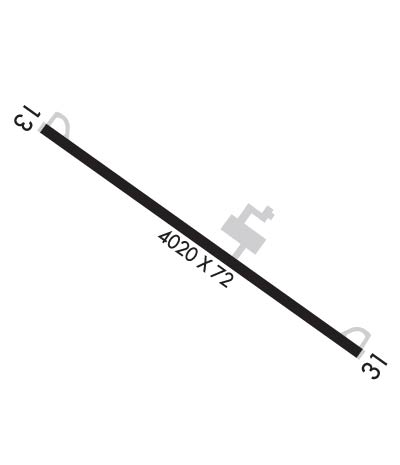
    Runway Identifications
    Runway Identification: 13/31
    Length: 5020 ft
    Width: 75 ft
    Surface: ASPHALT-GOOD CONDITION
    Edge lights: Medium Intensity

    Treatment: NONE

     Runway: 13   Runway: 31
    Mag heading: 133°Mag heading: 313°
    Rwy Slope: -.26% DownRwy Slope: .26% Up
    Approach: Approach:
    Pattern: Left TrafficPattern: Left Traffic
    Markings: NONPRECISION INSTRUMENTMarkings: NONPRECISION INSTRUMENT
    Marking Condition: GOODMarking Condition: GOOD
    Arresting Dev: Arresting Dev:
    Lat & Long: N3347.0  W08249.3Lat. & Long.: N3346.5  W08248.5
    Elev: 646.0 ft. MSLElev: 632.7 ft. MSL
    TCH: 30 ft. AGLTCH: 32 ft. AGL
    Visual Glide Path: 3.00 degreesVisual Glide Path: 3.00 degrees
    Displaced Threshold: NoDisplaced Threshold: 1000 feet
    Touchdown Zone: YESTouchdown Zone: YES
    Touchdown Elev.: 646.1 feetTouchdown Elev.: 640.5 feet
    Visual Glide Slope: 2-Light PAPI on LEFT side of RunwayVisual Glide Slope: 2-Light PAPI on LEFT side of Runway
    RVR Equipment: RVR Equipment:
    RVV Equipment: NORVV Equipment: NO
    Approach Lights: Approach Lights:
    REIL: NOREIL: NO
    Centerline Lights: NOCenterline Lights: NO
    Touchdown lights: NOTouchdown lights: NO
    Runway Category: Runway with a Non-precision Approach having visibility minimums greater than 3/4 mileRunway Category: Runway with a Non-precision Approach having visibility minimums greater than 3/4 mile
    Declared Distances: Declared Distances:
    Obstructions: ROADObstructions: TREES
    Marked: NOT Marked/LightedMarked: NOT Marked/Lighted
    Clearance slope: 20:1Clearance slope: 9:1
    Obstruction height: 29 feet AGLObstruction height: 65 feet AGL
    Dist. from runway: 780 feetDist. from runway: 785 feet
    Centerline offset: 241 right of centerlineCenterline offset: 219 feet right of centerline
    Comments: HIGH GROUND 205FT R OF CNTRLN.Comments: HIGH GROUND 205FT L OF CNTRLN.
    C:2/P: