Click here for more info on on SMS!

KIDL

INDIANOLA MUNI
INDIANOLA
MS
Time Zone: Central
Lat: N 3329.1
Long: W 09040.7
Elev: 126
Var: -00
Longest Runway: 7004
CTAF: 122.8

FBO & Flight Services info for KIDL

FBOs: Update your Fuel Prices

AIRPORT
-
Freq: 122.8
If you are an FBO, call 1-203-262-1700 to update your info or email: FltPlan.Advertising@garmin.com
Advertise your FBO on FltPlan.com

Runway & Approach Info for KIDL
Rwy
Length
Land Dist**
Approach*
  Rwy
Length
Land Dist**
Approach*
18
7004x150  7004'          
 
  
36
  7004x150  7004'          
 
 * only ILS, LOC, LDA, and SDF approaches to a specific runway are shown
** For any Declared Landing Distance Available, please see A/FD or Approach plates
Runway Weight Capability (lbs.) Help
Runway IDSingle WheelDouble WheelDouble Tandem WheelDual Double Wheel
18/3620,000N/AN/AN/A
These numbers are Advisory and are not limits.   The Airport Manager should have more accurate Weight Limits
Approach Charts
Approaches    
Current Weather/Notams
Customs Information Send updates to Support@FltPlan.com
Customs Not Available
Database effective 05/16/2024
Airport Diagram of KIDL
Airport Diagram might not be current.

Facility Name: INDIANOLA MUNI
City Name: INDIANOLA
County: SUNFLOWER
State abbrev: MS
State Name: MISSISSIPPI
   
Ownership: PUBLICLY OWNED
Use: OPEN TO THE PUBLIC
Owner's Name: CITY OF INDIANOLA
Address: PO BOX 269
 INDIANOLA, MS 38751
Owner's Phone: 662-887-3101
  
Manager's Name: BAYLOR BRYANT
Address: BOX 662
 INDIANOLA, MS 38751
Phone: 662-588-0580
   
FAA Region: SOUTHERN
FAA Field Office: JAN


Sunrise / Sunset times for INDIANOLA MUNI

DateSunriseSunset
04/25/24 Thursday6:2019:42
04/26/24 Friday6:1919:42
04/27/24 Saturday6:1819:43
04/28/24 Sunday6:1719:44
04/29/24 Monday6:1619:45
04/30/24 Tuesday6:1519:45
05/01/24 Wednesday6:1419:46
05/02/24 Thursday6:1319:47
05/03/24 Friday6:1219:48
05/04/24 Saturday6:1119:49
05/05/24 Sunday6:1019:49
05/06/24 Monday6:0919:50
05/07/24 Tuesday6:0819:51
05/08/24 Wednesday6:0719:52

Airport Facilities

Airport Attendance ScheduleMON-FRI 0800-1700
Airport Status OPERATIONAL (This Status can change at any time - please check NOTAMS)
Airport Lighting ScheduleACTVT MIRL RWY 18/36 - CTAF.
Airport Storage AvailableTie Downs
Extra Services AvailableCrop Dusting
Wind IndicatorYES - (lighted)
Control TowerNO
CTAF Frequency122.800
Unicom Frequency122.800
Rotating Beacon ColorWG
Segmented CircleYES
Landing FeeNO

Airport Inspection Data

Airport InspectedSTATE - performed by STATE AERONAUTICAL PERSONNEL
Inspection Date12/08/2023

Airport Services

Type of Fuel AvailableGrade 100LL
Airframe Repair ServiceMAJOR
Power Plant Repair ServiceMAJOR

Geographic Data

LatitudeN3329.1
LongitudeW09040.7 (ESTIMATED)
Arpt Elevation126ft (SURVEYED)
Magnetic Variation00E
2 miles NWof INDIANOLA
Traffic Pattern Altitude
Sectional ChartMEMPHIS

Aircraft Data

Operations (Reported)YearlyAvg. Daily
General Aviation Transient 735220
General Aviation Local 1899252
Air Taxi 00
Commerical 00
Commuter 00
Military 00
Aircraft based on Field
General Aviation Singles 15
General Aviation Multi 0
Jet Aircraft 0
General Aviation Helicopters 0
Military Aircraft 0
Gliders 1
Ultralights 0

FAA Services

FSS on field NO
FSS tie-in GREENWOOD
FSS Phone 1-800-WX-BRIEF
Who issues Notams GWO
Notam D service at airport YES
ARTCC Name MEMPHIS

Federal Status

Airport Certification
Aircraft Rescue & Firefighting IndexNone
Airport of EntryNo
Custom Landing RightsNo
Joint Civil/MilitaryNo
Military Landing rightsYES

Federal Agreements

NATIONAL PLAN OF INTEGRATED AIRPORT SYSTEMS (NPIAS)
GRANT AGREEMENTS UNDER FAAP/ADAP/AIP
SURPLUS PROPERTY AGREEMENT UNDER PUBLIC LAW 289
ASSURANCES PURSUANT TO TITLE VI, CIVIL RIGHTS ACT OF 1964

Remarks

(E81) TWY LGTS ON E-W TWY TO APN ONLY.
FOR CD CTC MEMPHIS ARTCC AT 901-368-8453/8449.
Airport Communications & Frequencies:
CTAF Frequency:
122.800
Unicom Frequency:
122.800
Remarks
  • APCH/DEP SVC PRVDD BY MEMPHIS ARTCC ON FREQS 135.875/269.35 (GREENVILLE RCAG & PINE BLUFF RCAG).
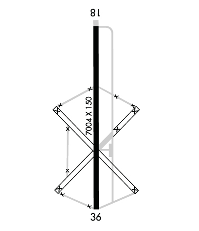
  • Runway Identifications
    Runway Identification: 18/36
    Length: 7004 ft
    Width: 150 ft
    Surface: CONCRETE-GOOD CONDITION
    Edge lights: Medium Intensity

    Treatment: NONE

     Runway: 18   Runway: 36
    Mag heading: 180°Mag heading: 360°
    Rwy Slope: -.08% DownRwy Slope: .08% Up
    Approach: Approach:
    Pattern: Left TrafficPattern: Left Traffic
    Markings: NONPRECISION INSTRUMENTMarkings: NONPRECISION INSTRUMENT
    Marking Condition: FAIRMarking Condition: GOOD
    Arresting Dev: Arresting Dev:
    Lat & Long: N3329.7  W09040.7Lat. & Long.: N3328.6  W09040.7
    Elev: 126.0 ft. MSLElev: 120.3 ft. MSL
    TCH: TCH:
    Visual Glide Path: Visual Glide Path:
    Displaced Threshold: NoDisplaced Threshold: No
    Touchdown Zone: YESTouchdown Zone: YES
    Touchdown Elev.: 126.0 feetTouchdown Elev.: 120.4 feet
    Visual Glide Slope: Visual Glide Slope:
    RVR Equipment: RVR Equipment:
    RVV Equipment: NORVV Equipment: NO
    Approach Lights: Approach Lights:
    REIL: NOREIL: NO
    Centerline Lights: NOCenterline Lights: NO
    Touchdown lights: NOTouchdown lights: NO
    Runway Category: Runway with a Non-precision Approach having visibility minimums greater than 3/4 mileRunway Category: Runway with a Non-precision Approach having visibility minimums greater than 3/4 mile
    Declared Distances: Declared Distances:
    Obstructions: TREESObstructions:
    Marked: NOT Marked/LightedMarked:
    Clearance slope: 22:1Clearance slope: 50:1
    Obstruction height: 35 feet AGLObstruction height:
    Dist. from runway: 1000 feetDist. from runway:
    Centerline offset: Centerline offset:
    Comments: Comments:
    C:1/P: