Approach Charts
| FltPlan does not have IFR approach charts available for KI99. |
Current Weather/Notams (Metars, TAFs, Notams, NWS Forecast, PIREPS, and nearby weather)
Customs Information Send updates to Support@FltPlan.com
Customs Not Available
Database effective 04/18/2024
Airport Diagram might not be current.
|
| Facility Name: | ALEXANDRIA |
| City Name: | ALEXANDRIA |
| County: | MADISON |
| State abbrev: | IN |
| State Name: | INDIANA |
| | |
| Ownership: | PRIVATELY OWNED |
| Use: | OPEN TO THE PUBLIC |
| Owner's Name: | CENTRAL INDIANA SOARING SOCIETY |
| Address: | 1577 E. 900 N. |
| | ALEXANDRIA, IN 46001 |
| Owner's Phone: | 765-744-0242 |
| | |
| Manager's Name: | DANIEL DEWITT |
| Address: | 1577 E. 900 N. |
| | ALEXANDRIA, IN 46001 |
| Phone: | (765) 744-4132 |
| | |
| FAA Region: | GREAT LAKES |
| FAA Field Office: | CHI |
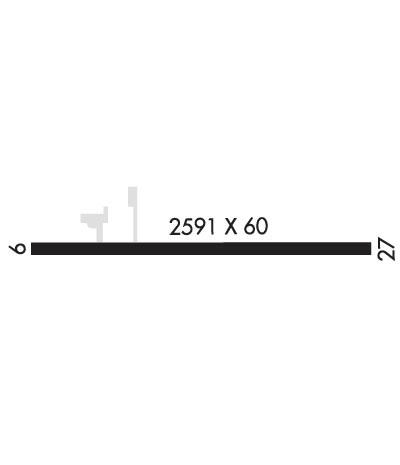
Runway Identifications
Runway Identification: 09/27Length: 2591 ft
Width: 60 ft
Surface: ASPHALT-FAIR CONDITION
Edge lights: Treatment: NONE
| | Runway: 09 | | Runway: 27 |
| Mag heading: | 91° | Mag heading: | 271° |
| Rwy Slope: | -.35% Down | Rwy Slope: | .35% Up |
| Approach: | | Approach: | |
| Pattern: | Left Traffic | Pattern: | Left Traffic |
| Markings: | | Markings: | |
| Marking Condition: | | Marking Condition: | |
| Arresting Dev: | | Arresting Dev: | |
| Lat & Long: | N4014.0 W08538.5 | Lat. & Long.: | N4013.9 W08538.0 |
| Elev: | 894.0 ft. MSL | Elev: | 885.0 ft. MSL |
| TCH: | | TCH: | |
| Visual Glide Path: | | Visual Glide Path: | |
| Displaced Threshold: | 195 feet | Displaced Threshold: | 276 feet |
| Touchdown Zone: | YES | Touchdown Zone: | YES |
| Touchdown Elev.: | 900.0 feet | Touchdown Elev.: | 900.0 feet |
| Visual Glide Slope: | | Visual Glide Slope: | |
| RVR Equipment: | | RVR Equipment: | |
| RVV Equipment: | NO | RVV Equipment: | NO |
| Approach Lights: | | Approach Lights: | |
| REIL: | NO | REIL: | NO |
| Centerline Lights: | NO | Centerline Lights: | NO |
| Touchdown lights: | NO | Touchdown lights: | NO |
| Runway Category: | Runway with a Visual Approach | Runway Category: | Runway with a Visual Approach |
| Declared Distances: | | Declared Distances: | |
| Obstructions: | CROPS | Obstructions: | CROPS |
| Marked: | NOT Marked/Lighted | Marked: | NOT Marked/Lighted |
| Clearance slope: | APCH SLOPE 21:1 AT DISP TH DUE TO 11 FT ROAD 235 FT FM DISP TH | Clearance slope: | APCH SLOPE 20:1 AT DISP TH DUE TO 15 FT ROAD 305 FT FM DISP TH |
| Obstruction height: | 10 feet AGL | Obstruction height: | 10 feet AGL |
| Dist. from runway: | 201 feet | Dist. from runway: | 201 feet |
| Centerline offset: | | Centerline offset: | |
| Comments: | 11 FT ROAD 45 FT FROM RWY END & CROPS 55 FT FROM RWY END | Comments: | 15 FT ROAD 30 FT FROM RWY END & CROPS 50 FT FROM RWY END |

