Current Weather/Notams (Metars, TAFs, Notams, NWS Forecast, PIREPS, and nearby weather)
Customs Information Send updates to Support@FltPlan.com
Customs Not Available
Database effective 05/16/2024
Airport Diagram might not be current.
|
| Facility Name: | MOUNT STERLING MUNI |
| City Name: | MOUNT STERLING |
| County: | BROWN |
| State abbrev: | IL |
| State Name: | ILLINOIS |
| | |
| Ownership: | PUBLICLY OWNED |
| Use: | OPEN TO THE PUBLIC |
| Owner's Name: | CITY OF MOUNT STERLING |
| Address: | 145 W. MAIN |
| | MOUNT STERLING, IL 62353 |
| Owner's Phone: | 217-773-4411; EXT 12644 |
| | |
| Manager's Name: | PAUL WALKER |
| Address: | 145 W. MAIN |
| | MOUNT STERLING, IL 62353 |
| Phone: | 217-779-7329 |
| | |
| FAA Region: | GREAT LAKES |
| FAA Field Office: | CHI |
Runway Identifications
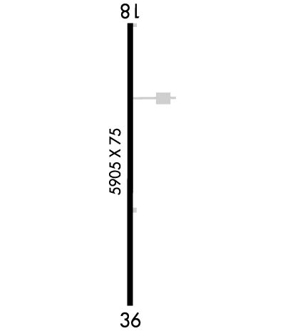
Runway Identification: 18/36Length: 5905 ft
Width: 75 ft
Surface: ASPHALT-GOOD CONDITION
Edge lights: Medium IntensityTreatment: NONE
| | Runway: 18 | | Runway: 36 |
| Mag heading: | 180° | Mag heading: | 0° |
| Rwy Slope: | -.31% Down | Rwy Slope: | .31% Up |
| Approach: | | Approach: | |
| Pattern: | Left Traffic | Pattern: | Left Traffic |
| Markings: | NONPRECISION INSTRUMENT | Markings: | NONPRECISION INSTRUMENT |
| Marking Condition: | FAIR | Marking Condition: | FAIR |
| Arresting Dev: | | Arresting Dev: | |
| Lat & Long: | N3959.6 W09048.2 | Lat. & Long.: | N3958.6 W09048.3 |
| Elev: | 733.7 ft. MSL | Elev: | 715.2 ft. MSL |
| TCH: | 43 ft. AGL | TCH: | 42 ft. AGL |
| Visual Glide Path: | 3.00 degrees | Visual Glide Path: | 3.00 degrees |
| Displaced Threshold: | No | Displaced Threshold: | No |
| Touchdown Zone: | YES | Touchdown Zone: | YES |
| Touchdown Elev.: | 733.7 feet | Touchdown Elev.: | 725.0 feet |
| Visual Glide Slope: | 4-Light PAPI on LEFT side of Runway | Visual Glide Slope: | 4-Light PAPI on LEFT side of Runway |
| RVR Equipment: | | RVR Equipment: | |
| RVV Equipment: | NO | RVV Equipment: | NO |
| Approach Lights: | | Approach Lights: | |
| REIL: | NO | REIL: | NO |
| Centerline Lights: | NO | Centerline Lights: | NO |
| Touchdown lights: | NO | Touchdown lights: | NO |
| Runway Category: | Runway with a Non-precision Approach having visibility minimums greater than 3/4 mile | Runway Category: | Runway with a Non-precision Approach having visibility minimums greater than 3/4 mile |
| Declared Distances: | | Declared Distances: | |
| Obstructions: | POLE | Obstructions: | |
| Marked: | MARKED | Marked: | |
| Clearance slope: | 31:1 | Clearance slope: | 34:1 |
| Obstruction height: | 44 feet AGL | Obstruction height: | |
| Dist. from runway: | 1577 feet | Dist. from runway: | |
| Centerline offset: | 255 left of centerline | Centerline offset: | |
| Comments: | | Comments: | |

