Click here for more info on on SMS!

KI17

PIQUA AIRPORT- HARTZELL FIELD
PIQUA
OH
Time Zone: Eastern
Lat: N 4009.9
Long: W 08418.5
Elev: 993
Var: +06
Longest Runway: 3998
CTAF: 123.0

FBO & Flight Services info for KI17

FBOs: Update your Fuel Prices

HARTZELL SV CTRPh: 937-778-4207 Fax: 937-778-4218 Freq: 123.0
Service
Jet
100LL
SAF
MoGas
Fuel Avail: JET A INCLUDES PRIST.
Full        Last Update: 04/15/2024 13:36

Self5.806.42    
 Address: 5465 WEST ST RT 185   PIQUA, OH 45356
If you are an FBO, call 1-203-262-1700 to update your info or email: FltPlan.Advertising@garmin.com
Advertise your FBO on FltPlan.com

Runway & Approach Info for KI17
Rwy
Length
Land Dist**
Approach*
  Rwy
Length
Land Dist**
Approach*
08
3998x75  3998'          
 
  
26
  3998x75  3998'          
 
 * only ILS, LOC, LDA, and SDF approaches to a specific runway are shown
** For any Declared Landing Distance Available, please see A/FD or Approach plates
Runway Weight Capability (lbs.) Help
Runway IDSingle WheelDouble WheelDouble Tandem WheelDual Double Wheel
08/2630,00036,000N/AN/A
These numbers are Advisory and are not limits.   The Airport Manager should have more accurate Weight Limits
Approach Charts
Approaches    
Current Weather/Notams
Customs Information Send updates to Support@FltPlan.com
Customs Not Available
Database effective 04/18/2024
Airport Diagram of KI17
Airport Diagram might not be current.

Facility Name: PIQUA/HARTZELL FLD
City Name: PIQUA
County: MIAMI
State abbrev: OH
State Name: OHIO
   
Ownership: PUBLICLY OWNED
Use: OPEN TO THE PUBLIC
Owner's Name: CITY OF PIQUA
Address: CITY BUILDING, 201 W WATER ST
 PIQUA, OH 45356-2235
Owner's Phone: 937-778-2051
  
Manager's Name: MARK RUNGE
Address: 1 PROPELLER PL
 PIQUA, OH 45356-2655
Phone: 937-778-4207
   
FAA Region: GREAT LAKES
FAA Field Office: DET


Sunrise / Sunset times for PIQUA/HARTZELL FLD

DateSunriseSunset
04/19/24 Friday6:5220:21
04/20/24 Saturday6:5120:22
04/21/24 Sunday6:4920:23
04/22/24 Monday6:4820:24
04/23/24 Tuesday6:4720:25
04/24/24 Wednesday6:4520:26
04/25/24 Thursday6:4420:27
04/26/24 Friday6:4220:28
04/27/24 Saturday6:4120:29
04/28/24 Sunday6:4020:30
04/29/24 Monday6:3920:31
04/30/24 Tuesday6:3720:32
05/01/24 Wednesday6:3620:33
05/02/24 Thursday6:3520:34

Airport Facilities

Airport Attendance ScheduleMON-FRI 0800-1700; UNATNDD MAJOR HOLS.
Airport Status OPERATIONAL (This Status can change at any time - please check NOTAMS)
Airport Lighting ScheduleACTVT REIL RWY 08 & 26; MIRL RWY 08/26 - CTAF. PAPI RWY 08 & 26 OPR CONSLY.
Airport Storage AvailableTie Downs, Hanger
Extra Services AvailableNONE
Wind IndicatorYES - (lighted)
Control TowerNO
CTAF Frequency123.000
Unicom Frequency123.000
Rotating Beacon ColorWG
Segmented CircleNO
Landing FeeNO

Airport Inspection Data

Airport InspectedSTATE - performed by STATE AERONAUTICAL PERSONNEL
Inspection Date09/30/2021

Airport Services

Type of Fuel AvailableGrade 100LL, JET A-1 (icing inhibitor, freeze point -50C); -10FUEL AVBL H24 VIA CREDIT CARD.
Airframe Repair ServiceMINOR; PROP RPRS.
Power Plant Repair ServiceMINOR

Geographic Data

LatitudeN4009.9
LongitudeW08418.5 (ESTIMATED)
Arpt Elevation993ft (SURVEYED)
Magnetic Variation06W
3 miles NWof PIQUA
Traffic Pattern Altitude
Sectional ChartDETROIT

Aircraft Data

Operations (Reported)YearlyAvg. Daily
General Aviation Transient 700019
General Aviation Local 480013
Air Taxi 2001
Commerical 00
Commuter 00
Military 00
Aircraft based on Field
General Aviation Singles 27
General Aviation Multi 0
Jet Aircraft 0
General Aviation Helicopters 0
Military Aircraft 0
Gliders 0
Ultralights 1

FAA Services

FSS on field NO
FSS tie-in DAYTON
FSS Phone 1-800-WX-BRIEF
Who issues Notams DAY
Notam D service at airport YES
ARTCC Name INDIANAPOLIS

Federal Status

Airport Certification
Aircraft Rescue & Firefighting IndexNone
Airport of EntryNo
Custom Landing RightsNo
Joint Civil/MilitaryNo
Military Landing rightsNo

Remarks

AEROBATIC BOX LCTD WI 1 NMR OF ARPT, BLW 4500 FT MSL, SR-SS.
ARPT CONDS UNMON MON-FRI 1600-0800, SAT-SUN, & HOLS.
FOR CD CTC COLUMBUS APCH AT 614-338-8537.
Airport Communications & Frequencies:
CTAF Frequency:
123.000
Unicom Frequency:
123.000
COLUMBUS Primary Approach Frequencies:  
134.45
294.5
352.05
COLUMBUS Primary Departure Frequencies:  
134.45
294.5
352.05
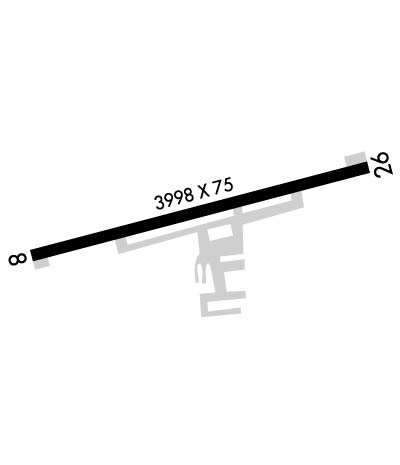
Runway Identifications
Runway Identification: 08/26
Length: 3998 ft
Width: 75 ft
Surface: ASPHALT-FAIR CONDITION
Edge lights: Medium Intensity

Treatment: NONE

 Runway: 08   Runway: 26
Mag heading: 82°Mag heading: 262°
Rwy Slope: -.21% DownRwy Slope: .21% Up
Approach: Approach:
Pattern: Left TrafficPattern: Left Traffic
Markings: NONPRECISION INSTRUMENTMarkings: NONPRECISION INSTRUMENT
Marking Condition: GOODMarking Condition: GOOD
Arresting Dev: Arresting Dev:
Lat & Long: N4009.8  W08418.9Lat. & Long.: N4010.0  W08418.1
Elev: 993.1 ft. MSLElev: 984.7 ft. MSL
TCH: 36 ft. AGLTCH: 37 ft. AGL
Visual Glide Path: 3.00 degreesVisual Glide Path: 3.00 degrees
Displaced Threshold: NoDisplaced Threshold: No
Touchdown Zone: YESTouchdown Zone: YES
Touchdown Elev.: 993.1 feetTouchdown Elev.: 986.4 feet
Visual Glide Slope: 2-Light PAPI on LEFT side of Runway; PAPI UNUSBL BYD 6 DEGS RIGHT OF CNTRLN.Visual Glide Slope: 2-Light PAPI on LEFT side of Runway
RVR Equipment: RVR Equipment:
RVV Equipment: NORVV Equipment: NO
Approach Lights: Approach Lights:
REIL: YESREIL: YES
Centerline Lights: NOCenterline Lights: NO
Touchdown lights: NOTouchdown lights: NO
Runway Category: Runway with a Non-precision ApproachRunway Category: Runway with a Non-precision Approach
Declared Distances: Declared Distances:
Obstructions: TREEObstructions:
Marked: NOT Marked/LightedMarked:
Clearance slope: 14:1Clearance slope: 20:1
Obstruction height: 30 feet AGLObstruction height:
Dist. from runway: 643 feetDist. from runway:
Centerline offset: 240 right of centerlineCenterline offset:
Comments: 10 FT MANURE STOCKPILE, 100-160 FT DIST, 225 FT R.Comments: 2-6 FT CROPS, 0-200 FT DIST, 160 FT L TO 230 FT R.
C:9/P: