Click here for more info on on SMS!

KHXD

HILTON HEAD
HILTON HEAD ISLAND
SC
Time Zone: Eastern
Lat: N 3213.5
Long: W 08041.8
Elev: 19
Var: +07
Longest Runway: 5000
Clr Del: 121.1
Dept. ATIS: 121.4
Arr. ATIS: 121.4
AWOS: 121.4
Ground: 121.1
Tower: 118.97

FBO & Flight Services info for KHXD

FBOs: Update your Fuel Prices

SIGNATUREPh: 843-689-3200 Fax: 843-681-3960 Freq: 128.87
Service
Jet
100LL
SAF
MoGas
Fuel Avail: Jet A w/Prist, add $0.10 per gallon. After hours fees apply
Full8.528.35    Last Update: 04/25/2024 09:46
PRICES GUARANTEED by FBO.
Self        
 Address: 52 GATEWAY CIRCLE,   HILTON HEAD ISLAND, SC 29926
ASOSPh: 843-342-5072
-
Freq: 121.4  
If you are an FBO, call 1-203-262-1700 to update your info or email: FltPlan.Advertising@garmin.com
Advertise your FBO on FltPlan.com

Runway & Approach Info for KHXD
Rwy
Length
Land Dist**
Approach*
  Rwy
Length
Land Dist**
Approach*
03
5000x100  4703'          
 
  
21
  5000x100  4597'          
LOC/DME
 111.30 - 213°  
 * only ILS, LOC, LDA, and SDF approaches to a specific runway are shown
** For any Declared Landing Distance Available, please see A/FD or Approach plates
Runway Weight Capability (lbs.) Help
Runway IDSingle WheelDouble WheelDouble Tandem WheelDual Double Wheel
03/2155,00075,000N/AN/A
These numbers are Advisory and are not limits.   The Airport Manager should have more accurate Weight Limits
Approach Charts
Approaches    
Current Weather/Notams
Customs Information Send updates to Support@FltPlan.com
Customs Not Available
Database effective 05/16/2024
Airport Diagram of KHXD
Airport Diagram might not be current.

Facility Name: HILTON HEAD
City Name: HILTON HEAD ISLAND
County: BEAUFORT
State abbrev: SC
State Name: SOUTH CAROLINA
   
Ownership: PUBLICLY OWNED
Use: OPEN TO THE PUBLIC
Owner's Name: BEAUFORT COUNTY
Address: 120 BEACH CITY ROAD
 HILTON HEAD ISLAND, SC 29926
Owner's Phone: 843-255-2950
  
Manager's Name: JON REMBOLD
Address: 120 BEACH CITY ROAD
 HILTON HEAD ISLAND, SC 29926
Phone: 843-255-2952
   
FAA Region: SOUTHERN
FAA Field Office: ATL
Joseph Pelton - www.aviationonlinetraining.net


Click here for full scale & interactive Sectional view of KHXD


Sunrise / Sunset times for HILTON HEAD

DateSunriseSunset
04/24/24 Wednesday6:4319:59
04/25/24 Thursday6:4220:00
04/26/24 Friday6:4120:01
04/27/24 Saturday6:4020:01
04/28/24 Sunday6:3920:02
04/29/24 Monday6:3820:03
04/30/24 Tuesday6:3720:04
05/01/24 Wednesday6:3620:04
05/02/24 Thursday6:3520:05
05/03/24 Friday6:3420:06
05/04/24 Saturday6:3320:06
05/05/24 Sunday6:3220:07
05/06/24 Monday6:3120:08
05/07/24 Tuesday6:3020:09

Airport Facilities

Airport Attendance Schedule7 Days A Week 0600-2200
Airport Status OPERATIONAL (This Status can change at any time - please check NOTAMS)
Airport Lighting Schedule
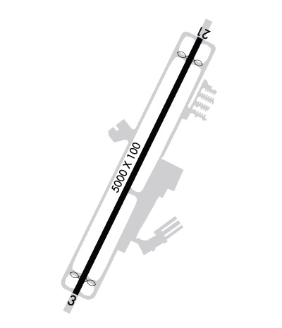
ACTVT MIRL 03/21 AND REIL RYS 03 & 21 - CTAF.
Airport Storage AvailableTie Downs
Extra Services AvailableAir Ambulance, Avionics, Charter, Flight Instruction, Aircraft Rental
Wind IndicatorYES - (lighted)
Control TowerYES
CTAF Frequency118.975
Unicom Frequency
Rotating Beacon ColorWG
Segmented CircleYES
Landing FeeNO

Airport Inspection Data

Airport InspectedFEDERAL - performed by FAA AIRPORTS FIELD PERSONNEL
Inspection Date08/09/2023

Airport Services

Type of Fuel AvailableGrade 100LL, JET A (freeze point -40C)
Airframe Repair ServiceMAJOR
Power Plant Repair ServiceMAJOR

Geographic Data

LatitudeN3213.5
LongitudeW08041.8 (ESTIMATED)
Arpt Elevation19ft (SURVEYED)
Magnetic Variation07W
3 miles Eof HILTON HEAD ISLAND
Traffic Pattern Altitude
Sectional ChartCHARLOTTE

Aircraft Data

Operations (Reported)YearlyAvg. Daily
General Aviation Transient 2627472
General Aviation Local 27698
Air Taxi 559915
Commerical 382110
Commuter 00
Military 10873
Aircraft based on Field
General Aviation Singles 55
General Aviation Multi 23
Jet Aircraft 8
General Aviation Helicopters 2
Military Aircraft 0
Gliders 0
Ultralights 0

FAA Services

FSS on field NO
FSS tie-in ANDERSON
FSS Phone 1-800-WX-BRIEF
Who issues Notams HXD
Notam D service at airport YES
ARTCC Name JACKSONVILLE

Federal Status

Airport CertificationAIRPORT RECEIVING SCHEDULED AIR CARRIER SERVICE FROM CARRIERS CERTIFICATED BY THE CIVIL AERONAUTICS BOARD; CLSD TO UNSKED ACR OPNS WITH MORE THAN 30 PSGR SEATS EXCP 24 HRS PPR CALL AMGR (843) 255-2950
Aircraft Rescue & Firefighting IndexAIRPORT HAS A CERTIFICATE UNDER CFR PART 139
Airport of EntryNo
Custom Landing RightsNo
Joint Civil/MilitaryNo
Military Landing rightsYES

Federal Agreements

NATIONAL PLAN OF INTEGRATED AIRPORT SYSTEMS (NPIAS)
GRANT AGREEMENTS UNDER FAAP/ADAP/AIP
ASSURANCES PURSUANT TO TITLE VI, CIVIL RIGHTS ACT OF 1964

Remarks

NOISE ABATEMENT PROCS IN EFC, CTC OPS (843) 255-2960.
BIRDS ON & INVOF ARPT.
PARASAIL OPNS WITHIN 3 NM RADIUS OF SAV 009 DEGS/15 NM, SFC TO 1500 DURG DALGT HRS.
DEER ON AND INVOF ARPT.
Airport Communications & Frequencies:
ATIS Frequencies:   Hours(local) of Operation: CONTINUOUS
121.4
HILTON HEAD Tower Frequencies:   Hours(local) of operation: 0700-2100   
118.975
HILTON HEAD Ground Frequencies:
121.1
Clearance Delivery Frequencies:
121.1
123.85 WHEN HXD TWR CLSD
CTAF Frequency:
118.975
Remarks
  • APCH/DEP SVC PRVDD BY JACKSONVILLE ARTCC ON FREQS 132.925/363.2 (SAVANNAH RCAG) WHEN SAVANNAH APCH CTL CLSD.
  • SAVANNAH Primary Approach Frequencies:  
    125.3
    371.875
    SAVANNAH Primary Departure Frequencies:  
    125.3
    371.875
    Runway Identifications
    Runway Identification: 03/21
    Length: 5000 ft
    Width: 100 ft
    Surface: ASPHALT-GOOD CONDITION
    Edge lights: Medium Intensity

    Treatment: GROOVED

     Runway: 03   Runway: 21
    Mag heading: 33°Mag heading: 213°
    Rwy Slope: -.15% DownRwy Slope: .15% Up
    Approach: Approach: LOC/DME
    Pattern: Left TrafficPattern: Left Traffic
    Markings: NONPRECISION INSTRUMENTMarkings: NONPRECISION INSTRUMENT
    Marking Condition: GOODMarking Condition: GOOD
    Arresting Dev: EMAS; ENGINEERED MATERIALS ARRESTING SYSTEM (EMAS) 207 FT IN LENGTH BY 105 FT IN WIDTH LCTD AT THE DER 03.Arresting Dev: EMAS; ENGINEERED MATERIALS ARRESTING SYSTEM (EMAS) 211 FT IN LENGTH BY 105 FT IN WIDTH LCTD AT THE DER 21.
    Lat & Long: N3213.1  W08042.1Lat. & Long.: N3213.8  W08041.6
    Elev: 18.9 ft. MSLElev: 11.2 ft. MSL
    TCH: 40 ft. AGLTCH: 40 ft. AGL
    Visual Glide Path: 3.00 degreesVisual Glide Path: 3.00 degrees
    Displaced Threshold: 297 feetDisplaced Threshold: 403 feet
    Touchdown Zone: YESTouchdown Zone: YES
    Touchdown Elev.: 19.4 feetTouchdown Elev.: 18.2 feet
    Visual Glide Slope: 4-Light PAPI on LEFT side of Runway; PAPI UNUSBL BYD 7 DEGS LEFT OF CNTRLN.Visual Glide Slope: 4-Light PAPI on RIGHT side of Runway
    RVR Equipment: RVR Equipment:
    RVV Equipment: NORVV Equipment: NO
    Approach Lights: Approach Lights:
    REIL: YESREIL: YES
    Centerline Lights: NOCenterline Lights: NO
    Touchdown lights: NOTouchdown lights: NO
    Runway Category: Runway with a Non-precision Approach having visibility minimums greater than 3/4 mileRunway Category: Runway with a Non-precision Approach having visibility minimums greater than 3/4 mile
    Declared Distances: TORA:5000' TODA:5000' ASDA:5000' LDA:4703'Declared Distances: TORA:5000' TODA:5000' ASDA:5000' LDA:4597'
    Obstructions: TREEObstructions: TREE
    Marked: NOT Marked/LightedMarked: NOT Marked/Lighted
    Clearance slope: 20:1Clearance slope: 20:1; 33:1 TO DSPLCD THLD ; TREES AT 1600 FT.
    Obstruction height: 56 feet AGLObstruction height: 55 feet AGL
    Dist. from runway: 1325 feetDist. from runway: 1300 feet
    Centerline offset: 250 right of centerlineCenterline offset: 225 feet right of centerline
    Comments: Comments:
    C:118/P: