
| ||||||||||||||||||||||||||||||||||||||||||||
| ||||||||||||||||||||||||||||||||||||||||||||
| ||||||||||||||||||||||||||||||||||||||||||||
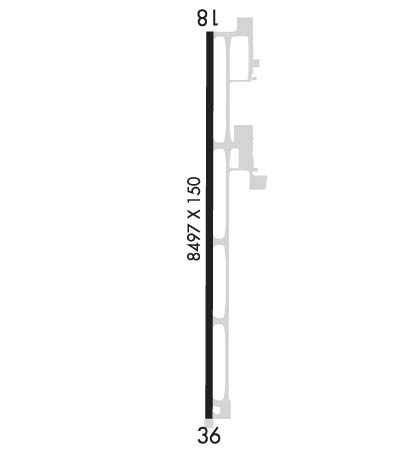
| Rwy | Rwy | |||||||
| 8498x150 | 8498' | 110.35 - 182° | 8498x150 | 8498' | ||||
| Runway ID | Single Wheel | Double Wheel | Double Tandem Wheel | Dual Double Wheel |
| 18/36 | N/A | N/A | 472,000 | 955,000 |
| These numbers are Advisory and are not limits. The Airport Manager should have more accurate Weight Limits | ||||
 Airport Diagram might not be current. | |
| Facility Name: | STENNIS INTL |
| City Name: | BAY ST LOUIS |
| County: | HANCOCK |
| State abbrev: | MS |
| State Name: | MISSISSIPPI |
| Ownership: | PUBLICLY OWNED |
| Use: | OPEN TO THE PUBLIC |
| Owner's Name: | HANCOCK CO PORT & HARBOR CMSN |
| Address: | 14054 FRED & AL KEY RD |
| KILN, MS 39556 | |
| Owner's Phone: | 228-467-7070 |
| Manager's Name: | JERRY ISLAND |
| Address: | 7250 STENNIS AIRPORT RD |
| KILN, MS 39556 | |
| Phone: | 228-467-7070 |
| FAA Region: | SOUTHERN |
| FAA Field Office: | JAN |

| Date | Sunrise | Sunset |
|---|---|---|
| 04/24/24 Wednesday | 6:20 | 19:32 |
| 04/25/24 Thursday | 6:19 | 19:32 |
| 04/26/24 Friday | 6:18 | 19:33 |
| 04/27/24 Saturday | 6:17 | 19:34 |
| 04/28/24 Sunday | 6:16 | 19:34 |
| 04/29/24 Monday | 6:16 | 19:35 |
| 04/30/24 Tuesday | 6:15 | 19:36 |
| 05/01/24 Wednesday | 6:14 | 19:36 |
| 05/02/24 Thursday | 6:13 | 19:37 |
| 05/03/24 Friday | 6:12 | 19:38 |
| 05/04/24 Saturday | 6:11 | 19:38 |
| 05/05/24 Sunday | 6:10 | 19:39 |
| 05/06/24 Monday | 6:10 | 19:40 |
| 05/07/24 Tuesday | 6:09 | 19:40 |
| Airport Attendance Schedule | MON-FRI 0700-1900, SAT-SUN 0800-2000 |
| Airport Status | OPERATIONAL (This Status can change at any time - please check NOTAMS) |
| Airport Lighting Schedule | ACTVT MALSR RWY 18; REIL RWY 36; PAPI RWY 18 & 36; HIRL RWY 18/36 - CTAF. |
| Airport Storage Available | Tie Downs, Hanger |
| Extra Services Available | Flight Instruction, Aircraft Rental, Aircraft Sales |
| Wind Indicator | YES - (lighted) |
| Control Tower | YES |
| CTAF Frequency | 127.150 |
| Unicom Frequency | 122.950 |
| Rotating Beacon Color | WG |
| Segmented Circle | YES |
| Landing Fee | NO |
| Airport Inspected | FEDERAL - performed by FAA AIRPORTS FIELD PERSONNEL |
| Inspection Date | 03/01/2023 |
| Type of Fuel Available | Grade 100LL, JET A; -10FOR FUEL & FBO SVCS AFT HRS CALL 228-463-2389. |
| Airframe Repair Service | MAJOR; FOR ALL RPRS CALL 228-463-2389. |
| Power Plant Repair Service | MAJOR |
| Latitude | N3022.1 |
| Longitude | W08927.3 (ESTIMATED) |
| Arpt Elevation | 22ft (SURVEYED) |
| Magnetic Variation | 02W |
| 8 miles NW | of BAY ST LOUIS |
| Traffic Pattern Altitude | |
| Sectional Chart | NEW ORLEANS |
| Operations (Reported) | Yearly | Avg. Daily |
|---|---|---|
| General Aviation Transient | 7886 | 22 |
| General Aviation Local | 6354 | 17 |
| Air Taxi | 769 | 2 |
| Commerical | 10 | 0 |
| Commuter | 0 | 0 |
| Military | 24515 | 67 |
| Aircraft based on Field | |
|---|---|
| General Aviation Singles | 28 |
| General Aviation Multi | 4 |
| Jet Aircraft | 1 |
| General Aviation Helicopters | 0 |
| Military Aircraft | 0 |
| Gliders | 0 |
| Ultralights | 0 |
| FSS on field | NO |
| FSS tie-in | GREENWOOD |
| FSS Phone | 1-800-WX-BRIEF |
| Who issues Notams | HSA |
| Notam D service at airport | YES |
| ARTCC Name | HOUSTON |
| Airport Certification | ACR ACFT OF AT LEAST 31 PAX SEATS OR MORE OR CARGO OPS RQRG INCRD ARFF INDEX, 48 HRS PPR 228-342-5415. |
| Aircraft Rescue & Firefighting Index | AIRPORT HAS A CERTIFICATE UNDER CFR PART 139 |
| Airport of Entry | No |
| Custom Landing Rights | YES |
| Joint Civil/Military | No |
| Military Landing rights | YES |
| NATIONAL PLAN OF INTEGRATED AIRPORT SYSTEMS (NPIAS) |
| GRANT AGREEMENTS UNDER FAAP/ADAP/AIP |
| CONVEYANCE UNDER SCETION 16, FEDERAL AIRPORT ACT OF 1946 OR SECTION 23, AIRPORT AND AIRWAY DEVELOPMENT ACT OF 1970 |
| ASSURANCES PURSUANT TO TITLE VI, CIVIL RIGHTS ACT OF 1964 |
| WHEN ATCT CLSD, FOR CD CTC HOUSTON ARTCC AT 281-230-5622. |
| AVOID OVERFLYING SCHOOLS .4 NM E OF RWY 18/36 WHEN POSS. |
| FBO ATNDD MON-FRI 0700-2000, SAT-SUN 0800-1800. |
| AFT HRS CALLOUT - 228-463-2389. |
| NMRS LOW FLYING FISH SPOTTER ACFT OPS NEAR SHORELINE BTN GULFPORT & BAY ST. LOUIS. |
| BIRDS ON & INVOF ARPT. |
Airport Communications & Frequencies:
| |||||||||||||||||||||||||||||||||
| Runway: 18 | Runway: 36 | ||
| Mag heading: | 182° | Mag heading: | 2° |
| Rwy Slope: | -.12% Down | Rwy Slope: | .12% Up |
| Approach: | ILS | Approach: | |
| Pattern: | Left Traffic | Pattern: | Left Traffic |
| Markings: | PRECISION INSTRUMENT | Markings: | NONPRECISION INSTRUMENT |
| Marking Condition: | POOR | Marking Condition: | POOR |
| Arresting Dev: | Arresting Dev: | ||
| Lat & Long: | N3022.8 W08927.3 | Lat. & Long.: | N3021.4 W08927.3 |
| Elev: | 22.5 ft. MSL | Elev: | 12.7 ft. MSL |
| TCH: | 56 ft. AGL | TCH: | 55 ft. AGL |
| Visual Glide Path: | 3.00 degrees | Visual Glide Path: | 3.00 degrees |
| Displaced Threshold: | No | Displaced Threshold: | No |
| Touchdown Zone: | YES | Touchdown Zone: | YES |
| Touchdown Elev.: | 22.8 feet | Touchdown Elev.: | 14.2 feet |
| Visual Glide Slope: | 4-Light PAPI on LEFT side of Runway | Visual Glide Slope: | 4-Light PAPI on LEFT side of Runway |
| RVR Equipment: | RVR Equipment: | ||
| RVV Equipment: | NO | RVV Equipment: | NO |
| Approach Lights: | MALSR - 1,400 foot medium intensity approach lighting system with runway alignment indicator lights | Approach Lights: | |
| REIL: | NO | REIL: | YES |
| Centerline Lights: | NO | Centerline Lights: | NO |
| Touchdown lights: | NO | Touchdown lights: | NO |
| Runway Category: | Precision Instrument Runway | Runway Category: | Runway with a Non-precision Approach having visibility minimums greater than 3/4 mile |
| Declared Distances: | TORA:8498' TODA:8498' ASDA:8498' LDA:8498' | Declared Distances: | TORA:8498' TODA:8498' ASDA:8498' LDA:8498' |
| Obstructions: | TREE | Obstructions: | TREES |
| Marked: | NOT Marked/Lighted | Marked: | NOT Marked/Lighted |
| Clearance slope: | 47:1 | Clearance slope: | 34:1 |
| Obstruction height: | 40 feet AGL | Obstruction height: | 55 feet AGL |
| Dist. from runway: | 2100 feet | Dist. from runway: | 2100 feet |
| Centerline offset: | 200 left of centerline | Centerline offset: | |
| Comments: | Comments: |