| |||||||||||||||||||||||||||||||||||||||||||||||||||||||||||||
| |||||||||||||||||||||||||||||||||||||||||||||||||||||||||||||
| |||||||||||||||||||||||||||||||||||||||||||||||||||||||||||||
| Rwy | Rwy | |||||||
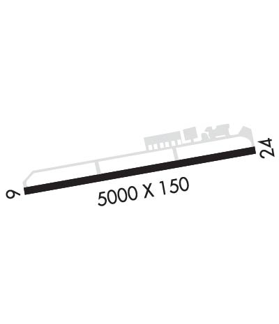
| 5000x150 | 5000' | 5000x150 | 5000' | 108.70 - 240° | ||||
| Runway ID | Single Wheel | Double Wheel | Double Tandem Wheel | Dual Double Wheel |
| 06/24 | 30,000 | 40,000 | 80,000 | N/A |
| These numbers are Advisory and are not limits. The Airport Manager should have more accurate Weight Limits | ||||
 Airport Diagram might not be current. | |
| Facility Name: | BOWERMAN |
| City Name: | HOQUIAM |
| County: | GRAYS HARBOR |
| State abbrev: | WA |
| State Name: | WASHINGTON |
| Ownership: | PUBLICLY OWNED |
| Use: | OPEN TO THE PUBLIC |
| Owner's Name: | PORT OF GRAYS HARBOR |
| Address: | BOX 660, 111 S WOODING STREET |
| ABERDEEN, WA 98520 | |
| Owner's Phone: | 360-533-9528 |
| Manager's Name: | SHANNON ANDERSON |
| Address: | BOX 660, 111 S WOODING STREET |
| ABERDEEN, WA 98520 | |
| Phone: | 360-533-9544; AMGR CELL 360-310-0201. |
| FAA Region: | NORTHWEST MOUNTAIN |
| FAA Field Office: | SEA |

| Date | Sunrise | Sunset |
|---|---|---|
| 04/22/24 Monday | 6:14 | 20:15 |
| 04/23/24 Tuesday | 6:12 | 20:17 |
| 04/24/24 Wednesday | 6:10 | 20:18 |
| 04/25/24 Thursday | 6:09 | 20:19 |
| 04/26/24 Friday | 6:07 | 20:21 |
| 04/27/24 Saturday | 6:05 | 20:22 |
| 04/28/24 Sunday | 6:04 | 20:23 |
| 04/29/24 Monday | 6:02 | 20:25 |
| 04/30/24 Tuesday | 6:00 | 20:26 |
| 05/01/24 Wednesday | 5:59 | 20:27 |
| 05/02/24 Thursday | 5:57 | 20:29 |
| 05/03/24 Friday | 5:56 | 20:30 |
| 05/04/24 Saturday | 5:54 | 20:31 |
| 05/05/24 Sunday | 5:53 | 20:33 |
| Airport Attendance Schedule | UNATTENDED |
| Airport Status | OPERATIONAL (This Status can change at any time - please check NOTAMS) |
| Airport Lighting Schedule | ACTVT HIRL RY 06/24, PAPI RWY 06/24, MALSR RY 24 & REIL RY 06 - CTAF. |
| Airport Storage Available | Tie Downs |
| Extra Services Available | Air Ambulance |
| Wind Indicator | YES - (lighted) |
| Control Tower | NO |
| CTAF Frequency | 122.700 |
| Unicom Frequency | 122.700 |
| Rotating Beacon Color | WG |
| Segmented Circle | YES |
| Landing Fee | NO |
| Airport Inspected | STATE - performed by STATE AERONAUTICAL PERSONNEL |
| Inspection Date | 06/13/2023 |
| Type of Fuel Available | Grade 100LL, JET A (freeze point -40C); -10100LL AND JET A AVBL 24 HRS A DAY WITH MAJOR CREDIT CARD. |
| Airframe Repair Service | NONE |
| Power Plant Repair Service | NONE |
| Latitude | N4658.3 |
| Longitude | W12356.2 (ESTIMATED) |
| Arpt Elevation | 17ft (SURVEYED) |
| Magnetic Variation | 19E |
| 2 miles W | of HOQUIAM |
| Traffic Pattern Altitude | |
| Sectional Chart | SEATTLE |
| Operations (Reported) | Yearly | Avg. Daily |
|---|---|---|
| General Aviation Transient | 1000 | 3 |
| General Aviation Local | 1000 | 3 |
| Air Taxi | 0 | 0 |
| Commerical | 0 | 0 |
| Commuter | 0 | 0 |
| Military | 0 | 0 |
| Aircraft based on Field | |
|---|---|
| General Aviation Singles | 12 |
| General Aviation Multi | 1 |
| Jet Aircraft | 1 |
| General Aviation Helicopters | 0 |
| Military Aircraft | 0 |
| Gliders | 0 |
| Ultralights | 0 |
| FSS on field | NO |
| FSS tie-in | SEATTLE |
| FSS Phone | 1-800-WX-BRIEF |
| Who issues Notams | HQM |
| Notam D service at airport | YES |
| ARTCC Name | SEATTLE |
| Airport Certification | |
| Aircraft Rescue & Firefighting Index | None |
| Airport of Entry | No |
| Custom Landing Rights | YES |
| Joint Civil/Military | No |
| Military Landing rights | YES |
| NATIONAL PLAN OF INTEGRATED AIRPORT SYSTEMS (NPIAS) |
| GRANT AGREEMENTS UNDER FAAP/ADAP/AIP |
| SURPLUS PROPERTY AGREEMENT UNDER REGULATION 16-WAA |
| ASSURANCES PURSUANT TO TITLE VI, CIVIL RIGHTS ACT OF 1964 |
| AGREEMENT UNDER DLAND OR DCLA HAS EXPIRED. |
| THIS AIRPORT HAS BEEN SURVEYED BY THE NATIONAL GEODETIC SURVEY. |
| SERVICE ROAD SOUTH OF RY IN PRIMARY SURFACE. |
| ULTRALIGHTS PROHIBITED WITHOUT WRITTEN PERMISSON FROM ARPT MGR. |
| 103 FT CRANE 0.2 NM SW OF AER RY 24. |
| FOR CD IF UNA TO CTC ON FSS FREQ, CTC SEATTLE ARTCC AT 253-351-3694. |
Airport Communications & Frequencies:
| |||||||||
| Runway: 06 | Runway: 24 | ||
| Mag heading: | 60° | Mag heading: | 240° |
| Rwy Slope: | -.05% Down | Rwy Slope: | .05% Up |
| Approach: | Approach: | ILS/DME | |
| Pattern: | Right Traffic | Pattern: | Left Traffic |
| Markings: | NONPRECISION INSTRUMENT | Markings: | PRECISION INSTRUMENT |
| Marking Condition: | FAIR | Marking Condition: | FAIR |
| Arresting Dev: | Arresting Dev: | ||
| Lat & Long: | N4658.2 W12356.8 | Lat. & Long.: | N4658.3 W12355.6 |
| Elev: | 17.5 ft. MSL | Elev: | 15.1 ft. MSL |
| TCH: | 40 ft. AGL | TCH: | 55 ft. AGL |
| Visual Glide Path: | 3.00 degrees | Visual Glide Path: | 3.50 degrees |
| Displaced Threshold: | No | Displaced Threshold: | No |
| Touchdown Zone: | YES | Touchdown Zone: | YES |
| Touchdown Elev.: | 17.8 feet | Touchdown Elev.: | 16.2 feet |
| Visual Glide Slope: | 4-Light PAPI on RIGHT side of Runway | Visual Glide Slope: | 4-Light PAPI on LEFT side of Runway |
| RVR Equipment: | RVR Equipment: | ||
| RVV Equipment: | NO | RVV Equipment: | NO |
| Approach Lights: | Approach Lights: | MALSR - 1,400 foot medium intensity approach lighting system with runway alignment indicator lights | |
| REIL: | YES | REIL: | NO |
| Centerline Lights: | NO | Centerline Lights: | NO |
| Touchdown lights: | NO | Touchdown lights: | NO |
| Runway Category: | Runway with a Non-precision Approach having visibility minimums greater than 3/4 mile | Runway Category: | Precision Instrument Runway |
| Declared Distances: | Declared Distances: |