Current Weather/Notams (Metars, TAFs, Notams, NWS Forecast, PIREPS, and nearby weather)
Customs Information Send updates to Support@FltPlan.com
Customs Not Available
Database effective 05/16/2024
Airport Diagram might not be current.
|
| Facility Name: | MARION COUNTY-RANKIN FITE |
| City Name: | HAMILTON |
| County: | MARION |
| State abbrev: | AL |
| State Name: | ALABAMA |
| | |
| Ownership: | PUBLICLY OWNED |
| Use: | OPEN TO THE PUBLIC |
| Owner's Name: | MARION COUNTY |
| Address: | BOX 460 |
| | HAMILTON, AL 35570 |
| Owner's Phone: | 205-921-3172 |
| | |
| Manager's Name: | JEFF DAVIS |
| Address: | 550 DR. PYLE DRIVE |
| | HAMILTON, AL 35570 |
| Phone: | 205-921-9585 |
| | |
| FAA Region: | SOUTHERN |
| FAA Field Office: | JAN |
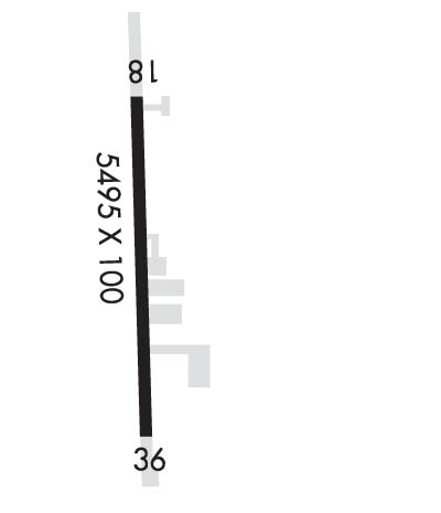
Runway Identifications
Runway Identification: 18/36Length: 5495 ft
Width: 100 ft
Surface: ASPHALT-GOOD CONDITION
Edge lights: Medium IntensityTreatment: NONE
| | Runway: 18 | | Runway: 36 |
| Mag heading: | 181° | Mag heading: | 1° |
| Rwy Slope: | -.60% Down | Rwy Slope: | .60% Up |
| Approach: | | Approach: | |
| Pattern: | Left Traffic | Pattern: | Left Traffic |
| Markings: | NONPRECISION INSTRUMENT | Markings: | NONPRECISION INSTRUMENT |
| Marking Condition: | FAIR | Marking Condition: | FAIR |
| Arresting Dev: | | Arresting Dev: | |
| Lat & Long: | N3407.5 W08759.9 | Lat. & Long.: | N3406.6 W08759.9 |
| Elev: | 435.9 ft. MSL | Elev: | 403.0 ft. MSL |
| TCH: | 34 ft. AGL | TCH: | 37 ft. AGL |
| Visual Glide Path: | 3.00 degrees | Visual Glide Path: | 3.00 degrees |
| Displaced Threshold: | No | Displaced Threshold: | No |
| Touchdown Zone: | YES | Touchdown Zone: | YES |
| Touchdown Elev.: | 435.9 feet | Touchdown Elev.: | 417.9 feet |
| Visual Glide Slope: | 2-Light PAPI on LEFT side of Runway | Visual Glide Slope: | 2-Light PAPI on LEFT side of Runway |
| RVR Equipment: | | RVR Equipment: | |
| RVV Equipment: | NO | RVV Equipment: | NO |
| Approach Lights: | | Approach Lights: | |
| REIL: | YES | REIL: | YES |
| Centerline Lights: | NO | Centerline Lights: | NO |
| Touchdown lights: | NO | Touchdown lights: | NO |
| Runway Category: | Runway with a Non-precision Approach having visibility minimums greater than 3/4 mile | Runway Category: | Runway with a Non-precision Approach having visibility minimums greater than 3/4 mile |
| Declared Distances: | | Declared Distances: | |
| Obstructions: | TREE | Obstructions: | TREE |
| Marked: | NOT Marked/Lighted | Marked: | NOT Marked/Lighted |
| Clearance slope: | 13:1 | Clearance slope: | 18:1 |
| Obstruction height: | 138 feet AGL | Obstruction height: | 21 feet AGL |
| Dist. from runway: | 2051 feet | Dist. from runway: | 588 feet |
| Centerline offset: | 360 right of centerline | Centerline offset: | 79 feet left of centerline |
| Comments: | | Comments: | |


