Current Weather/Notams (Metars, TAFs, Notams, NWS Forecast, PIREPS, and nearby weather)
Customs Information Send updates to Support@FltPlan.com
Customs Not Available
Database effective 05/16/2024
Airport Diagram might not be current.
|
| Facility Name: | STIGLER RGNL |
| City Name: | STIGLER |
| County: | HASKELL |
| State abbrev: | OK |
| State Name: | OKLAHOMA |
| | |
| Ownership: | PUBLICLY OWNED |
| Use: | OPEN TO THE PUBLIC |
| Owner's Name: | CITY OF STIGLER |
| Address: | 115 S. BROADWAY, 115 S. BDWY |
| | STIGLER, OK 74462 |
| Owner's Phone: | 918-967-2164 |
| | |
| Manager's Name: | BOBBY MOUSER; CITY MANAGER. |
| Address: | CITY HALL, 115 S. BDWY |
| | STIGLER, OK 74462 |
| Phone: | 918-967-2164 |
| | |
| FAA Region: | SOUTHWEST |
| FAA Field Office: | AOK |
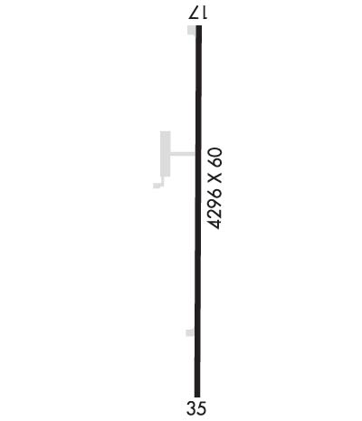
Runway Identifications
Runway Identification: 17/35Length: 4296 ft
Width: 60 ft
Surface: ASPHALT-GOOD CONDITION
Edge lights: Low IntensityTreatment: NONE
| | Runway: 17 | | Runway: 35 |
| Mag heading: | 177° | Mag heading: | 357° |
| Rwy Slope: | .00% Up | Rwy Slope: | .00% Down |
| Approach: | | Approach: | |
| Pattern: | Left Traffic | Pattern: | Left Traffic |
| Markings: | NONPRECISION INSTRUMENT | Markings: | NONPRECISION INSTRUMENT |
| Marking Condition: | GOOD | Marking Condition: | GOOD |
| Arresting Dev: | | Arresting Dev: | |
| Lat & Long: | N3517.6 W09505.6 | Lat. & Long.: | N3516.9 W09505.6 |
| Elev: | 599.6 ft. MSL | Elev: | 599.8 ft. MSL |
| TCH: | 40 ft. AGL | TCH: | 40 ft. AGL |
| Visual Glide Path: | 2.75 degrees | Visual Glide Path: | 3.00 degrees |
| Displaced Threshold: | 95 feet | Displaced Threshold: | No |
| Touchdown Zone: | YES | Touchdown Zone: | YES |
| Touchdown Elev.: | 598.6 feet | Touchdown Elev.: | 599.9 feet |
| Visual Glide Slope: | 2-Light PAPI on LEFT side of Runway | Visual Glide Slope: | 2-Light PAPI on LEFT side of Runway |
| RVR Equipment: | | RVR Equipment: | |
| RVV Equipment: | NO | RVV Equipment: | NO |
| Approach Lights: | | Approach Lights: | |
| REIL: | NO | REIL: | NO |
| Centerline Lights: | NO | Centerline Lights: | NO |
| Touchdown lights: | NO | Touchdown lights: | NO |
| Runway Category: | Runway with a Non-precision Approach | Runway Category: | Runway with a Non-precision Approach |
| Declared Distances: | TORA:4296' TODA:4296' ASDA:4296' LDA:4200' | Declared Distances: | TORA:4296' TODA:4296' ASDA:4296' LDA:4296' |
| Obstructions: | PLINE | Obstructions: | |
| Marked: | MARKED | Marked: | |
| Clearance slope: | 17:1 | Clearance slope: | 20:1 |
| Obstruction height: | 37 feet AGL | Obstruction height: | |
| Dist. from runway: | 860 feet | Dist. from runway: | |
| Centerline offset: | | Centerline offset: | |
| Comments: | | Comments: | |

