| |||||||||||||||||||||||||||||||||||||||||||||||||||||||||||||
| |||||||||||||||||||||||||||||||||||||||||||||||||||||||||||||
| |||||||||||||||||||||||||||||||||||||||||||||||||||||||||||||
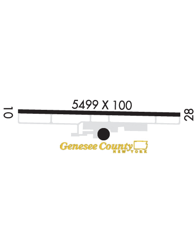
| Rwy | Rwy | |||||||
| 5499x100 | 5499' | 5499x100 | 5499' | 108.90 - 281° | ||||
| Runway ID | Single Wheel | Double Wheel | Double Tandem Wheel | Dual Double Wheel |
| 10/28 | 21,000 | 33,000 | N/A | N/A |
| These numbers are Advisory and are not limits. The Airport Manager should have more accurate Weight Limits | ||||
 Airport Diagram might not be current. | |
| Facility Name: | GENESEE COUNTY |
| City Name: | BATAVIA |
| County: | GENESEE |
| State abbrev: | NY |
| State Name: | NEW YORK |
| Ownership: | PUBLICLY OWNED |
| Use: | OPEN TO THE PUBLIC |
| Owner's Name: | MR. TIMOTHY HENS |
| Address: | GENESEE CO. SUPT. OF HWY., 153 CEDAR STREET |
| BATAVIA, NY 14020 | |
| Owner's Phone: | 585-344-8508 |
| Manager's Name: | JASON LONG |
| Address: | 4701 E. SAILE DRIVE |
| BATAVIA, NY 14020 | |
| Phone: | 585-344-8532; CALL ARPT AT 585-344-8532 DURING ATTENDED HOURS. |
| FAA Region: | EASTERN |
| FAA Field Office: | NYC |

| Date | Sunrise | Sunset |
|---|---|---|
| 04/25/24 Thursday | 6:14 | 20:08 |
| 04/26/24 Friday | 6:13 | 20:09 |
| 04/27/24 Saturday | 6:11 | 20:10 |
| 04/28/24 Sunday | 6:10 | 20:11 |
| 04/29/24 Monday | 6:08 | 20:12 |
| 04/30/24 Tuesday | 6:07 | 20:13 |
| 05/01/24 Wednesday | 6:05 | 20:15 |
| 05/02/24 Thursday | 6:04 | 20:16 |
| 05/03/24 Friday | 6:03 | 20:17 |
| 05/04/24 Saturday | 6:01 | 20:18 |
| 05/05/24 Sunday | 6:00 | 20:19 |
| 05/06/24 Monday | 5:59 | 20:20 |
| 05/07/24 Tuesday | 5:58 | 20:21 |
| 05/08/24 Wednesday | 5:56 | 20:22 |
| Airport Attendance Schedule | APR-OCT 7 Days A Week 0730-2000, NOV-MAR 7 Days A Week 0730-1830 |
| Airport Status | OPERATIONAL (This Status can change at any time - please check NOTAMS) |
| Airport Lighting Schedule | ACTVT MALSR RWY 28; REIL RWY 10; PAPI RWY 10 & 28; HIRL RWY 10/28 - CTAF. |
| Airport Storage Available | Tie Downs, Hanger |
| Extra Services Available | Air Freight, Crop Dusting, Air Ambulance, Charter, Flight Instruction, Aircraft Rental |
| Wind Indicator | YES - (lighted) |
| Control Tower | NO |
| CTAF Frequency | 122.700 |
| Unicom Frequency | 122.700 |
| Rotating Beacon Color | WG |
| Segmented Circle | YES |
| Landing Fee | NO |
| Airport Inspected | STATE - performed by STATE AERONAUTICAL PERSONNEL |
| Inspection Date | 08/12/2021 |
| Type of Fuel Available | Grade 100LL, JET A-1 (icing inhibitor, freeze point -50C) |
| Airframe Repair Service | MAJOR |
| Power Plant Repair Service | MAJOR |
| Latitude | N4301.9 |
| Longitude | W07810.2 (ESTIMATED) |
| Arpt Elevation | 913ft (SURVEYED) |
| Magnetic Variation | 11W |
| 2 miles N | of BATAVIA |
| Traffic Pattern Altitude | |
| Sectional Chart | DETROIT |
| Operations (Reported) | Yearly | Avg. Daily |
|---|---|---|
| General Aviation Transient | 15600 | 43 |
| General Aviation Local | 22800 | 62 |
| Air Taxi | 800 | 2 |
| Commerical | 0 | 0 |
| Commuter | 0 | 0 |
| Military | 800 | 2 |
| Aircraft based on Field | |
|---|---|
| General Aviation Singles | 28 |
| General Aviation Multi | 3 |
| Jet Aircraft | 8 |
| General Aviation Helicopters | 2 |
| Military Aircraft | 0 |
| Gliders | 0 |
| Ultralights | 0 |
| FSS on field | NO |
| FSS tie-in | BUFFALO |
| FSS Phone | 1-800-WX-BRIEF |
| Who issues Notams | GVQ |
| Notam D service at airport | YES |
| ARTCC Name | CLEVELAND |
| Airport Certification | |
| Aircraft Rescue & Firefighting Index | None |
| Airport of Entry | No |
| Custom Landing Rights | No |
| Joint Civil/Military | No |
| Military Landing rights | YES |
| NATIONAL PLAN OF INTEGRATED AIRPORT SYSTEMS (NPIAS) |
| GRANT AGREEMENTS UNDER FAAP/ADAP/AIP |
| ASSURANCES PURSUANT TO TITLE VI, CIVIL RIGHTS ACT OF 1964 |
| THIS AIRPORT HAS BEEN SURVEYED BY THE NATIONAL GEODETIC SURVEY. |
| RWY 10: +5' BERM 220' LEFT, WITHIN SIDE PRIMARY SURFACE (1597'-1997' DOWN RWY) |
| FOR CD CTC CLEVELAND ARTCC AT 440-774-0490. |
Airport Communications & Frequencies:
| ||||||||||||||||
| Runway: 10 | Runway: 28 | ||
| Mag heading: | 102° | Mag heading: | 282° |
| Rwy Slope: | -.02% Down | Rwy Slope: | .02% Up |
| Approach: | Approach: | ILS | |
| Pattern: | Left Traffic | Pattern: | Left Traffic |
| Markings: | NONPRECISION INSTRUMENT | Markings: | PRECISION INSTRUMENT |
| Marking Condition: | GOOD | Marking Condition: | GOOD |
| Arresting Dev: | Arresting Dev: | ||
| Lat & Long: | N4301.9 W07810.8 | Lat. & Long.: | N4301.9 W07809.6 |
| Elev: | 911.6 ft. MSL | Elev: | 910.6 ft. MSL |
| TCH: | 40 ft. AGL | TCH: | 62 ft. AGL |
| Visual Glide Path: | 3.00 degrees | Visual Glide Path: | 3.00 degrees |
| Displaced Threshold: | No | Displaced Threshold: | No |
| Touchdown Zone: | YES | Touchdown Zone: | YES |
| Touchdown Elev.: | 913.5 feet | Touchdown Elev.: | 910.5 feet |
| Visual Glide Slope: | 2-Light PAPI on LEFT side of Runway | Visual Glide Slope: | 2-Light PAPI on LEFT side of Runway |
| RVR Equipment: | RVR Equipment: | ||
| RVV Equipment: | NO | RVV Equipment: | NO |
| Approach Lights: | Approach Lights: | MALSR - 1,400 foot medium intensity approach lighting system with runway alignment indicator lights | |
| REIL: | YES | REIL: | NO |
| Centerline Lights: | NO | Centerline Lights: | NO |
| Touchdown lights: | NO | Touchdown lights: | NO |
| Runway Category: | D | Runway Category: | Precision Instrument Runway |
| Declared Distances: | Declared Distances: | ||
| Obstructions: | FENCE | Obstructions: | 110 FT TWR 1730 FT FM THR 1000 FT L OUTSIDE CLEAR ZONE. |
| Marked: | LIGHTED | Marked: | NOT Marked/Lighted |
| Clearance slope: | Clearance slope: | 50:1 | |
| Obstruction height: | 8 feet AGL | Obstruction height: | |
| Dist. from runway: | 200 feet | Dist. from runway: | |
| Centerline offset: | 460 right of centerline | Centerline offset: | |
| Comments: | +8 FT FENCE AT 460 FT FM CNTLN. | Comments: |