Click here for more info on on SMS!

KGUP

GALLUP MUNI
GALLUP
NM
Time Zone: Mountain
Lat: N 3530.7
Long: W 10847.4
Elev: 6472
Var: -12
Longest Runway: 7315
AWOS: 118.37
CTAF: 122.95

FBO & Flight Services info for KGUP

FBOs: Update your Fuel Prices
Providing high quality fuel and services to you and your customers, from Phillips 66 Aviation.
Ph: 505-879-0639
-
-
WebsiteE-Mail
Service
Jet
100LL
SAF
MoGas
Fuel Avail: PRIST PREMIXED
Full7.127.37    Last Update: 04/06/2024 11:54

Self6.686.69    
Misc. Info: Address: 2111 W HISTORIC RT 66   GALLUP, NM 87301

ASOSPh: 505-726-8232
-
Freq: 118.37  
If you are an FBO, call 1-203-262-1700 to update your info or email: FltPlan.Advertising@garmin.com
Advertise your FBO on FltPlan.com

Runway & Approach Info for KGUP
Rwy
Length
Land Dist**
Approach*
  Rwy
Length
Land Dist**
Approach*
06
7315x100  7315'          
LOC/DME
 111.70 - 061°  
  
24
  7315x100  7315'          
 
 * only ILS, LOC, LDA, and SDF approaches to a specific runway are shown
** For any Declared Landing Distance Available, please see A/FD or Approach plates
Runway Weight Capability (lbs.) Help
Runway IDSingle WheelDouble WheelDouble Tandem WheelDual Double Wheel
06/2445,00055,000N/AN/A
These numbers are Advisory and are not limits.   The Airport Manager should have more accurate Weight Limits
Approach Charts
Approaches    
Current Weather/Notams
Customs Information Send updates to Support@FltPlan.com
Customs Not Available
Database effective 05/16/2024
Airport Diagram of KGUP
Airport Diagram might not be current.

Facility Name: GALLUP MUNI
City Name: GALLUP
County: MC KINLEY
State abbrev: NM
State Name: NEW MEXICO
   
Ownership: PUBLICLY OWNED
Use: OPEN TO THE PUBLIC
Owner's Name: CITY OF GALLUP
Address: BOX 1270
 GALLUP, NM 87305
Owner's Phone: 505-863-1254
  
Manager's Name: ROBERT HAMBLEN
Address: 110 WEST AZTEC
 GALLUP, NM 87301
Phone: 505-863-1290; EMERGENCY PHONE: AARON LESLIE 505-870-2788.
   
FAA Region: SOUTHWEST
FAA Field Office: LNM


Sunrise / Sunset times for GALLUP MUNI

DateSunriseSunset
04/24/24 Wednesday6:3019:56
04/25/24 Thursday6:2919:57
04/26/24 Friday6:2819:58
04/27/24 Saturday6:2719:59
04/28/24 Sunday6:2620:00
04/29/24 Monday6:2520:01
04/30/24 Tuesday6:2420:01
05/01/24 Wednesday6:2320:02
05/02/24 Thursday6:2220:03
05/03/24 Friday6:2020:04
05/04/24 Saturday6:1920:05
05/05/24 Sunday6:1820:06
05/06/24 Monday6:1820:06
05/07/24 Tuesday6:1720:07

Airport Facilities

Airport Attendance ScheduleOCT-MAR MON-FRI 0730-1730, APR-SEPT MON-FRI 0700-1800, SAT-SUN 0800-1700
Airport Status OPERATIONAL (This Status can change at any time - please check NOTAMS)
Airport Lighting Schedule
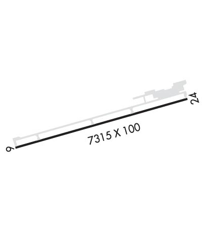
ACTVT MIRL RY 06/24 & REIL RY 24 - CTAF.
Airport Storage AvailableTie Downs, Hanger
Extra Services AvailableAir Freight, Air Ambulance, Cargo Handling, Charter
Wind IndicatorYES - (lighted)
Control TowerNO
CTAF Frequency122.950
Unicom Frequency122.950
Rotating Beacon ColorWG
Segmented CircleYES
Landing FeeNO

Airport Inspection Data

Airport InspectedSTATE - performed by PRIVATE CONTRACT PERSONNEL
Inspection Date04/07/2021

Airport Services

Type of Fuel AvailableGrade 100LL, JET A-1 (icing inhibitor, freeze point -50C); -A124 HR. SELF SERVE 100 LL & JET A1+ WITH MAJOR CREDIT CARD. AFTER HOUR SERVICE AVAILABLE WITH CALL OUT FEE.
Airframe Repair ServiceNONE
Power Plant Repair ServiceNONE

Geographic Data

LatitudeN3530.7
LongitudeW10847.4 (ESTIMATED)
Arpt Elevation6472ft (SURVEYED)
Magnetic Variation12E
3 miles SWof GALLUP
Traffic Pattern Altitude
Sectional ChartALBUQUERQUE

Aircraft Data

Operations (Reported)YearlyAvg. Daily
General Aviation Transient 20005
General Aviation Local 2001
Air Taxi 30008
Commerical 00
Commuter 00
Military 10003
Aircraft based on Field
General Aviation Singles 14
General Aviation Multi 2
Jet Aircraft 0
General Aviation Helicopters 2
Military Aircraft 0
Gliders 0
Ultralights 0

FAA Services

FSS on field NO
FSS tie-in ALBUQUERQUE
FSS Phone 1-800-WX-BRIEF
Who issues Notams GUP
Notam D service at airport YES
ARTCC Name ALBUQUERQUE

Federal Status

Airport Certification
Aircraft Rescue & Firefighting IndexNone
Airport of EntryNo
Custom Landing RightsNo
Joint Civil/MilitaryNo
Military Landing rightsYES

Federal Agreements

NATIONAL PLAN OF INTEGRATED AIRPORT SYSTEMS (NPIAS)
GRANT AGREEMENTS UNDER FAAP/ADAP/AIP
ASSURANCES PURSUANT TO TITLE VI, CIVIL RIGHTS ACT OF 1964

Remarks

PREFERRED CALM WIND RUNWAY 24.
FOR CD IF UNA TO CTC ON FSS FREQ, CTC ALBUQUERQUE ARTCC AT 505-856-4561.
Airport Communications & Frequencies:
CTAF Frequency:
122.950
Unicom Frequency:
122.950
Remarks
  • COMMUNICATIONS PRVDD BY ALBUQUERQUE RADIO ON FREQ 122.1R (GALLUP RCO).
  • APCH/DEP SVC PRVDD BY ALBUQUERQUE ARTCC (ZAB) ON 124.325/288.25 (WEST MESA RCAG).
  • Runway Identifications
    Runway Identification: 06/24
    Length: 7315 ft
    Width: 100 ft
    Surface: ASPHALT-GOOD CONDITION
    Edge lights: Medium Intensity

    Treatment: NONE
    Weight: PCN 39 /F/C/X/T

     Runway: 06   Runway: 24
    Mag heading: 62°Mag heading: 242°
    Rwy Slope: .10% UpRwy Slope: -.10% Down
    Approach: LOC/DMEApproach:
    Pattern: Left TrafficPattern: Left Traffic
    Markings: NONPRECISION INSTRUMENTMarkings: NONPRECISION INSTRUMENT
    Marking Condition: GOODMarking Condition: GOOD
    Arresting Dev: Arresting Dev:
    Lat & Long: N3530.5  W10848.1Lat. & Long.: N3530.8  W10846.7
    Elev: 6464.4 ft. MSLElev: 6472.0 ft. MSL
    TCH: 46 ft. AGLTCH: 48 ft. AGL
    Visual Glide Path: 3.00 degreesVisual Glide Path: 3.00 degrees
    Displaced Threshold: NoDisplaced Threshold: No
    Touchdown Zone: YESTouchdown Zone: YES
    Touchdown Elev.: 6465.1 feetTouchdown Elev.: 6472.3 feet
    Visual Glide Slope: 2-Light PAPI on LEFT side of RunwayVisual Glide Slope: 2-Light PAPI on LEFT side of Runway
    RVR Equipment: RVR Equipment:
    RVV Equipment: NORVV Equipment: NO
    Approach Lights: Approach Lights:
    REIL: NOREIL: YES
    Centerline Lights: NOCenterline Lights: NO
    Touchdown lights: NOTouchdown lights: NO
    Runway Category: Runway with a Non-precision Approach having visibility minimums greater than 3/4 mileRunway Category: Runway with a Non-precision Approach having visibility minimums greater than 3/4 mile
    Declared Distances: Declared Distances:
    Obstructions: TREEObstructions: TREE
    Marked: NOT Marked/LightedMarked: NOT Marked/Lighted
    Clearance slope: 33:1Clearance slope: 33:1
    Obstruction height: 34 feet AGLObstruction height: 35 feet AGL
    Dist. from runway: 1325 feetDist. from runway: 1375 feet
    Centerline offset: 50 left of centerlineCenterline offset: 200 feet left of centerline
    Comments: Comments:
    C:23/P: