Click here for more info on on SMS!

KGPC

PUTNAM COUNTY
GREENCASTLE
IN
Time Zone: Eastern
Lat: N 3938.0
Long: W 08648.8
Elev: 842
Var: +03
Longest Runway: 5002
AWOS: 118.12
CTAF: 122.8

FBO & Flight Services info for KGPC

FBOs: Update your Fuel Prices

PDM AVIATION LLCPh: 765-721-1289 Fax: 765-655-2390 Freq: 122.8
Service
Jet
100LL
SAF
MoGas
Fuel Avail: PRIST PREMIXED
Full5.505.75    Caution: Fuel prices have not been updated in 35 days.
Last Update: 03/22/2024 10:48

Self        
 Address: 100 BALLARD LANE   GREENCASTLE, IN 46135
AWOSPh: 765-653-1789
-
Freq: 118.12  
If you are an FBO, call 1-203-262-1700 to update your info or email: FltPlan.Advertising@garmin.com
Advertise your FBO on FltPlan.com

Runway & Approach Info for KGPC
Rwy
Length
Land Dist**
Approach*
  Rwy
Length
Land Dist**
Approach*
18
5002x100  5002'          
 
  
36
  5002x100  5002'          
 
 * only ILS, LOC, LDA, and SDF approaches to a specific runway are shown
** For any Declared Landing Distance Available, please see A/FD or Approach plates
Runway Weight Capability (lbs.) Help
Runway IDSingle WheelDouble WheelDouble Tandem WheelDual Double Wheel
18/36N/AN/AN/AN/A
These numbers are Advisory and are not limits.   The Airport Manager should have more accurate Weight Limits
Approach Charts
Approaches    
Current Weather/Notams
Customs Information Send updates to Support@FltPlan.com
Customs Not Available
Database effective 05/16/2024
Airport Diagram of KGPC
Airport Diagram might not be current.

Facility Name: PUTNAM COUNTY RGNL
City Name: GREENCASTLE
County: PUTNAM
State abbrev: IN
State Name: INDIANA
   
Ownership: PUBLICLY OWNED
Use: OPEN TO THE PUBLIC
Owner's Name: PUTNAM CO AIRPORT AUTHORITY
Address: 1595 BALLARD LANE
 GREENCASTLE, IN 46135
Owner's Phone: 765-653-1763
  
Manager's Name: P. DOUGLAS MILLER
Address: 1595 BALLARD LANE, PO BOX 318
 GREENCASTLE, IN 46135
Phone: 765-721-1289
   
FAA Region: GREAT LAKES
FAA Field Office: CHI


Sunrise / Sunset times for PUTNAM COUNTY RGNL

DateSunriseSunset
04/25/24 Thursday6:5520:36
04/26/24 Friday6:5320:37
04/27/24 Saturday6:5220:38
04/28/24 Sunday6:5120:39
04/29/24 Monday6:5020:40
04/30/24 Tuesday6:4820:41
05/01/24 Wednesday6:4720:42
05/02/24 Thursday6:4620:43
05/03/24 Friday6:4520:44
05/04/24 Saturday6:4420:45
05/05/24 Sunday6:4220:46
05/06/24 Monday6:4120:47
05/07/24 Tuesday6:4020:48
05/08/24 Wednesday6:3920:49

Airport Facilities

Airport Attendance Schedule7 Days A Week 0800-1630
Airport Status OPERATIONAL (This Status can change at any time - please check NOTAMS)
Airport Lighting ScheduleACTVT MIRL RWY 18/36 - CTAF; PAPI RWY 18 & 36 OPR CONSLY.
Airport Storage AvailableTie Downs, Hanger
Extra Services AvailableFlight Instruction, Aircraft Rental
Wind IndicatorYES - (lighted)
Control TowerNO
CTAF Frequency122.800
Unicom Frequency122.800
Rotating Beacon ColorWG
Segmented CircleNO
Landing FeeNO

Airport Inspection Data

Airport InspectedSTATE - performed by STATE AERONAUTICAL PERSONNEL
Inspection Date04/14/2023

Airport Services

Type of Fuel AvailableGrade 100LL, JET A-1 (icing inhibitor, freeze point -50C)
Airframe Repair ServiceMAJOR
Power Plant Repair ServiceMAJOR

Geographic Data

LatitudeN3938.0
LongitudeW08648.8 (ESTIMATED)
Arpt Elevation842ft (SURVEYED)
Magnetic Variation03W
3 miles SEof GREENCASTLE
Traffic Pattern Altitude
Sectional ChartST LOUIS

Aircraft Data

Operations (Reported)YearlyAvg. Daily
General Aviation Transient 19495
General Aviation Local 11833
Air Taxi 3491
Commerical 00
Commuter 00
Military 00
Aircraft based on Field
General Aviation Singles 20
General Aviation Multi 3
Jet Aircraft 0
General Aviation Helicopters 5
Military Aircraft 0
Gliders 0
Ultralights 0

FAA Services

FSS on field NO
FSS tie-in TERRE HAUTE
FSS Phone 1-800-WX-BRIEF
Who issues Notams HUF
Notam D service at airport YES
ARTCC Name INDIANAPOLIS

Federal Status

Airport Certification
Aircraft Rescue & Firefighting IndexNone
Airport of EntryNo
Custom Landing RightsNo
Joint Civil/MilitaryNo
Military Landing rightsYES

Federal Agreements

NATIONAL PLAN OF INTEGRATED AIRPORT SYSTEMS (NPIAS)
GRANT AGREEMENTS UNDER FAAP/ADAP/AIP
ASSURANCES PURSUANT TO TITLE VI, CIVIL RIGHTS ACT OF 1964

Remarks

FOR CD CTC INDIANAPOLIS APCH AT 317-227-5743.
Airport Communications & Frequencies:
CTAF Frequency:
122.800
Unicom Frequency:
122.800
INDIANAPOLIS Primary Approach Frequencies:  
119.05
317.8
INDIANAPOLIS Primary Departure Frequencies:  
119.05
317.8
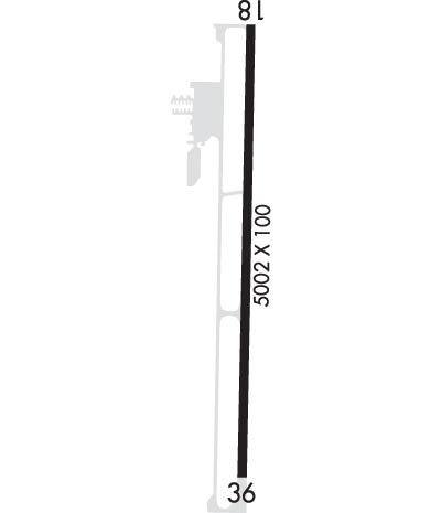
Runway Identifications
Runway Identification: 18/36
Length: 5002 ft
Width: 100 ft
Surface: ASPHALT
Edge lights: Medium Intensity

Treatment: GROOVED

 Runway: 18   Runway: 36
Mag heading: 184°Mag heading:
Rwy Slope: -.56% DownRwy Slope: .56% Up
Approach: Approach:
Pattern: Left TrafficPattern: Left Traffic
Markings: NONPRECISION INSTRUMENTMarkings: NONPRECISION INSTRUMENT
Marking Condition: GOODMarking Condition: GOOD
Arresting Dev: Arresting Dev:
Lat & Long: N3938.4  W08648.8Lat. & Long.: N3937.6  W08648.8
Elev: 842.0 ft. MSLElev: 814.2 ft. MSL
TCH: 29 ft. AGLTCH: 29 ft. AGL
Visual Glide Path: 3.00 degreesVisual Glide Path: 3.00 degrees
Displaced Threshold: NoDisplaced Threshold: No
Touchdown Zone: YESTouchdown Zone: YES
Touchdown Elev.: 842.0 feetTouchdown Elev.: 828.7 feet
Visual Glide Slope: 2-Light PAPI on LEFT side of RunwayVisual Glide Slope: 2-Light PAPI on LEFT side of Runway
RVR Equipment: RVR Equipment:
RVV Equipment: NORVV Equipment: NO
Approach Lights: Approach Lights:
REIL: YESREIL: NO
Centerline Lights: NOCenterline Lights: NO
Touchdown lights: NOTouchdown lights: NO
Runway Category: Runway with a Non-precision ApproachRunway Category: Runway with a Non-precision Approach
Declared Distances: Declared Distances:
Obstructions: CROPSObstructions: ROAD
Marked: NOT Marked/LightedMarked: NOT Marked/Lighted
Clearance slope: 22:1; APCH RATIO 42:1 TO THR.Clearance slope: 31:1; APCH RATIO 46:1 TO THR.
Obstruction height: 10 feet AGLObstruction height: 13 feet AGL
Dist. from runway: 420 feetDist. from runway: 610 feet
Centerline offset: Centerline offset: 280 feet left of centerline
Comments: Comments:
C:3/P: