| |||||||||||||||||||||||||||||||||||||||||||||||||||||||||||||
| |||||||||||||||||||||||||||||||||||||||||||||||||||||||||||||
| |||||||||||||||||||||||||||||||||||||||||||||||||||||||||||||
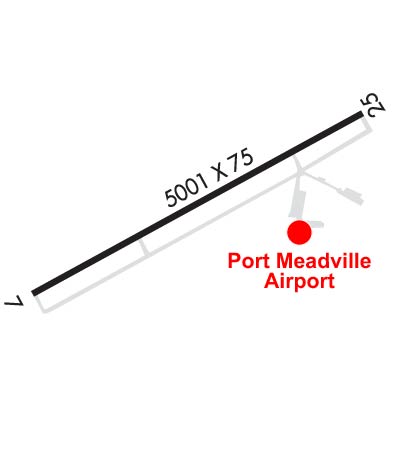
| Rwy | Rwy | |||||||
| 5001x75 | 5001' | 5001x75 | 5001' | 108.50 - 249° | ||||
| Runway ID | Single Wheel | Double Wheel | Double Tandem Wheel | Dual Double Wheel |
| 07/25 | 12,000 | 60,000 | N/A | N/A |
| These numbers are Advisory and are not limits. The Airport Manager should have more accurate Weight Limits | ||||
 Airport Diagram might not be current. | |
| Facility Name: | PORT MEADVILLE |
| City Name: | MEADVILLE |
| County: | CRAWFORD |
| State abbrev: | PA |
| State Name: | PENNSYLVANIA |
| Ownership: | PUBLICLY OWNED |
| Use: | OPEN TO THE PUBLIC |
| Owner's Name: | CCRAA; CRAWFORD COUNTY REGIONAL AIRPORT AUTHORITY |
| Address: | 16306 CORPORATE DR. |
| MEADVILLE, PA 16335 | |
| Owner's Phone: | 814-333-2677 |
| Manager's Name: | MICHAEL GOSS |
| Address: | 16306 CORPORATE DR. |
| MEADVILLE, PA 16335 | |
| Phone: | 814-720-2261; (814) 720-2261. |
| FAA Region: | EASTERN |
| FAA Field Office: | HAR |
| Date | Sunrise | Sunset |
|---|---|---|
| 04/23/24 Tuesday | 6:28 | 20:11 |
| 04/24/24 Wednesday | 6:26 | 20:12 |
| 04/25/24 Thursday | 6:25 | 20:13 |
| 04/26/24 Friday | 6:23 | 20:14 |
| 04/27/24 Saturday | 6:22 | 20:15 |
| 04/28/24 Sunday | 6:21 | 20:16 |
| 04/29/24 Monday | 6:19 | 20:18 |
| 04/30/24 Tuesday | 6:18 | 20:19 |
| 05/01/24 Wednesday | 6:17 | 20:20 |
| 05/02/24 Thursday | 6:15 | 20:21 |
| 05/03/24 Friday | 6:14 | 20:22 |
| 05/04/24 Saturday | 6:13 | 20:23 |
| 05/05/24 Sunday | 6:12 | 20:24 |
| 05/06/24 Monday | 6:10 | 20:25 |
| Airport Attendance Schedule | 7 Days A Week 0800-1700 |
| Airport Status | OPERATIONAL (This Status can change at any time - please check NOTAMS) |
| Airport Lighting Schedule | ACTVT MALS RWY 25; PAPI RWY 25; VASI RWY 07; MIRL RWY 07/25 - CTAF. |
| Airport Storage Available | Tie Downs, Hanger |
| Extra Services Available | Air Ambulance, Charter, Flight Instruction |
| Wind Indicator | YES - (lighted) |
| Control Tower | NO |
| CTAF Frequency | 123.000 |
| Unicom Frequency | 123.000 |
| Rotating Beacon Color | WG |
| Segmented Circle | NO |
| Landing Fee | YES; LANDING FEES VARY, CALL AIRPORT AT 814-333-2677 FOR FEE AMOUNTS. |
| Airport Inspected | STATE - performed by STATE AERONAUTICAL PERSONNEL |
| Inspection Date | 08/16/2023 |
| Type of Fuel Available | Grade 100LL, JET A (freeze point -40C); -A JET A ANTI-ICE AVAILABLE UPON REQUEST. |
| Airframe Repair Service | MAJOR |
| Power Plant Repair Service | MAJOR |
| Latitude | N4137.6 |
| Longitude | W08012.9 (ESTIMATED) |
| Arpt Elevation | 1399ft (SURVEYED) |
| Magnetic Variation | 08W |
| 3 miles W | of MEADVILLE |
| Traffic Pattern Altitude | |
| Sectional Chart | DETROIT |
| Operations (Reported) | Yearly | Avg. Daily |
|---|---|---|
| General Aviation Transient | 4056 | 11 |
| General Aviation Local | 8912 | 24 |
| Air Taxi | 296 | 1 |
| Commerical | 0 | 0 |
| Commuter | 0 | 0 |
| Military | 105 | 0 |
| Aircraft based on Field | |
|---|---|
| General Aviation Singles | 21 |
| General Aviation Multi | 2 |
| Jet Aircraft | 1 |
| General Aviation Helicopters | 1 |
| Military Aircraft | 0 |
| Gliders | 0 |
| Ultralights | 0 |
| FSS on field | NO |
| FSS tie-in | ALTOONA |
| FSS Phone | 1-800-WX-BRIEF |
| Who issues Notams | GKJ |
| Notam D service at airport | YES |
| ARTCC Name | CLEVELAND |
| Airport Certification | |
| Aircraft Rescue & Firefighting Index | None |
| Airport of Entry | No |
| Custom Landing Rights | No |
| Joint Civil/Military | No |
| Military Landing rights | YES |
| NATIONAL PLAN OF INTEGRATED AIRPORT SYSTEMS (NPIAS) |
| GRANT AGREEMENTS UNDER FAAP/ADAP/AIP |
| ASSURANCES PURSUANT TO TITLE VI, CIVIL RIGHTS ACT OF 1964 |
| BIRDS, DEER, & GND HOGS ON & INVOF ARPT. |
| TRML BLDG CLSD MAJOR HOLIDAYS & WKENDS. CALL AHD TO COORD SER. |
| FOR CD CTC YOUNGSTOWN APCH AT 330-856-4806, WHEN APCH CLSD CTC CLEVELAND ARTCC AT 440-774-0232. |
| DURING WINTER MONTHS RWY & AFLD PAVEMENTS MAY NOT BE MNTND, CALL FOR FLD COND. |
Airport Communications & Frequencies:
| |||||||||||||||||||
| Runway: 07 | Runway: 25 | ||
| Mag heading: | 69° | Mag heading: | 249° |
| Rwy Slope: | .08% Up | Rwy Slope: | -.08% Down |
| Approach: | Approach: | LOCALIZER | |
| Pattern: | Left Traffic | Pattern: | Left Traffic |
| Markings: | NONPRECISION INSTRUMENT | Markings: | NONPRECISION INSTRUMENT |
| Marking Condition: | GOOD | Marking Condition: | GOOD |
| Arresting Dev: | Arresting Dev: | ||
| Lat & Long: | N4137.4 W08013.4 | Lat. & Long.: | N4137.8 W08012.4 |
| Elev: | 1392.4 ft. MSL | Elev: | 1396.6 ft. MSL |
| TCH: | 58 ft. AGL | TCH: | 41 ft. AGL |
| Visual Glide Path: | 3.00 degrees | Visual Glide Path: | 3.00 degrees |
| Displaced Threshold: | No | Displaced Threshold: | No |
| Touchdown Zone: | YES | Touchdown Zone: | YES |
| Touchdown Elev.: | 1399.4 feet | Touchdown Elev.: | 1399.4 feet |
| Visual Glide Slope: | 4-BOX VASI ON LEFT SIDE OF RUNWAY | Visual Glide Slope: | 4-Light PAPI on LEFT side of Runway |
| RVR Equipment: | RVR Equipment: | ||
| RVV Equipment: | NO | RVV Equipment: | NO |
| Approach Lights: | Approach Lights: | MALS - 1,400 foot medium intensity approach lighting system | |
| REIL: | NO | REIL: | NO |
| Centerline Lights: | NO | Centerline Lights: | NO |
| Touchdown lights: | NO | Touchdown lights: | NO |
| Runway Category: | Runway with a Non-precision Approach having visibility minimums greater than 3/4 mile | Runway Category: | Runway with a Non-precision Approach having visibility minimums greater than 3/4 mile |
| Declared Distances: | Declared Distances: | ||
| Obstructions: | TREES | Obstructions: | |
| Marked: | NOT Marked/Lighted | Marked: | |
| Clearance slope: | 11:1 | Clearance slope: | 34:1 |
| Obstruction height: | 23 feet AGL | Obstruction height: | |
| Dist. from runway: | 473 feet | Dist. from runway: | |
| Centerline offset: | 272 left of centerline | Centerline offset: | |
| Comments: | Comments: |