
| ||||||||||||||||||||||||||||||||||||||||||||
| ||||||||||||||||||||||||||||||||||||||||||||
| Rwy | Rwy | |||||||
| 2579x50 | 2409' | 2579x50 | 2504' | |||||
| Runway ID | Single Wheel | Double Wheel | Double Tandem Wheel | Dual Double Wheel |
| 11/29 | 8,000 | N/A | N/A | N/A |
| These numbers are Advisory and are not limits. The Airport Manager should have more accurate Weight Limits | ||||
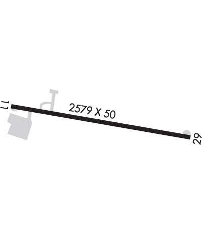 Airport Diagram might not be current. | |
| Facility Name: | WALTER J KOLADZA |
| City Name: | GREAT BARRINGTON |
| County: | BERKSHIRE |
| State abbrev: | MA |
| State Name: | MASSACHUSETTS |
| Ownership: | PRIVATELY OWNED |
| Use: | OPEN TO THE PUBLIC |
| Owner's Name: | BERKSHIRE AVIATION ENTERP |
| Address: | BOX 179, 70 EGREMONT PLAIN RD. |
| GREAT BARRINGTON, MA 01230 | |
| Owner's Phone: | 413-528-1010 |
| Manager's Name: | JOSEPH SOLAN |
| Address: | BOX 179, 70 EGREMONT PLAIN RD. |
| GREAT BARRINGTON, MA 01230 | |
| Phone: | 413-528-1010 |
| FAA Region: | NEW ENGLAND |
| FAA Field Office: | NONE |
| Date | Sunrise | Sunset |
|---|---|---|
| 04/17/24 Wednesday | 6:09 | 19:38 |
| 04/18/24 Thursday | 6:07 | 19:39 |
| 04/19/24 Friday | 6:06 | 19:40 |
| 04/20/24 Saturday | 6:04 | 19:41 |
| 04/21/24 Sunday | 6:02 | 19:43 |
| 04/22/24 Monday | 6:01 | 19:44 |
| 04/23/24 Tuesday | 5:59 | 19:45 |
| 04/24/24 Wednesday | 5:58 | 19:46 |
| 04/25/24 Thursday | 5:57 | 19:47 |
| 04/26/24 Friday | 5:55 | 19:48 |
| 04/27/24 Saturday | 5:54 | 19:49 |
| 04/28/24 Sunday | 5:52 | 19:50 |
| 04/29/24 Monday | 5:51 | 19:51 |
| 04/30/24 Tuesday | 5:50 | 19:53 |
| Airport Attendance Schedule | 7 Days A Week 0800-1700 |
| Airport Status | OPERATIONAL (This Status can change at any time - please check NOTAMS) |
| Airport Lighting Schedule | ACTVT REIL RWY 11; LIRL RWY 11/29 - 121.6. |
| Airport Storage Available | Tie Downs, Hanger |
| Extra Services Available | Charter, Flight Instruction, Aircraft Rental |
| Wind Indicator | YES - (lighted) |
| Control Tower | NO |
| CTAF Frequency | 122.800 |
| Unicom Frequency | 122.800 |
| Rotating Beacon Color | WG |
| Segmented Circle | NO |
| Landing Fee | YES; AVCARD NOT ACPTD. |
| Airport Inspected | STATE - performed by STATE AERONAUTICAL PERSONNEL |
| Inspection Date | 10/12/2023 |
| Type of Fuel Available | Grade 100LLUL94 |
| Airframe Repair Service | MAJOR |
| Power Plant Repair Service | MAJOR |
| Latitude | N4211.1 |
| Longitude | W07324.2 (ESTIMATED) |
| Arpt Elevation | 739ft (SURVEYED) |
| Magnetic Variation | 14W |
| 2 miles W | of GREAT BARRINGTON |
| Traffic Pattern Altitude | |
| Sectional Chart | NEW YORK |
| Operations (Reported) | Yearly | Avg. Daily |
|---|---|---|
| General Aviation Transient | 2000 | 5 |
| General Aviation Local | 10000 | 27 |
| Air Taxi | 175 | 0 |
| Commerical | 0 | 0 |
| Commuter | 0 | 0 |
| Military | 100 | 0 |
| Aircraft based on Field | |
|---|---|
| General Aviation Singles | 38 |
| General Aviation Multi | 2 |
| Jet Aircraft | 0 |
| General Aviation Helicopters | 0 |
| Military Aircraft | 0 |
| Gliders | 0 |
| Ultralights | 0 |
| FSS on field | NO |
| FSS tie-in | BURLINGTON |
| FSS Phone | 1-800-WX-BRIEF |
| Who issues Notams | BTV |
| Notam D service at airport | YES |
| ARTCC Name | BOSTON |
| Airport Certification | |
| Aircraft Rescue & Firefighting Index | None |
| Airport of Entry | No |
| Custom Landing Rights | No |
| Joint Civil/Military | No |
| Military Landing rights | No |
| NATIONAL PLAN OF INTEGRATED AIRPORT SYSTEMS (NPIAS) |
| THIS AIRPORT HAS BEEN SURVEYED BY THE NATIONAL GEODETIC SURVEY. |
| TGLS NA. |
| PRACTICE VFR GPS RWY 11 NA WHEN RWY 29 IS IN USE FOR STUDENT TFC. |
| FOR CD CTC ALBANY APCH AT 518-862-2299. |
| WILDLIFE ON & INVOF ARPT. |
| COLD TEMPERATURE AIRPORT. ALTITUDE CORRECTION REQUIRED AT OR BELOW -20C. |
| COMPASS ROSE ADZY ONLY, NOT CRTFYD. |
Airport Communications & Frequencies:
| ||||||||||||||
| Runway: 11 | Runway: 29 | ||
| Mag heading: | 110° | Mag heading: | 290° |
| Rwy Slope: | -.22% Down | Rwy Slope: | .22% Up |
| Approach: | Approach: | ||
| Pattern: | Left Traffic | Pattern: | Left Traffic |
| Markings: | BASIC | Markings: | BASIC |
| Marking Condition: | GOOD | Marking Condition: | GOOD |
| Arresting Dev: | Arresting Dev: | ||
| Lat & Long: | N4211.1 W07324.5 | Lat. & Long.: | N4211.0 W07323.9 |
| Elev: | 739.4 ft. MSL | Elev: | 733.6 ft. MSL |
| TCH: | TCH: | ||
| Visual Glide Path: | Visual Glide Path: | ||
| Displaced Threshold: | 170 feet; LGTD THR RELCTD 170 FT; 2409 FT OF RWY USBL FOR NGT OPS. | Displaced Threshold: | 75 feet |
| Touchdown Zone: | YES | Touchdown Zone: | YES |
| Touchdown Elev.: | 739.4 feet | Touchdown Elev.: | 739.4 feet |
| Visual Glide Slope: | Visual Glide Slope: | ||
| RVR Equipment: | RVR Equipment: | ||
| RVV Equipment: | NO | RVV Equipment: | NO |
| Approach Lights: | Approach Lights: | ||
| REIL: | YES | REIL: | NO |
| Centerline Lights: | NO | Centerline Lights: | NO |
| Touchdown lights: | NO | Touchdown lights: | NO |
| Runway Category: | Runway with a Visual Approach | Runway Category: | Runway with a Visual Approach |
| Declared Distances: | Declared Distances: | ||
| Obstructions: | TREES | Obstructions: | TREES |
| Marked: | NOT Marked/Lighted | Marked: | NOT Marked/Lighted |
| Clearance slope: | 7:1 | Clearance slope: | 14:1; APCH RATIO 19:1 TO DTHR. |
| Obstruction height: | 30 feet AGL | Obstruction height: | 57 feet AGL |
| Dist. from runway: | 425 feet | Dist. from runway: | 1000 feet |
| Centerline offset: | 130 right of centerline | Centerline offset: | 210 feet right of centerline |
| Comments: | Comments: | +15 FT ROAD IN PRIM SFC AREA. |
