
| |||||||||||||||||||||||||||||||||||||||||||||||||||||||||||||||||||||
| |||||||||||||||||||||||||||||||||||||||||||||||||||||||||||||||||||||
| |||||||||||||||||||||||||||||||||||||||||||||||||||||||||||||||||||||
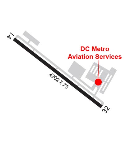
| Rwy | Rwy | |||||||
| 4202x75 | 4202' | 4202x75 | 4202' | |||||
| Runway ID | Single Wheel | Double Wheel | Double Tandem Wheel | Dual Double Wheel |
| 14/32 | N/A | N/A | N/A | N/A |
| These numbers are Advisory and are not limits. The Airport Manager should have more accurate Weight Limits | ||||
 Airport Diagram might not be current. | |
| Facility Name: | MONTGOMERY COUNTY AIRPARK |
| City Name: | GAITHERSBURG |
| County: | MONTGOMERY |
| State abbrev: | MD |
| State Name: | MARYLAND |
| Ownership: | PUBLICLY OWNED |
| Use: | OPEN TO THE PUBLIC |
| Owner's Name: | MONTGOMERY COUNTY REV AUTH |
| Address: | 101 MONROE ST 4TH FLOOR, SUITE 410 |
| ROCKVILLE, MD 20850 | |
| Owner's Phone: | 301-762-9080 |
| Manager's Name: | JUSTIN BOLLUM, C.M. |
| Address: | 7940 AIRPARK ROAD, SUITE 410 |
| GAITHERSBURG, MD 20879 | |
| Phone: | 301-978-7009; EXT. 1011 |
| FAA Region: | EASTERN |
| FAA Field Office: | DCA |
| Date | Sunrise | Sunset |
|---|---|---|
| 04/24/24 Wednesday | 6:18 | 19:56 |
| 04/25/24 Thursday | 6:17 | 19:57 |
| 04/26/24 Friday | 6:16 | 19:58 |
| 04/27/24 Saturday | 6:14 | 19:59 |
| 04/28/24 Sunday | 6:13 | 20:00 |
| 04/29/24 Monday | 6:12 | 20:01 |
| 04/30/24 Tuesday | 6:11 | 20:02 |
| 05/01/24 Wednesday | 6:09 | 20:02 |
| 05/02/24 Thursday | 6:08 | 20:03 |
| 05/03/24 Friday | 6:07 | 20:04 |
| 05/04/24 Saturday | 6:06 | 20:05 |
| 05/05/24 Sunday | 6:05 | 20:06 |
| 05/06/24 Monday | 6:04 | 20:07 |
| 05/07/24 Tuesday | 6:03 | 20:08 |
| Airport Attendance Schedule | JUNE-SEPTEMBER 7 Days A Week 0800-2000, OCTOBER-FEBRUARY 7 Days A Week 0800-1800, MARCH-MAY 7 Days A Week 0800-1900; UNATNDD CHRISTMAS DAY. FOR AFT HRS SVC CALL 301-963-8043. |
| Airport Status | OPERATIONAL (This Status can change at any time - please check NOTAMS) |
| Airport Lighting Schedule | ACTVT REIL RWY 14 & 32; MIRL RWY 14/32 - CTAF |
| Airport Storage Available | Tie Downs, Hanger |
| Extra Services Available | Air Freight, Avionics, Charter, Flight Instruction, Aircraft Rental, Aircraft Sales |
| Wind Indicator | NONE |
| Control Tower | NO |
| CTAF Frequency | 123.075 |
| Unicom Frequency | 123.075 |
| Rotating Beacon Color | WG |
| Segmented Circle | YES |
| Landing Fee | NO |
| Airport Inspected | STATE - performed by STATE AERONAUTICAL PERSONNEL |
| Inspection Date | 05/05/2023 |
| Type of Fuel Available | Grade 100LL, JET A (freeze point -40C); -10FUEL TRUCK AVBL 0800-2000; REQUEST ON 122.85. SELF-SERVE 100LL AVAILABLE WITH CREDIT CARD. |
| Airframe Repair Service | MINOR |
| Power Plant Repair Service | MAJOR |
| Latitude | N3910.1 |
| Longitude | W07710.0 (ESTIMATED) |
| Arpt Elevation | 538ft (SURVEYED) |
| Magnetic Variation | 09W |
| 3 miles NE | of GAITHERSBURG |
| Traffic Pattern Altitude | 1000 FT AGL (1539 FT MSL) TURBINE AND JET 1500 FT AGL (2039 FT MSL) HELICOPTERS 800 FT AGL (1339 FT MSL). |
| Sectional Chart | WASHINGTON |
| Operations (Reported) | Yearly | Avg. Daily |
|---|---|---|
| General Aviation Transient | 16526 | 45 |
| General Aviation Local | 49578 | 136 |
| Air Taxi | 1046 | 3 |
| Commerical | 0 | 0 |
| Commuter | 0 | 0 |
| Military | 45 | 0 |
| Aircraft based on Field | |
|---|---|
| General Aviation Singles | 129 |
| General Aviation Multi | 15 |
| Jet Aircraft | 8 |
| General Aviation Helicopters | 2 |
| Military Aircraft | 0 |
| Gliders | 0 |
| Ultralights | 0 |
| FSS on field | NO |
| FSS tie-in | LEESBURG |
| FSS Phone | 1-800-WX-BRIEF |
| Who issues Notams | DCA |
| Notam D service at airport | YES |
| ARTCC Name | WASHINGTON |
| Airport Certification | |
| Aircraft Rescue & Firefighting Index | None |
| Airport of Entry | No |
| Custom Landing Rights | No |
| Joint Civil/Military | No |
| Military Landing rights | YES |
| NATIONAL PLAN OF INTEGRATED AIRPORT SYSTEMS (NPIAS) |
| GRANT AGREEMENTS UNDER FAAP/ADAP/AIP |
| ADVANCE PLANNING AGREEMENT UNDER FAAP |
| ASSURANCES PURSUANT TO TITLE VI, CIVIL RIGHTS ACT OF 1964 |
| THIS AIRPORT HAS BEEN SURVEYED BY THE NATIONAL GEODETIC SURVEY. |
| NOISE ABATEMENT DEP RWY 32; TURN RIGHT TO AT LEAST 340 DEGS; JETS REFRAIN FROM RWY 32 TAKEOFF BTWN 2300-0700. |
| FOR CD CTC POTOMAC APCH AT 866-429-5882. |
| RWY 32 PAPI BAFFLED BYD 5 DEG L OF CRS DUE TO BLDG. |
| DEER & BIRDS ON & INVOF ARPT. |
| HELICOPTERS REFRAIN FM AIR TAXI OVER PAVED PARKING RAMPS. |
| RWY 14 HAS 30 FT DOWNSLOPE 75 FT L/R OF CNTRLN AT THR TO 150 FT BOTH SIDES. |
| ARPT NOT RECOMMENDED FOR ACFT WITH WINGSPAN IN EXCESS OF 79 FT & GROSS WT IN EXCESS OF 48000 POUNDS. |
| SOUTH RAMP NOT RECOMMENDED FOR AIRCRAFT WITH WINGSPAN GREATER THAN 79 FT OR WEIGHT GREATER THAN 40000 LBS. |
| BE ALERT SFRA PROCEDURES IN EFFECT. |
| PREFERRED CALM WIND RWY 14. |
Airport Communications & Frequencies:
| ||||||||||||||||
| Runway: 14 | Runway: 32 | ||
| Mag heading: | 136° | Mag heading: | 316° |
| Rwy Slope: | 1.08% Up | Rwy Slope: | -1.08% Down |
| Approach: | Approach: | ||
| Pattern: | Left Traffic | Pattern: | Right Traffic |
| Markings: | NONPRECISION INSTRUMENT | Markings: | NONPRECISION INSTRUMENT |
| Marking Condition: | GOOD | Marking Condition: | GOOD |
| Arresting Dev: | Arresting Dev: | ||
| Lat & Long: | N3910.3 W07710.3 | Lat. & Long.: | N3909.9 W07709.6 |
| Elev: | 493.3 ft. MSL | Elev: | 538.7 ft. MSL |
| TCH: | 53 ft. AGL | TCH: | 45 ft. AGL |
| Visual Glide Path: | 3.00 degrees | Visual Glide Path: | 3.25 degrees |
| Displaced Threshold: | No | Displaced Threshold: | No |
| Touchdown Zone: | YES | Touchdown Zone: | YES |
| Touchdown Elev.: | 520.4 feet | Touchdown Elev.: | 538.7 feet |
| Visual Glide Slope: | 4-BOX VASI ON LEFT SIDE OF RUNWAY | Visual Glide Slope: | 4-Light PAPI on LEFT side of Runway |
| RVR Equipment: | RVR Equipment: | ||
| RVV Equipment: | NO | RVV Equipment: | NO |
| Approach Lights: | Approach Lights: | ||
| REIL: | YES | REIL: | YES |
| Centerline Lights: | NO | Centerline Lights: | NO |
| Touchdown lights: | NO | Touchdown lights: | NO |
| Runway Category: | Runway with a Non-precision Approach having visibility minimums greater than 3/4 mile | Runway Category: | Runway with a Non-precision Approach having visibility minimums greater than 3/4 mile |
| Declared Distances: | Declared Distances: | ||
| Obstructions: | TREES | Obstructions: | POLE |
| Marked: | NOT Marked/Lighted | Marked: | LIGHTED |
| Clearance slope: | 3:1 | Clearance slope: | 28:1 |
| Obstruction height: | 12 feet AGL | Obstruction height: | 26 feet AGL |
| Dist. from runway: | 242 feet | Dist. from runway: | 949 feet |
| Centerline offset: | 118 right of centerline | Centerline offset: | 17 feet right of centerline |
| Comments: | RWY 14, 47 FT TREES, 169 FT R, 195 FT FM THR. | Comments: | RWY 32 HAS +15 FT RIDGE PARALLEL TO RWY 155 FT L; +6FT FENCE PARALLEL TO RWY 180 FT R. |


