
| ||||||||||||||||||||||||||||||||
| ||||||||||||||||||||||||||||||||
| ||||||||||||||||||||||||||||||||
| Rwy | Rwy | |||||||
| 5033x75 | 5033' | 5033x75 | 5033' | |||||
| Runway ID | Single Wheel | Double Wheel | Double Tandem Wheel | Dual Double Wheel |
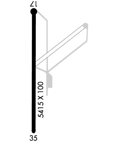
| 17/35 | 4,000 | N/A | N/A | N/A |
| These numbers are Advisory and are not limits. The Airport Manager should have more accurate Weight Limits | ||||
| FltPlan does not have IFR approach charts available for KGAG. |
 Airport Diagram might not be current. | |
| Facility Name: | GAGE |
| City Name: | GAGE |
| County: | ELLIS |
| State abbrev: | OK |
| State Name: | OKLAHOMA |
| Ownership: | PUBLICLY OWNED |
| Use: | OPEN TO THE PUBLIC |
| Owner's Name: | TOWN OF GAGE |
| Address: | BOX 328 |
| GAGE, OK 73843 | |
| Owner's Phone: | 580-923-7727 |
| Manager's Name: | ROBERT FORD |
| Address: | BOX 328 |
| GAGE, OK 73843 | |
| Phone: | (580) 923-7727 |
| FAA Region: | SOUTHWEST |
| FAA Field Office: | AOK |
| Date | Sunrise | Sunset |
|---|---|---|
| 04/17/24 Wednesday | 7:02 | 20:16 |
| 04/18/24 Thursday | 7:01 | 20:16 |
| 04/19/24 Friday | 6:59 | 20:17 |
| 04/20/24 Saturday | 6:58 | 20:18 |
| 04/21/24 Sunday | 6:57 | 20:19 |
| 04/22/24 Monday | 6:56 | 20:20 |
| 04/23/24 Tuesday | 6:54 | 20:21 |
| 04/24/24 Wednesday | 6:53 | 20:22 |
| 04/25/24 Thursday | 6:52 | 20:22 |
| 04/26/24 Friday | 6:51 | 20:23 |
| 04/27/24 Saturday | 6:50 | 20:24 |
| 04/28/24 Sunday | 6:49 | 20:25 |
| 04/29/24 Monday | 6:47 | 20:26 |
| 04/30/24 Tuesday | 6:46 | 20:27 |
| Airport Attendance Schedule | UNATTENDED |
| Airport Status | OPERATIONAL (This Status can change at any time - please check NOTAMS) |
| Airport Lighting Schedule | ACTVT LIRL RWY 17/35 - 123.0. |
| Airport Storage Available | NONE |
| Extra Services Available | NONE |
| Wind Indicator | YES - (unlit) |
| Control Tower | NO |
| CTAF Frequency | 122.900 |
| Unicom Frequency | |
| Rotating Beacon Color | WG |
| Segmented Circle | NO |
| Landing Fee | NO |
| Airport Inspected | STATE - performed by STATE AERONAUTICAL PERSONNEL |
| Inspection Date | 07/11/2023 |
| Type of Fuel Available | None |
| Airframe Repair Service | NONE |
| Power Plant Repair Service | NONE |
| Latitude | N3617.7 |
| Longitude | W09946.6 (ESTIMATED) |
| Arpt Elevation | 2223ft (ESTIMATED) |
| Magnetic Variation | 08E |
| 2 miles SW | of GAGE |
| Traffic Pattern Altitude | |
| Sectional Chart | WICHITA |
| Operations (Reported) | Yearly | Avg. Daily |
|---|---|---|
| General Aviation Transient | 200 | 1 |
| General Aviation Local | 500 | 1 |
| Air Taxi | 0 | 0 |
| Commerical | 0 | 0 |
| Commuter | 0 | 0 |
| Military | 0 | 0 |
| Aircraft based on Field | |
|---|---|
| General Aviation Singles | 6 |
| General Aviation Multi | 0 |
| Jet Aircraft | 0 |
| General Aviation Helicopters | 0 |
| Military Aircraft | 0 |
| Gliders | 0 |
| Ultralights | 0 |
| FSS on field | NO |
| FSS tie-in | MC ALESTER |
| FSS Phone | 1-800-WX-BRIEF |
| Who issues Notams | GAG |
| Notam D service at airport | YES |
| ARTCC Name | KANSAS CITY |
| Airport Certification | |
| Aircraft Rescue & Firefighting Index | None |
| Airport of Entry | No |
| Custom Landing Rights | No |
| Joint Civil/Military | No |
| Military Landing rights | No |
| NATIONAL PLAN OF INTEGRATED AIRPORT SYSTEMS (NPIAS) |
| GRANT AGREEMENT HAS EXPIRED; HOWEVER, AGREEMENT REMAINS IN EFFECT FOR THIS FACILITY AS LONG AS IT IS PUBLIC USE. |
| AGREEMENT UNDER DLAND OR DCLA HAS EXPIRED. |
| JET ACFT OVER 15000 LB NA. |
| TWYS CLSD; USE MIDWAY STUB & BACK TAXI. |
| ULTRALIGHT ACT ON & INVOF ARPT. |
| FOR CD IF UNA TO CTC ON FSS FREQ, CTC KANSAS CITY ARTCC AT 913-254-8508. |
| RWY 17/3 5 NSTD; RWY 17 HAS NO THR LGTS; RWY 35 HAS FOUR THR LGTS. |
| Runway: 17 | Runway: 35 | ||
| Mag heading: | 172° | Mag heading: | 352° |
| Rwy Slope: | .82% Up | Rwy Slope: | -.82% Down |
| Approach: | Approach: | ||
| Pattern: | Left Traffic | Pattern: | Left Traffic |
| Markings: | BASIC | Markings: | NONPRECISION INSTRUMENT |
| Marking Condition: | GOOD | Marking Condition: | GOOD |
| Arresting Dev: | Arresting Dev: | ||
| Lat & Long: | N3618.2 W09946.6 | Lat. & Long.: | N3617.3 W09946.6 |
| Elev: | 2182.1 ft. MSL | Elev: | 2223.2 ft. MSL |
| TCH: | TCH: | ||
| Visual Glide Path: | Visual Glide Path: | ||
| Displaced Threshold: | No | Displaced Threshold: | No |
| Touchdown Zone: | YES | Touchdown Zone: | YES |
| Touchdown Elev.: | 2162.0 feet | Touchdown Elev.: | 2223.2 feet |
| Visual Glide Slope: | Visual Glide Slope: | ||
| RVR Equipment: | RVR Equipment: | ||
| RVV Equipment: | NO | RVV Equipment: | NO |
| Approach Lights: | Approach Lights: | ||
| REIL: | NO | REIL: | NO |
| Centerline Lights: | NO | Centerline Lights: | NO |
| Touchdown lights: | NO | Touchdown lights: | NO |
| Runway Category: | Runway with a Visual Approach | Runway Category: | Runway with a Visual Approach |
| Declared Distances: | Declared Distances: |
