
| ||||||
| ||||||
|
| Rwy | Rwy | |||||||
| 2400x100 | 2400' | 2400x100 | 2400' | |||||
| Runway ID | Single Wheel | Double Wheel | Double Tandem Wheel | Dual Double Wheel |
| 13/31 | N/A | N/A | N/A | N/A |
| These numbers are Advisory and are not limits. The Airport Manager should have more accurate Weight Limits | ||||
| FltPlan does not have IFR approach charts available for KGA2. |
| Facility Name: | PEACH STATE AERODROME |
| City Name: | WILLIAMSON |
| County: | PIKE |
| State abbrev: | GA |
| State Name: | GEORGIA |
| Ownership: | PRIVATELY OWNED |
| Use: | OPEN TO THE PUBLIC |
| Owner's Name: | PEACH STATE AERODROME LLC |
| Address: | PO BOX 156 |
| WILLIAMSON, GA 30292 | |
| Owner's Phone: | 405-406-6313 |
| Manager's Name: | KEVEN SASSER |
| Address: | PO BOX 156 |
| WILLIAMSON, GA 30292 | |
| Phone: | 405-406-6313 |
| FAA Region: | SOUTHERN |
| FAA Field Office: | ATL |
| Date | Sunrise | Sunset |
|---|---|---|
| 04/17/24 Wednesday | 7:04 | 20:10 |
| 04/18/24 Thursday | 7:03 | 20:11 |
| 04/19/24 Friday | 7:02 | 20:12 |
| 04/20/24 Saturday | 7:01 | 20:12 |
| 04/21/24 Sunday | 7:00 | 20:13 |
| 04/22/24 Monday | 6:58 | 20:14 |
| 04/23/24 Tuesday | 6:57 | 20:15 |
| 04/24/24 Wednesday | 6:56 | 20:15 |
| 04/25/24 Thursday | 6:55 | 20:16 |
| 04/26/24 Friday | 6:54 | 20:17 |
| 04/27/24 Saturday | 6:53 | 20:18 |
| 04/28/24 Sunday | 6:52 | 20:18 |
| 04/29/24 Monday | 6:51 | 20:19 |
| 04/30/24 Tuesday | 6:50 | 20:20 |
| Airport Attendance Schedule | 7 Days A Week 0900-1800 |
| Airport Status | OPERATIONAL (This Status can change at any time - please check NOTAMS) |
| Airport Lighting Schedule | |
| Airport Storage Available | Tie Downs, Hanger |
| Extra Services Available | Flight Instruction, Aircraft Rental, Aircraft Sales |
| Wind Indicator | YES - (unlit) |
| Control Tower | NO |
| CTAF Frequency | 122.725 |
| Unicom Frequency | 122.725 |
| Rotating Beacon Color | |
| Segmented Circle | NO |
| Landing Fee | NO |
| Airport Inspected | STATE - performed by STATE AERONAUTICAL PERSONNEL |
| Inspection Date | 02/09/2024 |
| Type of Fuel Available | Grade 100LL |
| Airframe Repair Service | MAJOR |
| Power Plant Repair Service | MINOR |
| Latitude | N3311.0 |
| Longitude | W08422.3 (ESTIMATED) |
| Arpt Elevation | 926ft (ESTIMATED) |
| Magnetic Variation | 02W |
| 1 miles W | of WILLIAMSON |
| Traffic Pattern Altitude | |
| Sectional Chart | ATLANTA |
| Operations (Reported) | Yearly | Avg. Daily |
|---|---|---|
| General Aviation Transient | 750 | 2 |
| General Aviation Local | 2750 | 8 |
| Air Taxi | 0 | 0 |
| Commerical | 0 | 0 |
| Commuter | 0 | 0 |
| Military | 0 | 0 |
| Aircraft based on Field | |
|---|---|
| General Aviation Singles | 24 |
| General Aviation Multi | 1 |
| Jet Aircraft | 0 |
| General Aviation Helicopters | 0 |
| Military Aircraft | 0 |
| Gliders | 0 |
| Ultralights | 0 |
| FSS on field | NO |
| FSS tie-in | MACON |
| FSS Phone | 1-800-WX-BRIEF |
| Who issues Notams | MCN |
| Notam D service at airport | YES |
| ARTCC Name | ATLANTA |
| Airport Certification | |
| Aircraft Rescue & Firefighting Index | None |
| Airport of Entry | No |
| Custom Landing Rights | No |
| Joint Civil/Military | No |
| Military Landing rights | No |
| FOR CTC FBO AT 770-227-9989. |
| FOR CD CTC ATLANTA APCH AT 678-364-6131. |
| FOR DAYTIME USE ONLY. NO RWY LGTS OR BCN. |
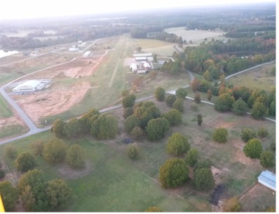
| RWY 13 - 56 FT TALL TREES 100 FT FROM CNTRLN ALONG LEFT OF RWY STARTING 375 FT DOWN RWY. |
| RWY 31 - HNGR LCTD AT RWY END 110 FT RIGHT OF CNTRLN. |
| Runway: 13 | Runway: 31 | ||
| Mag heading: | N/A | Mag heading: | N/A |
| Approach: | Approach: | ||
| Pattern: | Right Traffic | Pattern: | Left Traffic |
| Markings: | NONSTANDARD | Markings: | NONSTANDARD |
| Marking Condition: | THR MKD BY TIRES. | Marking Condition: | THR MKD BY TIRES. |
| Arresting Dev: | Arresting Dev: | ||
| Lat & Long: | Lat. & Long.: | ||
| Elev: | N/A | Elev: | N/A |
| TCH: | TCH: | ||
| Visual Glide Path: | Visual Glide Path: | ||
| Displaced Threshold: | No | Displaced Threshold: | No |
| Touchdown Zone: | NO | Touchdown Zone: | NO |
| Touchdown Elev.: | Touchdown Elev.: | ||
| Visual Glide Slope: | Visual Glide Slope: | ||
| RVR Equipment: | RVR Equipment: | ||
| RVV Equipment: | NO | RVV Equipment: | NO |
| Approach Lights: | Approach Lights: | ||
| REIL: | NO | REIL: | NO |
| Centerline Lights: | NO | Centerline Lights: | NO |
| Touchdown lights: | NO | Touchdown lights: | NO |
| Runway Category: | Runway with a Visual Approach | Runway Category: | Runway with a Visual Approach |
| Declared Distances: | Declared Distances: | ||
| Obstructions: | TREES | Obstructions: | BLDG |
| Marked: | NOT Marked/Lighted | Marked: | NOT Marked/Lighted |
| Clearance slope: | CTLNG OBSTN EXCEEDS A 45 DEG SLP. | Clearance slope: | |
| Obstruction height: | 55 feet AGL | Obstruction height: | 23 feet AGL |
| Dist. from runway: | 1 feet | Dist. from runway: | 1 feet |
| Centerline offset: | 100 left of centerline | Centerline offset: | 110 feet right of centerline |
| Comments: | Comments: |