Current Weather/Notams (Metars, TAFs, Notams, NWS Forecast, PIREPS, and nearby weather)
Customs Information Send updates to Support@FltPlan.com
Customs Not Available
Database effective 04/18/2024
Airport Diagram might not be current.
|
| Facility Name: | FOSSTON MUNI/ANDERSON FLD |
| City Name: | FOSSTON |
| County: | POLK |
| State abbrev: | MN |
| State Name: | MINNESOTA |
| | |
| Ownership: | PUBLICLY OWNED |
| Use: | OPEN TO THE PUBLIC |
| Owner's Name: | CITY OF FOSSTON |
| Address: | CITY HALL, 220 1ST ST E |
| | FOSSTON, MN 56542-1337 |
| Owner's Phone: | 218-435-1959 |
| | |
| Manager's Name: | CASSIE HEIDE |
| Address: | 220 1ST ST E |
| | FOSSTON, MN 56542-1337 |
| Phone: | 218-435-1959 |
| | |
| FAA Region: | GREAT LAKES |
| FAA Field Office: | DMA |
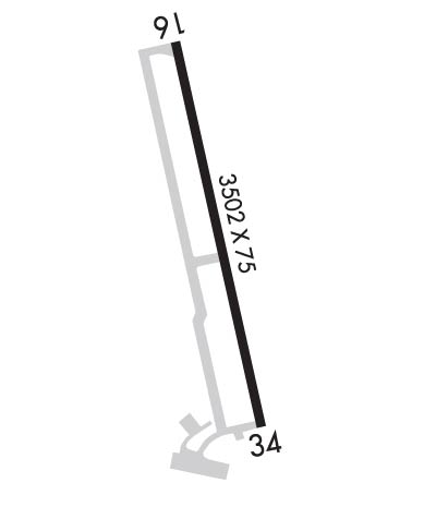
Runway Identifications
Runway Identification: 16/34Length: 3502 ft
Width: 75 ft
Surface: ASPHALT-GOOD CONDITION
Edge lights: Non-Standard Lighting SystemTreatment: NONE
| | Runway: 16 | | Runway: 34 |
| Mag heading: | 164° | Mag heading: | 344° |
| Rwy Slope: | .35% Up | Rwy Slope: | -.35% Down |
| Approach: | | Approach: | |
| Pattern: | Left Traffic | Pattern: | Left Traffic |
| Markings: | NONPRECISION INSTRUMENT | Markings: | NONPRECISION INSTRUMENT |
| Marking Condition: | FAIR | Marking Condition: | FAIR |
| Arresting Dev: | | Arresting Dev: | |
| Lat & Long: | N4735.9 W09546.5 | Lat. & Long.: | N4735.3 W09546.3 |
| Elev: | 1266.3 ft. MSL | Elev: | 1278.7 ft. MSL |
| TCH: | 25 ft. AGL | TCH: | 25 ft. AGL |
| Visual Glide Path: | 2.80 degrees | Visual Glide Path: | 2.80 degrees |
| Displaced Threshold: | No | Displaced Threshold: | No |
| Touchdown Zone: | YES | Touchdown Zone: | YES |
| Touchdown Elev.: | 1276.6 feet | Touchdown Elev.: | 1278.7 feet |
| Visual Glide Slope: | 4-Light PAPI on LEFT side of Runway | Visual Glide Slope: | 4-Light PAPI on LEFT side of Runway |
| RVR Equipment: | | RVR Equipment: | |
| RVV Equipment: | NO | RVV Equipment: | NO |
| Approach Lights: | | Approach Lights: | |
| REIL: | YES | REIL: | YES |
| Centerline Lights: | NO | Centerline Lights: | NO |
| Touchdown lights: | NO | Touchdown lights: | NO |
| Runway Category: | Runway with a Non-precision Approach | Runway Category: | Runway with a Non-precision Approach |
| Declared Distances: | | Declared Distances: | |
| Obstructions: | TREES | Obstructions: | ROAD |
| Marked: | NOT Marked/Lighted | Marked: | NOT Marked/Lighted |
| Clearance slope: | 4:1 | Clearance slope: | 31:1 |
| Obstruction height: | 46 feet AGL | Obstruction height: | 19 feet AGL |
| Dist. from runway: | 423 feet | Dist. from runway: | 800 feet |
| Centerline offset: | 269 left of centerline | Centerline offset: | 315 feet left of centerline |
| Comments: | 3 FT CROPS, 43 FT DIST, 158 FT R. | Comments: | |

