
| ||||||||||||||||||||||||||||||||||||||||||||
| ||||||||||||||||||||||||||||||||||||||||||||
| ||||||||||||||||||||||||||||||||||||||||||||
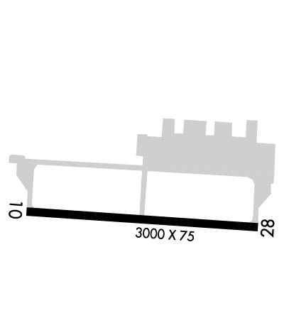
| Rwy | Rwy | |||||||
| 3000x75 | 3000' | 3000x75 | 3000' | |||||
| Runway ID | Single Wheel | Double Wheel | Double Tandem Wheel | Dual Double Wheel |
| 10/28 | N/A | N/A | N/A | N/A |
| These numbers are Advisory and are not limits. The Airport Manager should have more accurate Weight Limits | ||||
 Airport Diagram might not be current. | |
| Facility Name: | TIPTON |
| City Name: | FORT MEADE (ODENTON) |
| County: | ANNE ARUNDEL |
| State abbrev: | MD |
| State Name: | MARYLAND |
| Ownership: | PUBLICLY OWNED |
| Use: | OPEN TO THE PUBLIC |
| Owner's Name: | TIPTON ARPT AUTHORITY |
| Address: | 7515 GENERAL AVIATION DRIVE |
| FT. MEADE, MD 20755 | |
| Owner's Phone: | 410-222-6815 |
| Manager's Name: | MICHAEL A WASSEL |
| Address: | 7515 GENERAL AVIATION DRIVE, SUITE 1 |
| FT. MEADE, MD 20755 | |
| Phone: | 410-222-6815 |
| FAA Region: | EASTERN |
| FAA Field Office: | DCA |
| Date | Sunrise | Sunset |
|---|---|---|
| 04/24/24 Wednesday | 6:17 | 19:54 |
| 04/25/24 Thursday | 6:15 | 19:55 |
| 04/26/24 Friday | 6:14 | 19:56 |
| 04/27/24 Saturday | 6:13 | 19:57 |
| 04/28/24 Sunday | 6:12 | 19:58 |
| 04/29/24 Monday | 6:10 | 19:59 |
| 04/30/24 Tuesday | 6:09 | 20:00 |
| 05/01/24 Wednesday | 6:08 | 20:01 |
| 05/02/24 Thursday | 6:07 | 20:02 |
| 05/03/24 Friday | 6:06 | 20:03 |
| 05/04/24 Saturday | 6:04 | 20:04 |
| 05/05/24 Sunday | 6:03 | 20:05 |
| 05/06/24 Monday | 6:02 | 20:06 |
| 05/07/24 Tuesday | 6:01 | 20:06 |
| Airport Attendance Schedule | 7 Days A Week 0830-1800 |
| Airport Status | OPERATIONAL (This Status can change at any time - please check NOTAMS) |
| Airport Lighting Schedule | ACTVT REIL RWY 10 & 28; PAPI RWY 10 & 28; MIRL RWY 10/28 - CTAF. |
| Airport Storage Available | Tie Downs |
| Extra Services Available | Charter, Flight Instruction, Aircraft Rental |
| Wind Indicator | YES - (lighted) |
| Control Tower | NO |
| CTAF Frequency | 123.050 |
| Unicom Frequency | 123.050 |
| Rotating Beacon Color | WG |
| Segmented Circle | YES |
| Landing Fee | NO |
| Airport Inspected | STATE - performed by STATE AERONAUTICAL PERSONNEL |
| Inspection Date | 04/05/2023 |
| Type of Fuel Available | Grade 100LL, JET A; -1024 HR SELF SVC 100LL AVBL WITH CREDIT CARD.; -A+24 HR SELF SVC JET A+ AVBL WITH CREDIT CARD. |
| Airframe Repair Service | MINOR |
| Power Plant Repair Service | MINOR |
| Latitude | N3905.1 |
| Longitude | W07645.6 (ESTIMATED) |
| Arpt Elevation | 150ft (ESTIMATED) |
| Magnetic Variation | 10W |
| 1 miles SW | of FORT MEADE (ODENTON) |
| Traffic Pattern Altitude | 850 |
| Sectional Chart | WASHINGTON |
| Operations (Reported) | Yearly | Avg. Daily |
|---|---|---|
| General Aviation Transient | 771 | 2 |
| General Aviation Local | 37189 | 102 |
| Air Taxi | 104 | 0 |
| Commerical | 0 | 0 |
| Commuter | 0 | 0 |
| Military | 60 | 0 |
| Aircraft based on Field | |
|---|---|
| General Aviation Singles | 76 |
| General Aviation Multi | 7 |
| Jet Aircraft | 0 |
| General Aviation Helicopters | 14 |
| Military Aircraft | 0 |
| Gliders | 0 |
| Ultralights | 0 |
| FSS on field | NO |
| FSS tie-in | LEESBURG |
| FSS Phone | 1-800-WX-BRIEF |
| Who issues Notams | FME |
| Notam D service at airport | YES |
| ARTCC Name | WASHINGTON |
| Airport Certification | |
| Aircraft Rescue & Firefighting Index | None |
| Airport of Entry | No |
| Custom Landing Rights | No |
| Joint Civil/Military | No |
| Military Landing rights | No |
| NATIONAL PLAN OF INTEGRATED AIRPORT SYSTEMS (NPIAS) |
| DEER ON RWY & TWY. |
| BE ALERT FOR NMRS BWI TBJT ARR/DEP IN THE AREA. FLY TFC PATTERN SOUTH OF THE FIELD TO AVOID BWI CLASS B ASP. REMAIN CLEAR OF BWI CLASS B ASP UNTIL CLNC IS OBTAINED. |
| PAEW ADJ ALL TWYS AND RWYS 10 & 28 INDEFLY. |
| FOR CD CTC POTOMAC APCH AT 866-429-5882. |
| RWY 10 & 28 REIL; MIRL RWY 10/28 ON PHOTOCELL DURING DALGT HRS. |
Airport Communications & Frequencies:
| ||||||||||||||
| Runway: 10 | Runway: 28 | ||
| Mag heading: | 104° | Mag heading: | 284° |
| Rwy Slope: | 1.17% Up | Rwy Slope: | -1.17% Down |
| Approach: | Approach: | ||
| Pattern: | Right Traffic | Pattern: | Left Traffic |
| Markings: | NONPRECISION INSTRUMENT | Markings: | NONPRECISION INSTRUMENT |
| Marking Condition: | GOOD | Marking Condition: | GOOD |
| Arresting Dev: | Arresting Dev: | ||
| Lat & Long: | N3905.1 W07645.9 | Lat. & Long.: | N3905.1 W07645.3 |
| Elev: | 115.0 ft. MSL | Elev: | 150.0 ft. MSL |
| TCH: | 51 ft. AGL | TCH: | 57 ft. AGL |
| Visual Glide Path: | 4.00 degrees | Visual Glide Path: | 4.00 degrees |
| Displaced Threshold: | No | Displaced Threshold: | No |
| Touchdown Zone: | YES | Touchdown Zone: | YES |
| Touchdown Elev.: | 150.0 feet | Touchdown Elev.: | 150.0 feet |
| Visual Glide Slope: | 2-Light PAPI on LEFT side of Runway; PAPI UNUSBL BYD 8 DEGS LEFT & RIGHT OF CRS. | Visual Glide Slope: | 2-Light PAPI on LEFT side of Runway; PAPI UNUSBL BYD 5 DEGS LEFT OF CRS (TREES), AND 8 DEGS RIGHT OF CRS. |
| RVR Equipment: | RVR Equipment: | ||
| RVV Equipment: | NO | RVV Equipment: | NO |
| Approach Lights: | Approach Lights: | ||
| REIL: | YES | REIL: | YES |
| Centerline Lights: | NO | Centerline Lights: | NO |
| Touchdown lights: | NO | Touchdown lights: | NO |
| Runway Category: | Runway with a Non-precision Approach | Runway Category: | Runway with a Non-precision Approach |
| Declared Distances: | Declared Distances: | ||
| Obstructions: | TREES | Obstructions: | TREES |
| Marked: | NOT Marked/Lighted | Marked: | NOT Marked/Lighted |
| Clearance slope: | 16:1 | Clearance slope: | 20:1 |
| Obstruction height: | 63 feet AGL | Obstruction height: | 57 feet AGL |
| Dist. from runway: | 1261 feet | Dist. from runway: | 1372 feet |
| Centerline offset: | 314 left of centerline | Centerline offset: | 120 feet left of centerline |
| Comments: | Comments: |