
| ||||||||||||||||||||||||||||||||||||||||||||
| ||||||||||||||||||||||||||||||||||||||||||||
| Rwy | Rwy | |||||||
| 5318x102 | 5318' | 5318x102 | 5318' | |||||
| Runway ID | Single Wheel | Double Wheel | Double Tandem Wheel | Dual Double Wheel |
| 16/34 | N/A | N/A | N/A | N/A |
| These numbers are Advisory and are not limits. The Airport Manager should have more accurate Weight Limits | ||||
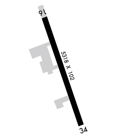 Airport Diagram might not be current. | |
| Facility Name: | SHERMAN AAF |
| City Name: | FORT LEAVENWORTH; GA RAMP ASSOCIATED W/CITY OF LEAVENWORTH. |
| County: | LEAVENWORTH |
| State abbrev: | KS |
| State Name: | KANSAS |
| Ownership: | ARMY OWNED; U.S. ARMY AIRFIELD/CIVILIAN RAMP LEASED TO CITY. |
| Use: | OPEN TO THE PUBLIC |
| Owner's Name: | U S ARMY, ARMY AVIATION DIV; CIVILIAN RAMP LEASED TO CITY. |
| Address: | DIR OF PLANS, TRNG & OPS, 290 GRANT AVE., UNIT 3 |
| FT LEAVENWORTH, KS 66027-1254; GA RAMP ASSOCIATED W/CITY OF LEAVENWORTH. | |
| Owner's Phone: | 913-684-6040; FAX: 913-684-6043. |
| Manager's Name: | AIRFIELD OPS; CITY ARPT/FBO MGR DEAN AYERS. |
| Address: | 1000 CHIEF JOSEPH LOOP |
| FT. LEAVENWORTH, KS 66027-1254 | |
| Phone: | 913-684-6041; ALT: 913-684-6039; FAX: 913-684-6040; FOR GENERAL AVIATION CONTACT CITY OF LEAVENWORTH AIRPORT OFFICE, PHONE 913-651-0111, FAX: 913-682-1592. |
| FAA Region: | CENTRAL |
| FAA Field Office: | NONE |
| Date | Sunrise | Sunset |
|---|---|---|
| 04/25/24 Thursday | 6:28 | 20:08 |
| 04/26/24 Friday | 6:26 | 20:09 |
| 04/27/24 Saturday | 6:25 | 20:10 |
| 04/28/24 Sunday | 6:24 | 20:11 |
| 04/29/24 Monday | 6:22 | 20:12 |
| 04/30/24 Tuesday | 6:21 | 20:13 |
| 05/01/24 Wednesday | 6:20 | 20:14 |
| 05/02/24 Thursday | 6:19 | 20:15 |
| 05/03/24 Friday | 6:18 | 20:16 |
| 05/04/24 Saturday | 6:16 | 20:17 |
| 05/05/24 Sunday | 6:15 | 20:18 |
| 05/06/24 Monday | 6:14 | 20:19 |
| 05/07/24 Tuesday | 6:13 | 20:20 |
| 05/08/24 Wednesday | 6:12 | 20:21 |
| Airport Attendance Schedule | M-F 0730-1630 (MIL), 7 Days A Week 0900-1800 (GA); LIMITED SCV OT AND FED HOL. RSTD-MILITARY RAMP 24 HOUR PPR, CALL DSN 552-6039/40/41/42 OR C913-684-6039/40/41/42. |
| Airport Status | OPERATIONAL (This Status can change at any time - please check NOTAMS) |
| Airport Lighting Schedule | ACTVT PAPI RWYS 16 & 34; HIRL RWY 16/34; & TWY LGTS - CTAF. |
| Airport Storage Available | Tie Downs, Hanger |
| Extra Services Available | Flight Instruction, Aircraft Rental |
| Wind Indicator | YES - (unlit) |
| Control Tower | NO |
| CTAF Frequency | 126.200 |
| Unicom Frequency | |
| Rotating Beacon Color | SWG |
| Segmented Circle | NO |
| Landing Fee | NO |
| Airport Inspected | STATE - performed by STATE AERONAUTICAL PERSONNEL |
| Inspection Date | 09/30/2022 |
| Type of Fuel Available | Grade 100LL, JET A (freeze point -40C), JET A-1 (icing inhibitor, freeze point -50C); -10MIL FUEL JET A ONLY AVBL 0730-1630L. 24 HR PPR. SVC OTR TIMES FOR CODE 4 & ABV. GA 100LL & JET A AVBL 0900-1800L, OTR TIMES BY REQ. |
| Airframe Repair Service | NONE |
| Power Plant Repair Service | NONE |
| Latitude | N3922.1 |
| Longitude | W09454.9 (ESTIMATED) |
| Arpt Elevation | 771ft (SURVEYED) |
| Magnetic Variation | 04E |
| 3 miles N | of FORT LEAVENWORTH; GA RAMP ASSOCIATED W/CITY OF LEAVENWORTH. |
| Traffic Pattern Altitude | 698; TPA: ROTARY WING 698 FT AGL, TURBINE FIXED WING ACFT 1028 FT AGL. |
| Sectional Chart | KANSAS CITY |
| Operations (Reported) | Yearly | Avg. Daily |
|---|---|---|
| General Aviation Transient | 4950 | 14 |
| General Aviation Local | 4600 | 13 |
| Air Taxi | 0 | 0 |
| Commerical | 0 | 0 |
| Commuter | 0 | 0 |
| Military | 700 | 2 |
| Aircraft based on Field | |
|---|---|
| General Aviation Singles | 30 |
| General Aviation Multi | 1 |
| Jet Aircraft | 1 |
| General Aviation Helicopters | 0 |
| Military Aircraft | 0 |
| Gliders | 0 |
| Ultralights | 0 |
| FSS on field | NO |
| FSS tie-in | WICHITA |
| FSS Phone | 1-800-WX-BRIEF |
| Who issues Notams | ICT |
| Notam D service at airport | YES |
| ARTCC Name | KANSAS CITY |
| Airport Certification | |
| Aircraft Rescue & Firefighting Index | None |
| Airport of Entry | No |
| Custom Landing Rights | No |
| Joint Civil/Military | YES |
| Military Landing rights | No |
| RSTD: NO HAZARDOUS CARGO PAD. |
| RSTD: MILITARY RAMP 24 HOUR PPR, CALL DSN 552-6041 OR C913-684-6041. |
| +19 FT LGTD LEVEE 780 FT FROM AER 16, OB (PVT ROAD ON TOP OF +9 FT LEVEE). |
| MISC: CLASS E ASP EFF 1230-0030Z, MON-FRI, EXCEPT HOLS OTHER TIMES CLASS G. |
| FOR CD CTC KANSAS CITY APCH AT 816-329-2710. |
| WILDLIFE ON & INVOF RY. |
| JOINT USE AIRFIELD, FBO ATNDD MON-FRI 0900-1800. ALL OTR TIMES BY PRIOR ARRANGEMENTS. |
| POTENTIAL BIRD HAZARD ON & NEAR RY EARLY MORNING & EVENING. |
| NUMEROUS MIGRATORY BIRDS ON & INVOF ARPT OCT-APR. |
| MISC: BASE OPS 0730-1630L MON-FRI, EXC HOL; OT CODE 4 AND ABV BY PPR. AIRFIELD CONDITIONS UNMONITORED AND UNREPORTED OUTSIDE OF POSTED OPERATING HOURS. NO TRAN ALERT, LAVATORY SVC OR DE-ICE CAPABILITY. ALL ACFT WITH CODE 4 VIP OR ABV CTC SHERMAN BASE OPS (126.2) AT LEAST 20 MIN PRIOR TO LDG. |
| MISC: CIV ACFT ON NON-GOVT BUS USE CITY OF LEAVENWORTH RAMP C913-651-0111 ON S END OF FLD OPR 0900-1800L. |
| CALM WIND USE RY 16. |
Airport Communications & Frequencies:
| ||||||||||||
| Runway: 16 | Runway: 34 | ||
| Mag heading: | 155° | Mag heading: | 335° |
| Rwy Slope: | -.08% Down | Rwy Slope: | .08% Up |
| Approach: | Approach: | ||
| Pattern: | Left Traffic | Pattern: | Right Traffic |
| Markings: | NONPRECISION INSTRUMENT | Markings: | NONPRECISION INSTRUMENT |
| Marking Condition: | GOOD | Marking Condition: | GOOD |
| Arresting Dev: | Arresting Dev: | ||
| Lat & Long: | N3922.5 W09455.1 | Lat. & Long.: | N3921.6 W09454.7 |
| Elev: | 770.6 ft. MSL | Elev: | 766.3 ft. MSL |
| TCH: | 40 ft. AGL | TCH: | 41 ft. AGL |
| Visual Glide Path: | 3.00 degrees | Visual Glide Path: | 3.00 degrees |
| Displaced Threshold: | No | Displaced Threshold: | No |
| Touchdown Zone: | YES | Touchdown Zone: | YES |
| Touchdown Elev.: | 771.0 feet | Touchdown Elev.: | 769.3 feet |
| Visual Glide Slope: | 4-Light PAPI on LEFT side of Runway | Visual Glide Slope: | 4-Light PAPI on LEFT side of Runway |
| RVR Equipment: | RVR Equipment: | ||
| RVV Equipment: | NO | RVV Equipment: | NO |
| Approach Lights: | Approach Lights: | ||
| REIL: | NO | REIL: | NO |
| Centerline Lights: | NO | Centerline Lights: | NO |
| Touchdown lights: | NO | Touchdown lights: | NO |
| Runway Category: | Runway with a Non-precision Approach having visibility minimums greater than 3/4 mile | Runway Category: | Runway with a Non-precision Approach having visibility minimums greater than 3/4 mile |
| Declared Distances: | Declared Distances: | ||
| Obstructions: | BERM | Obstructions: | ROAD |
| Marked: | NOT Marked/Lighted | Marked: | NOT Marked/Lighted |
| Clearance slope: | 30:1 | Clearance slope: | 10:1 |
| Obstruction height: | 19 feet AGL | Obstruction height: | 7 feet AGL |
| Dist. from runway: | 780 feet | Dist. from runway: | 273 feet |
| Centerline offset: | Centerline offset: | 256 feet right of centerline | |
| Comments: | Comments: |
