Click here for more info on on SMS!

KFLT

FLAT AIRPORT
FLAT
AK
Time Zone: Alaska
Lat: N 6227.2
Long: W 15759.3
Elev: 309
Var: -21
Longest Runway: 4045T
CTAF: 122.9

FBO & Flight Services info for KFLT

FBOs: Update your Fuel Prices

AIRPORTPh: 907-524-3241
-
Freq: 122.9
Service
Jet
100LL
SAF
MoGas
Fuel Avail: NO FUEL AVAILABLE
Full        Last Update: 04/24/2024 06:02:18

Self        
RUNWAY - TURF
-
-
 
If you are an FBO, call 1-203-262-1700 to update your info or email: FltPlan.Advertising@garmin.com
Advertise your FBO on FltPlan.com

Runway & Approach Info for KFLT
Rwy
Length
Land Dist**
Approach*
  Rwy
Length
Land Dist**
Approach*
08
4045x90  4045'          
 
  
26
  4045x90  2600'          
 
 * only ILS, LOC, LDA, and SDF approaches to a specific runway are shown
** For any Declared Landing Distance Available, please see A/FD or Approach plates
Runway Weight Capability (lbs.) Help
Runway IDSingle WheelDouble WheelDouble Tandem WheelDual Double Wheel
08/26N/AN/AN/AN/A
These numbers are Advisory and are not limits.   The Airport Manager should have more accurate Weight Limits
Approach Charts
FltPlan does not have IFR approach charts available for KFLT.
Current Weather/Notams
Customs Information Send updates to Support@FltPlan.com
Customs Not Available
Database effective 05/16/2024
Airport Diagram of KFLT
Airport Diagram might not be current.

Facility Name: FLAT
City Name: FLAT
County: YUKON-KOYUKUK
State abbrev: AK
State Name: ALASKA
   
Ownership: PUBLICLY OWNED
Use: OPEN TO THE PUBLIC
Owner's Name: ALASKA DOT&PF CENTRAL REGION
Address: PO BOX 196900
 ANCHORAGE, AK 99519-6900
Owner's Phone: (907) 269-0749
  
Manager's Name: STEFFEN STRICK
Address: PO BOX 21
 MCGRATH, AK 99627
Phone: 907-524-3241
   
FAA Region: ALASKA
FAA Field Office: NONE


Sunrise / Sunset times for FLAT

DateSunriseSunset
04/23/24 Tuesday6:3822:24
04/24/24 Wednesday6:3422:27
04/25/24 Thursday6:3122:30
04/26/24 Friday6:2822:33
04/27/24 Saturday6:2522:36
04/28/24 Sunday6:2222:38
04/29/24 Monday6:1922:41
04/30/24 Tuesday6:1522:44
05/01/24 Wednesday6:1222:47
05/02/24 Thursday6:0922:50
05/03/24 Friday6:0622:53
05/04/24 Saturday6:0322:56
05/05/24 Sunday6:0022:59
05/06/24 Monday5:5723:01

Airport Facilities

Airport Attendance ScheduleUNATTENDED
Airport Status OPERATIONAL (This Status can change at any time - please check NOTAMS)
Airport Lighting Schedule
Airport Storage AvailableNONE
Extra Services AvailableCargo Handling
Wind IndicatorYES - (unlit)
Control TowerNO
CTAF Frequency122.900
Unicom Frequency
Rotating Beacon Color
Segmented CircleNO
Landing FeeNO

Airport Inspection Data

Airport InspectedCONTRACTOR - performed by PRIVATE CONTRACT PERSONNEL
Inspection Date08/02/2023

Airport Services

Type of Fuel AvailableNone
Airframe Repair ServiceNone
Power Plant Repair ServiceNone

Geographic Data

LatitudeN6227.2
LongitudeW15759.3 (ESTIMATED)
Arpt Elevation309ft (SURVEYED)
Magnetic Variation21E
0 miles Eof FLAT
Traffic Pattern Altitude
Sectional ChartMC GRATH

Aircraft Data

Operations (Reported)YearlyAvg. Daily
General Aviation Transient 00
General Aviation Local 00
Air Taxi 1000
Commerical 00
Commuter 00
Military 00
Aircraft based on Field
General Aviation Singles 0
General Aviation Multi 0
Jet Aircraft 0
General Aviation Helicopters 0
Military Aircraft 0
Gliders 0
Ultralights 0

FAA Services

FSS on field NO
FSS tie-in KENAI
FSS Phone 1-800-866-864-1737
Who issues Notams ENA
Notam D service at airport YES
ARTCC Name ANCHORAGE

Federal Status

Airport Certification
Aircraft Rescue & Firefighting IndexNone
Airport of EntryNo
Custom Landing RightsNo
Joint Civil/MilitaryNo
Military Landing rightsYES

Federal Agreements

NATIONAL PLAN OF INTEGRATED AIRPORT SYSTEMS (NPIAS)

Remarks

RY CONDITION NOT MONITORED; RCMD VISUAL INSPECTION PRIOR TO USING.
SMALL TREES, GRASS AND SHRUBS ALONG RY.
NO MAINTENANCE ON RY.
RWY 08/2 6 SFC COVERED WITH 12 TO 30 IN GRASS & BRUSH.
RWY 08/2 6 1RY SOFT WHEN WET 600 FT FM RY 26. RY 26 LAST 150 FT UNUSABLE BRUSH AND GRASS.
Runway Identifications
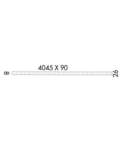
Runway Identification: 08/26
Length: 4045 ft
Width: 90 ft
Surface: GRASS-GOOD CONDITION-POOR CONDITION
Edge lights:

Treatment: NONE

 Runway: 08   Runway: 26
Mag heading: N/AMag heading: N/A
Approach: Approach:
Pattern: Left TrafficPattern: Left Traffic
Markings: NONSTANDARDMarkings: NONSTANDARD
Marking Condition: POOR; RY 08 MKD WITH ORANGE 3 FT CONES AND THLD PANELS. CONES AND THLD PANELS OVERGROWN AND MOSTLY INVISIBLE.Marking Condition: POOR; RY 26 MKD WITH ORANGE 3 FT CONES AND THLD PANELS. CONES AND THLD PANELS MOSTLY OVERGROWN.
Arresting Dev: Arresting Dev:
Lat & Long:   Lat. & Long.:   
Elev: N/AElev: N/A
TCH: TCH:
Visual Glide Path: Visual Glide Path:
Displaced Threshold: NoDisplaced Threshold: 1445 feet; DSPLD THLD MKD WITH WHITE 55 GAL DRUMS.
Touchdown Zone: NOTouchdown Zone: NO
Touchdown Elev.: Touchdown Elev.:
Visual Glide Slope: Visual Glide Slope:
RVR Equipment: RVR Equipment:
RVV Equipment: NORVV Equipment: NO
Approach Lights: Approach Lights:
REIL: NOREIL: NO
Centerline Lights: NOCenterline Lights: NO
Touchdown lights: NOTouchdown lights: NO
Runway Category: Runway with a Visual ApproachRunway Category: Runway with a Visual Approach
Declared Distances: Declared Distances:
Obstructions: TREESObstructions: TREES
Marked: NOT Marked/LightedMarked: NOT Marked/Lighted
Clearance slope: Clearance slope:
Obstruction height: 38 feet AGLObstruction height: 18 feet AGL
Dist. from runway: 0 feetDist. from runway: 0 feet
Centerline offset: 120 right of centerlineCenterline offset: 85 feet left of centerline
Comments: Comments:
C:/P: