Current Weather/Notams (Metars, TAFs, Notams, NWS Forecast, PIREPS, and nearby weather)
Customs Information Send updates to Support@FltPlan.com
Customs Not Available
Database effective 05/16/2024
Airport Diagram might not be current.
|
| Facility Name: | FRANKLIN RGNL |
| City Name: | FRANKLIN |
| County: | ISLE OF WIGHT |
| State abbrev: | VA |
| State Name: | VIRGINIA |
| | |
| Ownership: | PUBLICLY OWNED |
| Use: | OPEN TO THE PUBLIC |
| Owner's Name: | CITY OF FRANKLIN |
| Address: | P O BOX 179 |
| | FRANKLIN, VA 23851 |
| Owner's Phone: | 757-562-8561 |
| | |
| Manager's Name: | TREVELYN LINTON |
| Address: | 32470 JOHN BEVERLY ROSE DR |
| | FRANKLIN, VA 23851 |
| Phone: | 757-562-8764; CTC 757-562-8575 FOR AFTER HOUR EMERGENCIES. |
| | |
| FAA Region: | EASTERN |
| FAA Field Office: | DCA |
Runway Identifications
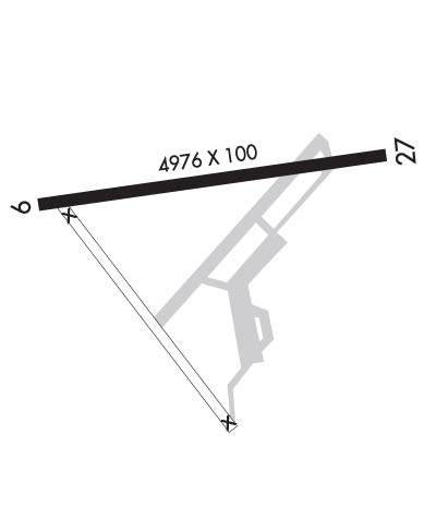
Runway Identification: 09/27Length: 4977 ft
Width: 100 ft
Surface: ASPHALT-GOOD CONDITION
Edge lights: Medium IntensityTreatment: GROOVED
| | Runway: 09 | | Runway: 27 |
| Mag heading: | 90° | Mag heading: | 270° |
| Rwy Slope: | .14% Up | Rwy Slope: | -.14% Down |
| Approach: | | Approach: | |
| Pattern: | Left Traffic | Pattern: | Left Traffic |
| Markings: | NONPRECISION INSTRUMENT | Markings: | NONPRECISION INSTRUMENT |
| Marking Condition: | FAIR | Marking Condition: | FAIR |
| Arresting Dev: | | Arresting Dev: | |
| Lat & Long: | N3642.0 W07654.6 | Lat. & Long.: | N3642.1 W07653.6 |
| Elev: | 33.3 ft. MSL | Elev: | 40.3 ft. MSL |
| TCH: | 40 ft. AGL | TCH: | 40 ft. AGL |
| Visual Glide Path: | 3.00 degrees | Visual Glide Path: | 3.00 degrees |
| Displaced Threshold: | No | Displaced Threshold: | No |
| Touchdown Zone: | YES | Touchdown Zone: | YES |
| Touchdown Elev.: | 35.3 feet | Touchdown Elev.: | 40.3 feet |
| Visual Glide Slope: | 2-Light PAPI on LEFT side of Runway | Visual Glide Slope: | 2-Light PAPI on LEFT side of Runway; RWY 27 PAPI UNUSABLE BYD 1 NM FM THR. |
| RVR Equipment: | | RVR Equipment: | |
| RVV Equipment: | NO | RVV Equipment: | NO |
| Approach Lights: | | Approach Lights: | |
| REIL: | NO | REIL: | NO |
| Centerline Lights: | NO | Centerline Lights: | NO |
| Touchdown lights: | NO | Touchdown lights: | NO |
| Runway Category: | Runway with a Non-precision Approach having visibility minimums greater than 3/4 mile | Runway Category: | Runway with a Non-precision Approach having visibility minimums greater than 3/4 mile |
| Declared Distances: | | Declared Distances: | |
| Obstructions: | TREE | Obstructions: | TREE |
| Marked: | NOT Marked/Lighted | Marked: | NOT Marked/Lighted |
| Clearance slope: | 15:1 | Clearance slope: | 18:1 |
| Obstruction height: | 28 feet AGL | Obstruction height: | 59 feet AGL |
| Dist. from runway: | 632 feet | Dist. from runway: | 1308 feet |
| Centerline offset: | 200 right of centerline | Centerline offset: | 297 feet left of centerline |
| Comments: | | Comments: | 4 FT HIGH FENCE 139 FT FM RWY END, 242 FT L ON APCH. |

