Current Weather/Notams (Metars, TAFs, Notams, NWS Forecast, PIREPS, and nearby weather)
Customs Information Send updates to Support@FltPlan.com
Customs Not Available
Database effective 05/16/2024
Airport Diagram might not be current.
|
| Facility Name: | FLEMING-MASON |
| City Name: | FLEMINGSBURG |
| County: | MASON |
| State abbrev: | KY |
| State Name: | KENTUCKY |
| | |
| Ownership: | PUBLICLY OWNED |
| Use: | OPEN TO THE PUBLIC |
| Owner's Name: | FLEMING-MASON ARPT BOARD; DAVID MAHER |
| Address: | PO BOX 460,, POB 460 |
| | MAYSVILLE, KY 41056 |
| Owner's Phone: | (606) 407-2966 |
| | |
| Manager's Name: | DERON MULLIKIN |
| Address: | 7079 AIRPORT RD. |
| | MAYSVILLE, KY 41056 |
| Phone: | 606-742-2411; MANAGER'S CELL (606) 541-2957 |
| | |
| FAA Region: | SOUTHERN |
| FAA Field Office: | MEM |
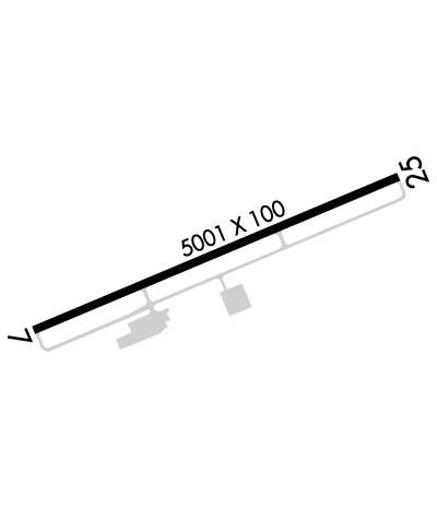
Runway Identifications
Runway Identification: 07/25Length: 5002 ft
Width: 100 ft
Surface: ASPHALT-GOOD CONDITION
Edge lights: Medium IntensityTreatment: NONE
Weight: PCN 22 /F/C/X/T
| | Runway: 07 | | Runway: 25 |
| Mag heading: | 72° | Mag heading: | 252° |
| Rwy Slope: | .11% Up | Rwy Slope: | -.11% Down |
| Approach: | | Approach: | LOCALIZER |
| Pattern: | Left Traffic | Pattern: | Left Traffic |
| Markings: | NONPRECISION INSTRUMENT | Markings: | NONPRECISION INSTRUMENT |
| Marking Condition: | POOR; MARKINGS FADED. | Marking Condition: | POOR; MARKINGS FADED. |
| Arresting Dev: | | Arresting Dev: | |
| Lat & Long: | N3832.3 W08345.1 | Lat. & Long.: | N3832.7 W08344.2 |
| Elev: | 905.0 ft. MSL | Elev: | 910.7 ft. MSL |
| TCH: | 40 ft. AGL | TCH: | 40 ft. AGL |
| Visual Glide Path: | 3.00 degrees | Visual Glide Path: | 3.00 degrees |
| Displaced Threshold: | No | Displaced Threshold: | No |
| Touchdown Zone: | YES | Touchdown Zone: | YES |
| Touchdown Elev.: | 912.9 feet | Touchdown Elev.: | 913.3 feet |
| Visual Glide Slope: | 4-Light PAPI on RIGHT side of Runway | Visual Glide Slope: | 4-Light PAPI on LEFT side of Runway |
| RVR Equipment: | | RVR Equipment: | |
| RVV Equipment: | NO | RVV Equipment: | NO |
| Approach Lights: | | Approach Lights: | |
| REIL: | YES | REIL: | YES |
| Centerline Lights: | NO | Centerline Lights: | NO |
| Touchdown lights: | NO | Touchdown lights: | NO |
| Runway Category: | Runway with a Non-precision Approach having visibility minimums greater than 3/4 mile | Runway Category: | Runway with a Non-precision Approach having visibility minimums greater than 3/4 mile |
| Declared Distances: | TORA:5002' TODA:5002' ASDA:5002' LDA:4703' | Declared Distances: | TORA:5002' TODA:5002' ASDA:4703' LDA:4703' |
| Obstructions: | TREE | Obstructions: | TREE |
| Marked: | NOT Marked/Lighted | Marked: | NOT Marked/Lighted |
| Clearance slope: | 20:1 | Clearance slope: | 4:1 |
| Obstruction height: | 19 feet AGL | Obstruction height: | 20 feet AGL |
| Dist. from runway: | 588 feet | Dist. from runway: | 299 feet |
| Centerline offset: | 197 left of centerline | Centerline offset: | 153 feet left of centerline |
| Comments: | | Comments: | |

