
| ||||||||||||||||||||||||||||||||
| ||||||||||||||||||||||||||||||||
| Rwy | Rwy | |||||||
| 5011x110 | 4306' | 5011x110 | 4814' | |||||
| Runway ID | Single Wheel | Double Wheel | Double Tandem Wheel | Dual Double Wheel |
| 09/27 | N/A | N/A | N/A | N/A |
| These numbers are Advisory and are not limits. The Airport Manager should have more accurate Weight Limits | ||||
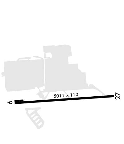 Airport Diagram might not be current. | |
| Facility Name: | SIMMONS AAF |
| City Name: | FORT LIBERTY |
| County: | CUMBERLAND |
| State abbrev: | NC |
| State Name: | NORTH CAROLINA |
| Ownership: | ARMY OWNED |
| Use: | PRIVATE |
| Owner's Name: | US ARMY ATCA-ASO |
| Address: | 9325 GUNSTON ROAD |
| FT BELVIOR, VA 22060 | |
| Owner's Phone: | |
| Manager's Name: | LARRY E LEWIS |
| Address: | SIMMONS AAAF BLDG P4541 |
| FT BRAGG, NC 28307 | |
| Phone: | 910-396-6605 |
| FAA Region: | SOUTHERN |
| FAA Field Office: | MEM |
| Date | Sunrise | Sunset |
|---|---|---|
| 04/18/24 Thursday | 6:39 | 19:51 |
| 04/19/24 Friday | 6:38 | 19:52 |
| 04/20/24 Saturday | 6:36 | 19:53 |
| 04/21/24 Sunday | 6:35 | 19:54 |
| 04/22/24 Monday | 6:34 | 19:55 |
| 04/23/24 Tuesday | 6:33 | 19:56 |
| 04/24/24 Wednesday | 6:32 | 19:56 |
| 04/25/24 Thursday | 6:31 | 19:57 |
| 04/26/24 Friday | 6:29 | 19:58 |
| 04/27/24 Saturday | 6:28 | 19:59 |
| 04/28/24 Sunday | 6:27 | 20:00 |
| 04/29/24 Monday | 6:26 | 20:00 |
| 04/30/24 Tuesday | 6:25 | 20:01 |
| 05/01/24 Wednesday | 6:24 | 20:02 |
| Airport Attendance Schedule | MON-SAT 1200-0500Z++; CLSD HOL, OT BY NOTAM. SEE FLIP AP/1 FLT HAZ AND SUPPLEMENTARY ARPT |
| Airport Status | OPERATIONAL (This Status can change at any time - please check NOTAMS) |
| Airport Lighting Schedule | |
| Airport Storage Available | NONE |
| Extra Services Available | NONE |
| Wind Indicator | NONE |
| Control Tower | YES |
| CTAF Frequency | 125.900; CTAF WHEN TWR CLSD. |
| Unicom Frequency | |
| Rotating Beacon Color | SWG |
| Segmented Circle | NO |
| Landing Fee |
| Airport Inspected | No Inspection Data Available performed by the OWNER |
| Inspection Date | Unknown |
| Type of Fuel Available | JET A |
| Airframe Repair Service | None |
| Power Plant Repair Service | None |
| Latitude | N3507.9 |
| Longitude | W07856.2 (ESTIMATED) |
| Arpt Elevation | 244ft (ESTIMATED) |
| Magnetic Variation | 07W |
| 4 miles E | of FORT LIBERTY |
| Traffic Pattern Altitude | |
| Sectional Chart | CHARLOTTE |
| Operations (Reported) | Yearly | Avg. Daily |
|---|---|---|
| General Aviation Transient | 0 | 0 |
| General Aviation Local | 0 | 0 |
| Air Taxi | 0 | 0 |
| Commerical | 0 | 0 |
| Commuter | 0 | 0 |
| Military | 0 | 0 |
| Aircraft based on Field | |
|---|---|
| General Aviation Singles | 0 |
| General Aviation Multi | 0 |
| Jet Aircraft | 0 |
| General Aviation Helicopters | 0 |
| Military Aircraft | 0 |
| Gliders | 0 |
| Ultralights | 0 |
| FSS on field | NO |
| FSS tie-in | RALEIGH |
| FSS Phone | 1-800-WX-BRIEF |
| Who issues Notams | FBG |
| Notam D service at airport | YES |
| ARTCC Name | WASHINGTON |
| Airport Certification | |
| Aircraft Rescue & Firefighting Index | None |
| Airport of Entry | No |
| Custom Landing Rights | No |
| Joint Civil/Military | No |
| Military Landing rights | No |
| FUEL: J8, 24 HR PPR FOR COLD FUEL. HOT REFUEL HOURS 2100-0500Z++MON-FRI. |
| RSTD: V22 RESTRICTIONS SEE AP/1. |
| MISC: ALL WEEKEND FUEL REQUEST ARE REQUIRED TO BE SUBMITTED TO BASE OPS BY TUES 1500L. |
| CAUTION: DISTANCE BETWEEN C/L AND 9/27 AND HELIPADS E AND W DOES NOT MEET STANDARDS. DISTANCE BETWEEN C/L AND HELIPADS IS 350 FT. NO SIMULTANEOUS OPS AUTH DUR VFR CONDS WHEN THE TWR IS NOT OPER. A PORTION OF TWY JULIET NORTH IS NOT LIT, AIRCREWS TAXI AT YOUR OWN RISK DURING IFR CONDS AND AT NIGHT. |
| RSTD: 24 HR PPR FOR RON AND ALL CIV ACFT, DSN 236-7804, C910-396-7804. |
| CAUTION: ARPT PERIMETER LGT MAY CAUSE PILOT DISTRACTION. |
| TFC PAT: R/W 1000 FT. |
| MISC: PILOTS NOTIFY SIMMONS OPS 20 MIN OUT WITH CODE 6 OR ABV ON BOARD. |
| MISC: ALL WHEELED ROTO WING ACFT GND TAXI ON ALL RAMPS AND TWYS. |
| WHEN TWR AND/OR SFC VIS IS BLO 4 SM THE LESSER VALUE WILL BE RPRTD AS PVLING. |
| CAUTION: BIRD HAZARD. |
| MISC: 26 OWS BARKSDALE AFB, LA, DSN 331-2651, C318-529-2651. DSN 331-2651/2/3, C866-223-9328. |
| RWY 09/2 7 RSTD: RWY R/W ACFT ONLY. |
Airport Communications & Frequencies:
| |||||||||||||||||||||||||||||||||
| Runway: 09 | Runway: 27 | ||
| Mag heading: | 93° | Mag heading: | 273° |
| Rwy Slope: | -.43% Down | Rwy Slope: | .43% Up |
| Approach: | Approach: | ||
| Pattern: | Left Traffic | Pattern: | Left Traffic |
| Markings: | PRECISION INSTRUMENT | Markings: | PRECISION INSTRUMENT |
| Marking Condition: | GOOD | Marking Condition: | GOOD |
| Arresting Dev: | Arresting Dev: | ||
| Lat & Long: | N3507.9 W07856.7 | Lat. & Long.: | N3508.0 W07855.7 |
| Elev: | 244.1 ft. MSL | Elev: | 222.6 ft. MSL |
| TCH: | TCH: | 36 ft. AGL | |
| Visual Glide Path: | Visual Glide Path: | 3.00 degrees | |
| Displaced Threshold: | 705 feet | Displaced Threshold: | 197 feet |
| Touchdown Zone: | YES | Touchdown Zone: | YES |
| Touchdown Elev.: | 240.5 feet | Touchdown Elev.: | 228.4 feet |
| Visual Glide Slope: | Visual Glide Slope: | 2-Light PAPI on LEFT side of Runway | |
| RVR Equipment: | RVR Equipment: | ||
| RVV Equipment: | NO | RVV Equipment: | NO |
| Approach Lights: | Approach Lights: | ||
| REIL: | NO | REIL: | YES |
| Centerline Lights: | NO | Centerline Lights: | NO |
| Touchdown lights: | NO | Touchdown lights: | NO |
| Runway Category: | Runway Category: | ||
| Declared Distances: | Declared Distances: |
