KFAR

HECTOR INTL
FARGO
ND
Time Zone: Central
Lat: N 4655.2
Long: W 09648.9
Elev: 901
Var: -04
Longest Runway: 9001
Clr Del: 121.9
Dept. ATIS: 124.5
Arr. ATIS: 124.5
Ground: 121.9
Tower: 133.8

FBO & Flight Services info for KFAR

FBOs: Update your Fuel Prices

  click here  
Enjoy our award-winning FBO services and facilities on your next visit or quick turn into Fargo!
All services available 24/7, US Customs based at our facility, 9000 ft. runway w/2 ILS approaches, competitive fuel pricing, hangars for G650/Global aircraft, full concierge incl. rental cars/hotels/catering, AC charter & management, maintenance & avionics, paint & interior, sales & acquisitions.
Ph: 800-770-0538 Fax: 701-237-6887 Freq: 130.52WebsiteE-Mail
                     
Service
Jet
100LL
SAF
MoGas
Fuel Avail: 24/7
Full7.827.00    Last Update: 04/23/2024 14:33
PRICES GUARANTEED by FBO.
Self        
Misc. Info: Please call (701) 373-8800 for volume discounts; Clear US Customs at our door 24/7Address: 3802 20TH STREET NORTH   FARGO, ND 58102

ASOSPh: 701-298-3877
-
-
 
If you are an FBO, call 1-203-262-1700 to update your info or email: FltPlan.Advertising@garmin.com
Advertise your FBO on FltPlan.com
FBOs at nearby airports who want your business:
KFSD


  click here  
A Great Alternative to KFAR!
- Open 24/7
- No Ramp Fees, No Security Fees, No Handling Fees, No Additive Fees!
- Providing Excellent Service at competitive rates
- Quick Turns
- Jet A & 100LL
- Walk-up rental vehicles
- Large hangar space, able to accomodate a G550
www.maverickaircenter.com
Ph: 1-605-312-5680WebsiteE-MailFax: 1-605-271-6387Freq: 122.77

Runway & Approach Info for KFAR
Rwy
Length
Land Dist**
Approach*
  Rwy
Length
Land Dist**
Approach*
09
6302x100  6302'          
 
  
27
  6302x100  6302'          
 
13
3801x75  3801'          
 
  
31
  3801x75  3801'          
 
18
9001x150  9001'          
ILS
 108.90 - 176°  
  
36
  9001x150  9001'          
ILS/DME
 110.30 - 356°  
 * only ILS, LOC, LDA, and SDF approaches to a specific runway are shown
** For any Declared Landing Distance Available, please see A/FD or Approach plates
Runway Weight Capability (lbs.) Help
Runway IDSingle WheelDouble WheelDouble Tandem WheelDual Double Wheel
09/2760,000100,000N/AN/A
13/3126,00035,000N/AN/A
18/36100,000200,000400,000N/A
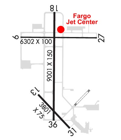
These numbers are Advisory and are not limits.   The Airport Manager should have more accurate Weight Limits
Approach Charts
Approaches    
Current Weather/Notams
Customs Information Send updates to Support@FltPlan.com
Phone 701-241-8124
Fax 701-241-6024

Comments Available 24/7/365 to clear int'l arrivals. Two hours advanced notice required prior to arrival. *Phone call required; you must speak with an officer before arriving in Fargo (use phone options). Maximum passengers per flight: 10 plus crew.
Database effective 05/16/2024
Airport Diagram of KFAR
Airport Diagram might not be current.

Facility Name: HECTOR INTL
City Name: FARGO
County: CASS
State abbrev: ND
State Name: NORTH DAKOTA
   
Ownership: PUBLICLY OWNED
Use: OPEN TO THE PUBLIC
Owner's Name: MUNI ARPT AUTH OF THE CITY OF FARGO
Address: PO BOX 2845
 FARGO, ND 58108
Owner's Phone: 701-241-1501
  
Manager's Name: SHAWN DOBBERSTEIN
Address: PO BOX 2845
 FARGO, ND 58108
Phone: 701-241-1501
   
FAA Region: GREAT LAKES
FAA Field Office: DMA


Sunrise / Sunset times for HECTOR INTL

DateSunriseSunset
04/24/24 Wednesday6:2220:29
04/25/24 Thursday6:2020:31
04/26/24 Friday6:1920:32
04/27/24 Saturday6:1720:33
04/28/24 Sunday6:1520:35
04/29/24 Monday6:1420:36
04/30/24 Tuesday6:1220:37
05/01/24 Wednesday6:1120:39
05/02/24 Thursday6:0920:40
05/03/24 Friday6:0820:41
05/04/24 Saturday6:0620:43
05/05/24 Sunday6:0520:44
05/06/24 Monday6:0320:45
05/07/24 Tuesday6:0220:47

Airport Facilities

Airport Attendance ScheduleCONTINUOUS
Airport Status OPERATIONAL (This Status can change at any time - please check NOTAMS)
Airport Lighting Schedule
Airport Storage AvailableTie Downs, Hanger
Extra Services AvailableAir Ambulance, Avionics, Charter, Flight Instruction, Aircraft Rental, Aircraft Sales, Annual Surveying
Wind IndicatorYES - (lighted)
Control TowerYES
CTAF Frequency
Unicom Frequency122.950
Rotating Beacon ColorWG
Segmented CircleNO
Landing FeeNO

Airport Inspection Data

Airport InspectedFEDERAL - performed by FAA AIRPORTS FIELD PERSONNEL
Inspection Date09/28/2023

Airport Services

Type of Fuel AvailableGrade 100LL, JET A (freeze point -40C), JET AA++J8
Airframe Repair ServiceMAJOR
Power Plant Repair ServiceMAJOR

Geographic Data

LatitudeN4655.2
LongitudeW09648.9 (ESTIMATED)
Arpt Elevation901ft (SURVEYED)
Magnetic Variation04E
3 miles NWof FARGO
Traffic Pattern Altitude
Sectional ChartTWIN CITIES

Aircraft Data

Operations (Reported)YearlyAvg. Daily
General Aviation Transient 2616172
General Aviation Local 2551470
Air Taxi 2456367
Commerical 1123831
Commuter 00
Military 29748
Aircraft based on Field
General Aviation Singles 128
General Aviation Multi 49
Jet Aircraft 28
General Aviation Helicopters 1
Military Aircraft 11
Gliders 0
Ultralights 0

FAA Services

FSS on field NO
FSS tie-in GRAND FORKS
FSS Phone 1-800-WX-BRIEF
Who issues Notams FAR
Notam D service at airport YES
ARTCC Name MINNEAPOLIS

Federal Status

Airport CertificationAIRPORT RECEIVING SCHEDULED AIR CARRIER SERVICE FROM CARRIERS CERTIFICATED BY THE CIVIL AERONAUTICS BOARD; INDEX E ARFF AVBL 2 HOURS PPR CTC 701-476-6790.
Aircraft Rescue & Firefighting IndexAIRPORT HAS A CERTIFICATE UNDER CFR PART 139
Airport of EntryNo
Custom Landing RightsYES
Joint Civil/MilitaryNo
Military Landing rightsYES

Federal Agreements

NATIONAL PLAN OF INTEGRATED AIRPORT SYSTEMS (NPIAS)
GRANT AGREEMENTS UNDER FAAP/ADAP/AIP
SURPLUS PROPERTY AGREEMENT UNDER PUBLIC LAW 289
ASSURANCES PURSUANT TO TITLE VI, CIVIL RIGHTS ACT OF 1964
AGREEMENT UNDER DLAND OR DCLA HAS EXPIRED.

Remarks

TWY B N OF TWY D RSTRD TO ACFT LESS THAN 130,000 LBS.
REMARKS: SEE FLIP AP/1 SUPPLEMENTARY ARPT INFO INCL BASH INFO.
CAUTION: USE EXTREME CAUTION FOR UAS OPS IN VCNTY.
ANG: BIRD HAZARD (BASH PHASE II) MAR-MAY, SEP-DEC.
FLIGHT NOTIFICATION SERVICE (ADCUS) AVAILABLE MON-FRI 0830-1700.
ANG-OFFL BUS ONLY CTC BASE OPS DSN 362-8508, C701-451-2508 OPR 1300-2230Z++ WKD, CLSD WKEND AND HOL EXC DUR SKED TRNG. OTHER TRAN ACFT CTC JET CNTR C701-235-3600; CSTMS AVBL 24 HR. RCR AVBL FR ANG OPS ON 262.0. RGT TFC RWY 18.
BIRDS ON AND INVOF ARPT.
RWY 13/3 1 RWY 13/31 NOT AVBL FOR SKEDD ACR OPNS WITH MORE THAN 9 PSGR SEATS OR UNSKEDD ACR AT LEAST 31 PSGR SEATS.
RWY 18/3 6 AUW-847
Airport Communications & Frequencies:
ATIS Frequencies:   Hours(local) of Operation: CONTINUOUS
124.5
379.2
FARGO Tower Frequencies:   Hours(local) of operation: CONTINUOUS   
133.8
290.4
FARGO Ground Frequencies:
121.9
348.6
Clearance Delivery Frequencies:
121.9
348.6
Emergency Frequencies:
121.5
243.0
Unicom Frequency:
122.950
FARGO Primary Approach Frequencies:   Hours(local) of operation: CONTINUOUS   
120.4
377.15
Part-time Approach Frequencies:  
125.125
370.85
FARGO Primary Departure Frequencies:   Hours(local) of operation: CONTINUOUS   
120.4
377.15
Part-time Departure Frequencies:  
125.125
370.85
Runway Identifications
Runway Identification: 09/27
Length: 6302 ft
Width: 100 ft
Surface: CONCRETE-GOOD CONDITION
Edge lights: Medium Intensity

Treatment: GROOVED
Weight: PCN 25 /R/C/W/T

 Runway: 09   Runway: 27
Mag heading: 86°Mag heading: 266°
Rwy Slope: .04% UpRwy Slope: -.04% Down
Approach: Approach:
Pattern: Left TrafficPattern: Left Traffic
Markings: NONPRECISION INSTRUMENTMarkings: NONPRECISION INSTRUMENT
Marking Condition: GOODMarking Condition: GOOD
Arresting Dev: Arresting Dev:
Lat & Long: N4655.6  W09649.6Lat. & Long.: N4655.6  W09648.1
Elev: 896.2 ft. MSLElev: 898.6 ft. MSL
TCH: 42 ft. AGLTCH: 42 ft. AGL
Visual Glide Path: 3.00 degreesVisual Glide Path: 3.00 degrees
Displaced Threshold: NoDisplaced Threshold: No
Touchdown Zone: YESTouchdown Zone: YES
Touchdown Elev.: 900.0 feetTouchdown Elev.: 899.5 feet
Visual Glide Slope: 4-Light PAPI on LEFT side of RunwayVisual Glide Slope: 4-Light PAPI on LEFT side of Runway
RVR Equipment: RVR Equipment:
RVV Equipment: NORVV Equipment: NO
Approach Lights: Approach Lights:
REIL: YESREIL: YES
Centerline Lights: NOCenterline Lights: NO
Touchdown lights: NOTouchdown lights: NO
Runway Category: DRunway Category: D
Declared Distances: TORA:6302' TODA:6302' ASDA:6302' LDA:6302'Declared Distances: TORA:6302' TODA:6302' ASDA:6302' LDA:6302'
Obstructions: Obstructions: POLE
Marked: Marked: LIGHTED
Clearance slope: 50:1Clearance slope: 35:1
Obstruction height: Obstruction height: 25 feet AGL
Dist. from runway: Dist. from runway: 1086 feet
Centerline offset: Centerline offset: 468 feet left of centerline
Comments: Comments:
Runway Identification: 13/31
Length: 3801 ft
Width: 75 ft
Surface: CONCRETE-GOOD CONDITION
Edge lights: Medium Intensity

Treatment: GROOVED
Weight: PCN 17 /R/D/W/T

 Runway: 13   Runway: 31
Mag heading: 133°Mag heading: 313°
Rwy Slope: -.07% DownRwy Slope: .07% Up
Approach: Approach:
Pattern: Left TrafficPattern: Left Traffic
Markings: BASICMarkings: BASIC
Marking Condition: GOODMarking Condition: GOOD
Arresting Dev: Arresting Dev:
Lat & Long: N4654.8  W09649.3Lat. & Long.: N4654.4  W09648.7
Elev: 901.3 ft. MSLElev: 898.5 ft. MSL
TCH: 61 ft. AGLTCH: 37 ft. AGL
Visual Glide Path: 3.00 degreesVisual Glide Path: 3.00 degrees
Displaced Threshold: NoDisplaced Threshold: No
Touchdown Zone: YESTouchdown Zone: YES
Touchdown Elev.: 901.3 feetTouchdown Elev.: 899.5 feet
Visual Glide Slope: 2-Light PAPI on RIGHT side of RunwayVisual Glide Slope: 2-Light PAPI on LEFT side of Runway
RVR Equipment: RVR Equipment:
RVV Equipment: NORVV Equipment: NO
Approach Lights: Approach Lights:
REIL: NOREIL: NO
Centerline Lights: NOCenterline Lights: NO
Touchdown lights: NOTouchdown lights: NO
Runway Category: Runway with a Visual ApproachRunway Category: Runway with a Visual Approach
Declared Distances: TORA:3801' TODA:3801' ASDA:3801' LDA:3801'Declared Distances: TORA:3801' TODA:3801' ASDA:3801' LDA:3801'
Obstructions: ROADObstructions: ROAD
Marked: NOT Marked/LightedMarked: NOT Marked/Lighted
Clearance slope: 47:1Clearance slope: 29:1
Obstruction height: 7 feet AGLObstruction height: 8 feet AGL
Dist. from runway: 550 feetDist. from runway: 432 feet
Centerline offset: 180 right of centerlineCenterline offset: 147 feet left of centerline
Comments: Comments:
Runway Identification: 18/36
Length: 9001 ft
Width: 150 ft
Surface: CONCRETE-GOOD CONDITION
Edge lights: High Intensity

Treatment: GROOVED
Weight: PCN 95 /R/C/W/T

 Runway: 18   Runway: 36
Mag heading: 176°Mag heading: 356°
Rwy Slope: -.01% DownRwy Slope: .01% Up
Approach: ILSApproach: ILS/DME
Pattern: Left TrafficPattern: Left Traffic
Markings: PRECISION INSTRUMENTMarkings: PRECISION INSTRUMENT
Marking Condition: GOODMarking Condition: GOOD
Arresting Dev: Arresting Dev:
Lat & Long: N4656.0  W09649.0Lat. & Long.: N4654.5  W09649.0
Elev: 899.8 ft. MSLElev: 899.3 ft. MSL
TCH: 68 ft. AGLTCH: 71 ft. AGL
Visual Glide Path: 3.00 degreesVisual Glide Path: 3.00 degrees
Displaced Threshold: NoDisplaced Threshold: No
Touchdown Zone: YESTouchdown Zone: YES
Touchdown Elev.: 900.0 feetTouchdown Elev.: 899.4 feet
Visual Glide Slope: 4-Light PAPI on LEFT side of RunwayVisual Glide Slope: 4-Light PAPI on RIGHT side of Runway
RVR Equipment: TOUCHDOWN-ROLLOUTRVR Equipment: TOUCHDOWN-ROLLOUT
RVV Equipment: NORVV Equipment: YES
Approach Lights: MALSR - 1,400 foot medium intensity approach lighting system with runway alignment indicator lightsApproach Lights: MALSR - 1,400 foot medium intensity approach lighting system with runway alignment indicator lights
REIL: NOREIL: NO
Centerline Lights: NOCenterline Lights: NO
Touchdown lights: NOTouchdown lights: NO
Runway Category: Precision Instrument RunwayRunway Category: Precision Instrument Runway
Declared Distances: TORA:9001' TODA:9001' ASDA:9001' LDA:9001'Declared Distances: TORA:9001' TODA:9001' ASDA:9001' LDA:9001'
C:150/P: