Click here for more info on on SMS!

KF68

ANADARKO MUNI
ANADARKO
OK
Time Zone: Central
Lat: N 3503.1
Long: W 09815.8
Elev: 1291
Var: -07
Longest Runway: 3100
CTAF: 122.9

FBO & Flight Services info for KF68

FBOs: Update your Fuel Prices

ANADARKO MUNICPh: 405-247-2481 Fax: 405-247-6974
-
Service
Jet
100LL
SAF
MoGas
Fuel Avail: NO FUEL AVAILABLE
Full        Last Update: 04/18/2024 05:44:57

Self        
If you are an FBO, call 1-203-262-1700 to update your info or email: FltPlan.Advertising@garmin.com
Advertise your FBO on FltPlan.com

Runway & Approach Info for KF68
Rwy
Length
Land Dist**
Approach*
  Rwy
Length
Land Dist**
Approach*
17
3100x50  3100'          
 
  
35
  3100x50  3100'          
 
 * only ILS, LOC, LDA, and SDF approaches to a specific runway are shown
** For any Declared Landing Distance Available, please see A/FD or Approach plates
Runway Weight Capability (lbs.) Help
Runway IDSingle WheelDouble WheelDouble Tandem WheelDual Double Wheel
17/3512,500N/AN/AN/A
These numbers are Advisory and are not limits.   The Airport Manager should have more accurate Weight Limits
Approach Charts
FltPlan does not have IFR approach charts available for KF68.
Current Weather/Notams
Customs Information Send updates to Support@FltPlan.com
Customs Not Available
Database effective 04/18/2024
Airport Diagram of KF68
Airport Diagram might not be current.

Facility Name: ANADARKO MUNI
City Name: ANADARKO
County: CADDO
State abbrev: OK
State Name: OKLAHOMA
   
Ownership: PUBLICLY OWNED
Use: OPEN TO THE PUBLIC
Owner's Name: CITY OF ANADARKO
Address: CITY HALL, BOX 647
 ANADARKO, OK 73005
Owner's Phone: 405-247-2481
  
Manager's Name: RICHARD ROGALSKI; CITY MANAGER, OR CONTACT SKIP WILKERSON 405-933-1756.
Address: 501 WEST VIRGINIA
 ANADARKO, OK 73005
Phone: 405-247-2483
   
FAA Region: SOUTHWEST
FAA Field Office: AOK


Sunrise / Sunset times for ANADARKO MUNI

DateSunriseSunset
04/17/24 Wednesday6:5720:08
04/18/24 Thursday6:5620:09
04/19/24 Friday6:5520:10
04/20/24 Saturday6:5420:10
04/21/24 Sunday6:5320:11
04/22/24 Monday6:5120:12
04/23/24 Tuesday6:5020:13
04/24/24 Wednesday6:4920:14
04/25/24 Thursday6:4820:14
04/26/24 Friday6:4720:15
04/27/24 Saturday6:4620:16
04/28/24 Sunday6:4520:17
04/29/24 Monday6:4320:18
04/30/24 Tuesday6:4220:18

Airport Facilities

Airport Attendance ScheduleUNATTENDED
Airport Status OPERATIONAL (This Status can change at any time - please check NOTAMS)
Airport Lighting ScheduleMIRL RWY 17/35 PRESET LOW INTENSITY TO INCREASE - CTAF.
Airport Storage AvailableTie Downs
Extra Services AvailableCrop Dusting
Wind IndicatorYES - (lighted)
Control TowerNO
CTAF Frequency122.900
Unicom Frequency
Rotating Beacon ColorWG
Segmented CircleYES
Landing FeeNO

Airport Inspection Data

Airport InspectedSTATE - performed by STATE AERONAUTICAL PERSONNEL
Inspection Date07/20/2023

Airport Services

Type of Fuel AvailableNone
Airframe Repair ServiceNONE
Power Plant Repair ServiceNONE

Geographic Data

LatitudeN3503.1
LongitudeW09815.8 (ESTIMATED)
Arpt Elevation1291ft (ESTIMATED)
Magnetic Variation07E
2 miles SWof ANADARKO
Traffic Pattern Altitude
Sectional ChartDALLAS-FT WORTH

Aircraft Data

Operations (Reported)YearlyAvg. Daily
General Aviation Transient 6002
General Aviation Local 3001
Air Taxi 00
Commerical 00
Commuter 00
Military 1000
Aircraft based on Field
General Aviation Singles 9
General Aviation Multi 0
Jet Aircraft 0
General Aviation Helicopters 0
Military Aircraft 0
Gliders 0
Ultralights 2

FAA Services

FSS on field NO
FSS tie-in MC ALESTER
FSS Phone 1-800-WX-BRIEF
Who issues Notams MLC
Notam D service at airport YES
ARTCC Name FORT WORTH

Federal Status

Airport Certification
Aircraft Rescue & Firefighting IndexNone
Airport of EntryNo
Custom Landing RightsNo
Joint Civil/MilitaryNo
Military Landing rightsYES

Remarks

FOR CD CTC FORT WORTH ARTCC AT 817-858-7584.
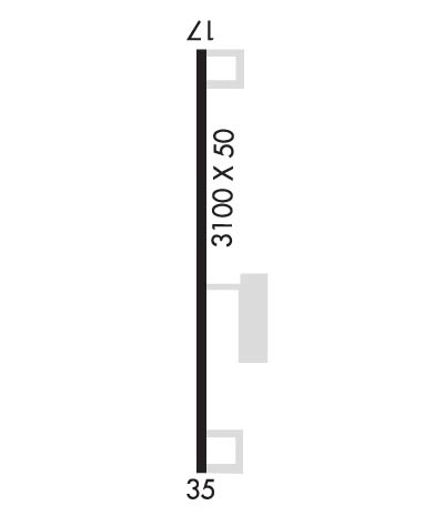
Runway Identifications
Runway Identification: 17/35
Length: 3100 ft
Width: 50 ft
Surface: ASPHALT-GOOD CONDITION
Edge lights: Medium Intensity

Treatment: NONE

 Runway: 17   Runway: 35
Mag heading: 173°Mag heading: 353°
Rwy Slope: 1.10% UpRwy Slope: -1.10% Down
Approach: Approach:
Pattern: Left TrafficPattern: Left Traffic
Markings: BASICMarkings: BASIC
Marking Condition: GOODMarking Condition: GOOD
Arresting Dev: Arresting Dev:
Lat & Long: N3503.4  W09815.8Lat. & Long.: N3502.9  W09815.8
Elev: 1257.0 ft. MSLElev: 1291.0 ft. MSL
TCH: TCH:
Visual Glide Path: Visual Glide Path:
Displaced Threshold: NoDisplaced Threshold: No
Touchdown Zone: NOTouchdown Zone: NO
Touchdown Elev.: Touchdown Elev.:
Visual Glide Slope: Visual Glide Slope:
RVR Equipment: RVR Equipment:
RVV Equipment: NORVV Equipment: NO
Approach Lights: Approach Lights:
REIL: NOREIL: NO
Centerline Lights: NOCenterline Lights: NO
Touchdown lights: NOTouchdown lights: NO
Runway Category: Runway with a Visual ApproachRunway Category: Runway with a Visual Approach
Declared Distances: Declared Distances:
Obstructions: ROADObstructions: TREES
Marked: NOT Marked/LightedMarked: NOT Marked/Lighted
Clearance slope: 18:1Clearance slope: 3:1
Obstruction height: 15 feet AGLObstruction height: 27 feet AGL
Dist. from runway: 471 feetDist. from runway: 304 feet
Centerline offset: Centerline offset: 99 feet right of centerline
Comments: Comments:
C:/P: