Current Weather/Notams (Metars, TAFs, Notams, NWS Forecast, PIREPS, and nearby weather)
Customs Information Send updates to Support@FltPlan.com
Customs Not Available
Database effective 04/18/2024
Airport Diagram might not be current.
|
| Facility Name: | ENNIS MUNI |
| City Name: | ENNIS |
| County: | ELLIS |
| State abbrev: | TX |
| State Name: | TEXAS |
| | |
| Ownership: | PUBLICLY OWNED |
| Use: | OPEN TO THE PUBLIC |
| Owner's Name: | CITY OF ENNIS |
| Address: | PO BOX 220 |
| | ENNIS, TX 75120-0220 |
| Owner's Phone: | 972-875-1234 |
| | |
| Manager's Name: | JERRY HAMMOCK |
| Address: | 3002 W ENNIS AVE |
| | ENNIS, TX 75119 |
| Phone: | (972) 875-4279 |
| | |
| FAA Region: | SOUTHWEST |
| FAA Field Office: | TEX |
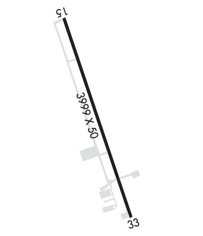
Runway Identifications
Runway Identification: 16/34Length: 3999 ft
Width: 50 ft
Surface: ASPHALT-GOOD CONDITION
Edge lights: Medium IntensityTreatment: NONE
| | Runway: 16 | | Runway: 34 |
| Mag heading: | 158° | Mag heading: | 338° |
| Rwy Slope: | -.58% Down | Rwy Slope: | .58% Up |
| Approach: | | Approach: | |
| Pattern: | Right Traffic | Pattern: | Left Traffic |
| Markings: | BASIC | Markings: | BASIC |
| Marking Condition: | GOOD | Marking Condition: | GOOD |
| Arresting Dev: | | Arresting Dev: | |
| Lat & Long: | N3220.1 W09640.0 | Lat. & Long.: | N3219.5 W09639.7 |
| Elev: | 500.1 ft. MSL | Elev: | 477.0 ft. MSL |
| TCH: | 35 ft. AGL | TCH: | 35 ft. AGL |
| Visual Glide Path: | 3.00 degrees | Visual Glide Path: | 3.00 degrees |
| Displaced Threshold: | No | Displaced Threshold: | 255 feet |
| Touchdown Zone: | YES | Touchdown Zone: | YES |
| Touchdown Elev.: | 500.1 feet | Touchdown Elev.: | 491.5 feet |
| Visual Glide Slope: | 2-Light PAPI on LEFT side of Runway | Visual Glide Slope: | 2-Light PAPI on LEFT side of Runway |
| RVR Equipment: | | RVR Equipment: | |
| RVV Equipment: | NO | RVV Equipment: | NO |
| Approach Lights: | | Approach Lights: | |
| REIL: | YES | REIL: | YES |
| Centerline Lights: | NO | Centerline Lights: | NO |
| Touchdown lights: | NO | Touchdown lights: | NO |
| Runway Category: | Runway with a Visual Approach | Runway Category: | Runway with a Visual Approach |
| Declared Distances: | | Declared Distances: | |
| Obstructions: | GND | Obstructions: | PLINE |
| Marked: | NOT Marked/Lighted | Marked: | MARKED |
| Clearance slope: | | Clearance slope: | 34:1; APCH SLOPE 23:1 TO DSPLCD THR OVR 16 FT BRUSH, 375 FT DSTC. |
| Obstruction height: | 5 feet AGL | Obstruction height: | 27 feet AGL |
| Dist. from runway: | 201 feet | Dist. from runway: | 1125 feet |
| Centerline offset: | 86 left of centerline | Centerline offset: | |
| Comments: | RISING GROUND 0 TO 5 FT FROM 0-199 FT DSTC, 88 FT L. | Comments: | 20 FT BRUSH, 0-130 FT DSTC, ACRS APCH. |

