Click here for more info on on SMS!

KETC

TARBORO-EDGECOMBE
TARBORO
NC
Time Zone: Eastern
Lat: N 3556.2
Long: W 07732.8
Elev: 53
Var: +08
Longest Runway: 3999
AWOS: 119.57
CTAF: 122.9

FBO & Flight Services info for KETC

FBOs: Update your Fuel Prices

UNATTENDED
-
Freq: 122.9
Service
Jet
100LL
SAF
MoGas
Fuel Avail: NO FUEL AVAILABLE
Full        Last Update: 04/18/2024 05:44:58

Self        
AWOSPh: 252-641-1640
-
Freq: 119.57  
If you are an FBO, call 1-203-262-1700 to update your info or email: FltPlan.Advertising@garmin.com
Advertise your FBO on FltPlan.com

Runway & Approach Info for KETC
Rwy
Length
Land Dist**
Approach*
  Rwy
Length
Land Dist**
Approach*
09
3999x60  3799'          
 
  
27
  3999x60  3999'          
 
 * only ILS, LOC, LDA, and SDF approaches to a specific runway are shown
** For any Declared Landing Distance Available, please see A/FD or Approach plates
Runway Weight Capability (lbs.) Help
Runway IDSingle WheelDouble WheelDouble Tandem WheelDual Double Wheel
09/27N/AN/AN/AN/A
These numbers are Advisory and are not limits.   The Airport Manager should have more accurate Weight Limits
Approach Charts
Approaches    
Current Weather/Notams
Customs Information Send updates to Support@FltPlan.com
Customs Not Available
Database effective 04/18/2024
Airport Diagram of KETC
Airport Diagram might not be current.

Facility Name: TARBORO-EDGECOMBE
City Name: TARBORO
County: EDGECOMBE
State abbrev: NC
State Name: NORTH CAROLINA
   
Ownership: PUBLICLY OWNED
Use: OPEN TO THE PUBLIC
Owner's Name: TARBORO-EDGECOMBE ARPT AUTH
Address: PO BOX 280
 TARBORO, NC 27886
Owner's Phone: 252-641-4229
  
Manager's Name: JASON NICHOLS
Address: PO BOX 220
 TARBORO, NC 27886
Phone: (252) 641-4229; EMERGENCY PHONE DURG BUS HRS 252-641-4229 TOWN HALL; 252-641-4247 POLICE DISPATCH.
   
FAA Region: SOUTHERN
FAA Field Office: MEM


Sunrise / Sunset times for TARBORO-EDGECOMBE

DateSunriseSunset
04/17/24 Wednesday6:3419:46
04/18/24 Thursday6:3219:47
04/19/24 Friday6:3119:48
04/20/24 Saturday6:3019:49
04/21/24 Sunday6:2919:49
04/22/24 Monday6:2719:50
04/23/24 Tuesday6:2619:51
04/24/24 Wednesday6:2519:52
04/25/24 Thursday6:2419:53
04/26/24 Friday6:2319:54
04/27/24 Saturday6:2119:55
04/28/24 Sunday6:2019:55
04/29/24 Monday6:1919:56
04/30/24 Tuesday6:1819:57

Airport Facilities

Airport Attendance ScheduleUNATTENDED
Airport Status OPERATIONAL (This Status can change at any time - please check NOTAMS)
Airport Lighting ScheduleACTVT MIRL RWY 09/27, REIL RWY 27 & PAPI RWYS 09 & 27 - CTAF.
Airport Storage AvailableTie Downs
Extra Services AvailableCrop Dusting
Wind IndicatorYES - (lighted)
Control TowerNO
CTAF Frequency122.900
Unicom Frequency
Rotating Beacon ColorWG
Segmented CircleYES
Landing FeeNO

Airport Inspection Data

Airport InspectedSTATE - performed by STATE AERONAUTICAL PERSONNEL
Inspection Date05/20/2021

Airport Services

Type of Fuel AvailableGrade 100LL; -10SELF SVC 100LL AVBL 24 HRS WITH CREDITCARD.
Airframe Repair ServiceNONE
Power Plant Repair ServiceNONE

Geographic Data

LatitudeN3556.2
LongitudeW07732.8 (ESTIMATED)
Arpt Elevation52ft (SURVEYED)
Magnetic Variation08W
2 miles Nof TARBORO
Traffic Pattern Altitude
Sectional ChartCHARLOTTE

Aircraft Data

Operations (Reported)YearlyAvg. Daily
General Aviation Transient 20005
General Aviation Local 20005
Air Taxi 8002
Commerical 00
Commuter 00
Military 5001
Aircraft based on Field
General Aviation Singles 5
General Aviation Multi 1
Jet Aircraft 0
General Aviation Helicopters 0
Military Aircraft 0
Gliders 0
Ultralights 0

FAA Services

FSS on field NO
FSS tie-in RALEIGH
FSS Phone 1-800-WX-BRIEF
Who issues Notams RDU
Notam D service at airport YES
ARTCC Name WASHINGTON

Federal Status

Airport Certification
Aircraft Rescue & Firefighting IndexNone
Airport of EntryNo
Custom Landing RightsNo
Joint Civil/MilitaryNo
Military Landing rightsNo

Federal Agreements

NATIONAL PLAN OF INTEGRATED AIRPORT SYSTEMS (NPIAS)

Remarks

DEER ON AND INVOF ARPT.
500' LOW LEVEL ROUTE 3 MI NE OF ARPT - BE ALERT FOR MIL ACFT INVOF ARPT.
RWY 27 SAFETY AREA HAS SFC VARIATIONS & DEPRESSIONS AND A 20 FT DROP OFF 100 FT FM BOTH SIDES.
FOR CD CTC WASHINGTON ARTCC AT 703-771-3587.
Airport Communications & Frequencies:
CTAF Frequency:
122.900
Remarks
  • APCH/DEP SVC PRVDD BY WASHINGTON ARTCC (ZDC) ON 123.85/279.65 (NEW BERN RCAG).
  • Runway Identifications
    Runway Identification: 09/27
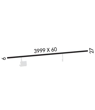
    Length: 3999 ft
    Width: 60 ft
    Surface: ASPHALT-GOOD CONDITION
    Edge lights: Medium Intensity

    Treatment: NONE

     Runway: 09   Runway: 27
    Mag heading: 92°Mag heading: 272°
    Rwy Slope: -.19% DownRwy Slope: .19% Up
    Approach: Approach:
    Pattern: Left TrafficPattern: Left Traffic
    Markings: NONPRECISION INSTRUMENTMarkings: NONPRECISION INSTRUMENT
    Marking Condition: GOODMarking Condition: GOOD
    Arresting Dev: Arresting Dev:
    Lat & Long: N3556.2  W07733.2Lat. & Long.: N3556.3  W07732.4
    Elev: 52.6 ft. MSLElev: 44.9 ft. MSL
    TCH: 27 ft. AGLTCH: 29 ft. AGL
    Visual Glide Path: 4.00 degreesVisual Glide Path: 3.00 degrees
    Displaced Threshold: 200 feetDisplaced Threshold: No
    Touchdown Zone: YESTouchdown Zone: YES
    Touchdown Elev.: 52.5 feetTouchdown Elev.: 51.6 feet
    Visual Glide Slope: 2-Light PAPI on LEFT side of RunwayVisual Glide Slope: 2-Light PAPI on LEFT side of Runway
    RVR Equipment: RVR Equipment:
    RVV Equipment: NORVV Equipment: NO
    Approach Lights: Approach Lights:
    REIL: NOREIL: YES
    Centerline Lights: NOCenterline Lights: NO
    Touchdown lights: NOTouchdown lights: NO
    Runway Category: Runway with a Visual ApproachRunway Category: Runway with a Non-precision Approach
    Declared Distances: Declared Distances:
    Obstructions: TREESObstructions: TREES
    Marked: NOT Marked/LightedMarked: NOT Marked/Lighted
    Clearance slope: 4:1; RWY 9 APCH SLOPE 7:1 DUE TO 48 FT TREES 575 FT FM THE DSPLCD THLD & OFFSET 126 FT R OF CNTRLN.Clearance slope: 30:1
    Obstruction height: 27 feet AGLObstruction height: 21 feet AGL
    Dist. from runway: 319 feetDist. from runway: 839 feet
    Centerline offset: 3 right of centerlineCenterline offset: 4 feet left of centerline
    Comments: 15 FT ROAD 160 FT FM END BOTH SIDES CNTRLN; 4 FT FENCE 125 FT FM END BOTH SIDES CNTRLN; 13 FT TREE 125 FT FM END OFFSET 10 FT R OF CNTRLN; AND 10 FT TREE 152 FT FM END OFFSET 121 FT L OF CNTRLN.Comments:
    C:3/P: