Current Weather/Notams (Metars, TAFs, Notams, NWS Forecast, PIREPS, and nearby weather)
Customs Information Send updates to Support@FltPlan.com
Phone 704-329-6120
Fax 000-000-0000
Comments Hours are Monday to Friday 0800-1700
Database effective 05/16/2024
Airport Diagram might not be current.
|
| Facility Name: | CHARLOTTE/MONROE EXEC |
| City Name: | MONROE |
| County: | UNION |
| State abbrev: | NC |
| State Name: | NORTH CAROLINA |
| | |
| Ownership: | PUBLICLY OWNED |
| Use: | OPEN TO THE PUBLIC |
| Owner's Name: | CITY OF MONROE |
| Address: | CITY HALL, P.O. BOX 69 |
| | MONROE, NC 28111 |
| Owner's Phone: | 704-282-4731 |
| | |
| Manager's Name: | BOB HEITZ |
| Address: | 3900 PAUL J. HELMS DRIVE |
| | MONROE, NC 28110 |
| Phone: | 704-282-4731 |
| | |
| FAA Region: | SOUTHERN |
| FAA Field Office: | MEM |
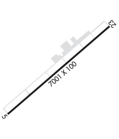
Runway Identifications
Runway Identification: 05/23Length: 7001 ft
Width: 100 ft
Surface: ASPHALT
Edge lights: High IntensityTreatment: NONE
| | Runway: 05 | | Runway: 23 |
| Mag heading: | 53° | Mag heading: | 233° |
| Rwy Slope: | -.29% Down | Rwy Slope: | .29% Up |
| Approach: | ILS/DME | Approach: | |
| Pattern: | Left Traffic | Pattern: | Left Traffic |
| Markings: | PRECISION INSTRUMENT | Markings: | NONPRECISION INSTRUMENT |
| Marking Condition: | GOOD | Marking Condition: | GOOD |
| Arresting Dev: | | Arresting Dev: | |
| Lat & Long: | N3500.7 W08037.8 | Lat. & Long.: | N3501.4 W08036.8 |
| Elev: | 682.5 ft. MSL | Elev: | 662.0 ft. MSL |
| TCH: | 46 ft. AGL | TCH: | 40 ft. AGL |
| Visual Glide Path: | 3.00 degrees | Visual Glide Path: | 3.00 degrees |
| Displaced Threshold: | No | Displaced Threshold: | No |
| Touchdown Zone: | YES | Touchdown Zone: | YES |
| Touchdown Elev.: | 682.5 feet | Touchdown Elev.: | 671.1 feet |
| Visual Glide Slope: | 4-Light PAPI on LEFT side of Runway | Visual Glide Slope: | 4-Light PAPI on LEFT side of Runway |
| RVR Equipment: | | RVR Equipment: | |
| RVV Equipment: | NO | RVV Equipment: | NO |
| Approach Lights: | MALSR - 1,400 foot medium intensity approach lighting system with runway alignment indicator lights | Approach Lights: | |
| REIL: | NO | REIL: | YES |
| Centerline Lights: | NO | Centerline Lights: | NO |
| Touchdown lights: | NO | Touchdown lights: | NO |
| Runway Category: | Precision Instrument Runway | Runway Category: | Runway with a Non-precision Approach having visibility minimums greater than 3/4 mile |
| Declared Distances: | | Declared Distances: | |
| Obstructions: | TREES | Obstructions: | TREES |
| Marked: | NOT Marked/Lighted | Marked: | NOT Marked/Lighted |
| Clearance slope: | 33:1 | Clearance slope: | 17:1 |
| Obstruction height: | 54 feet AGL | Obstruction height: | 50 feet AGL |
| Dist. from runway: | 1999 feet | Dist. from runway: | 1089 feet |
| Centerline offset: | 17 left of centerline | Centerline offset: | 438 feet right of centerline |
| Comments: | | Comments: | 62 FT TREES LOCATED 0-200 FT FM THR AND OFFSET 312 FT L. |

