Click here for more info on on SMS!

KELM

ELMIRA/CORNING RGNL
ELMIRA/CORNING
NY
Time Zone: Eastern
Lat: N 4209.6
Long: W 07653.5
Elev: 955
Var: +12
Longest Runway: 8001
Clr Del: 121.9
Dept. ATIS: 125.47
Arr. ATIS: 125.47
AWOS: 125.47
Ground: 121.9
Tower: 121.1

FBO & Flight Services info for KELM

FBOs: Update your Fuel Prices
Atlantic Aviation is your premier aviation service provider with more than 100 locations in North America, including Hawaii and the Caribbean. We provide standard ground services you'd expect, with a detailed focus on ensuring an unforgettable customer experience.
Ph: 607-739-3597 Fax: 607-739-0239 Freq: 122.95WebsiteE-Mail
                                       
Service
Jet
100LL
SAF
MoGas
Full7.276.99    Last Update: 04/24/2024 13:37:44

Self        
Misc. Info: All prices are 'Out The Door', call for volume discountsAddress: 42 AVIATION DR   HORSEHEADS, NY 14845

PREMIER AVIATIONPh: 607-301-1390
-
Freq: 130.22
Service
Jet
100LL
SAF
MoGas
Fuel Avail: PIRIST+$0.07/gal Contract Fuel Discounts Available. AVTrip, Avfuel.
Full7.146.98    Last Update: 04/05/2024 10:18  
Self  6.98    
 Address: 236 SING SING ROAD   HORSEHEADS, NY 14845
ASOSPh: 607-796-0065
-
Freq: 125.47  
If you are an FBO, call 1-203-262-1700 to update your info or email: FltPlan.Advertising@garmin.com
Advertise your FBO on FltPlan.com

Runway & Approach Info for KELM
Rwy
Length
Land Dist**
Approach*
  Rwy
Length
Land Dist**
Approach*
05
2016x150  2016'          
 
  
23
  2016x150  2016'          
 
06
8001x150  7401'          
ILS
 109.10 - 062°  
  
24
  8001x150  7799'          
ILS
 109.10 - 242°  
10
5404x150  5404'          
 
  
28
  5404x150  5002'          
 
 * only ILS, LOC, LDA, and SDF approaches to a specific runway are shown
** For any Declared Landing Distance Available, please see A/FD or Approach plates
Runway Weight Capability (lbs.) Help
Runway IDSingle WheelDouble WheelDouble Tandem WheelDual Double Wheel
05/23N/AN/AN/AN/A
06/2480,000121,000200,000N/A
10/2857,00090,000150,000N/A
These numbers are Advisory and are not limits.   The Airport Manager should have more accurate Weight Limits
Approach Charts
Approaches    
Current Weather/Notams
Customs Information Send updates to Support@FltPlan.com
Phone ###-###-####
Fax N/A

Comments CUSOMS NO LONGER AVAILABLE
Database effective 05/16/2024
Airport Diagram of KELM
Airport Diagram might not be current.

Facility Name: ELMIRA/CORNING RGNL
City Name: ELMIRA/CORNING
County: CHEMUNG
State abbrev: NY
State Name: NEW YORK
   
Ownership: PUBLICLY OWNED
Use: OPEN TO THE PUBLIC
Owner's Name: COUNTY OF CHEMUNG
Address: 276 SING SING RD., SUITE 1
 HORSEHEADS, NY 14845
Owner's Phone: 607-739-5621; OR 607-739-5622.
  
Manager's Name: THOMAS FREEMAN
Address: 276 SING SING RD.,SUITE 1
 HORSEHEADS, NY 14845
Phone: 607-739-5621
   
FAA Region: EASTERN
FAA Field Office: NYC


Sunrise / Sunset times for ELMIRA/CORNING RGNL

DateSunriseSunset
04/23/24 Tuesday6:1319:59
04/24/24 Wednesday6:1220:00
04/25/24 Thursday6:1120:01
04/26/24 Friday6:0920:02
04/27/24 Saturday6:0820:03
04/28/24 Sunday6:0620:04
04/29/24 Monday6:0520:05
04/30/24 Tuesday6:0420:06
05/01/24 Wednesday6:0220:08
05/02/24 Thursday6:0120:09
05/03/24 Friday6:0020:10
05/04/24 Saturday5:5820:11
05/05/24 Sunday5:5720:12
05/06/24 Monday5:5620:13

Airport Facilities

Airport Attendance ScheduleCONTINUOUS
Airport Status OPERATIONAL (This Status can change at any time - please check NOTAMS)
Airport Lighting ScheduleWHEN ATCT CLSD ACTVT MALSR RWY 06 & 24; HIRL RWY 06/24; MIRL RWY 10/28; TWY LGTS - CTAF.
Airport Storage AvailableTie Downs, Hanger
Extra Services AvailableCargo Handling, Charter, Flight Instruction, Aircraft Rental, Aircraft Sales
Wind IndicatorYES - (lighted)
Control TowerYES
CTAF Frequency121.100
Unicom Frequency122.950
Rotating Beacon ColorWG
Segmented CircleNO
Landing FeeYES; LNDG FEE FOR ALL NON BASED ACFT.

Airport Inspection Data

Airport InspectedFEDERAL - performed by FAA AIRPORTS FIELD PERSONNEL
Inspection Date04/18/2023

Airport Services

Type of Fuel AvailableGrade 100LL, JET A (freeze point -40C)
Airframe Repair ServiceMAJOR
Power Plant Repair ServiceMAJOR

Geographic Data

LatitudeN4209.6
LongitudeW07653.5 (ESTIMATED)
Arpt Elevation955ft (SURVEYED)
Magnetic Variation12W
6 miles NWof ELMIRA/CORNING
Traffic Pattern Altitude1545; TPA: 1545 FT AGL RECIPROCATING ENG, 2045 FT AGL TURBOPROP/JET.
Sectional ChartNEW YORK

Aircraft Data

Operations (Reported)YearlyAvg. Daily
General Aviation Transient 512014
General Aviation Local 18985
Air Taxi 23056
Commerical 19825
Commuter 00
Military 2111
Aircraft based on Field
General Aviation Singles 21
General Aviation Multi 3
Jet Aircraft 12
General Aviation Helicopters 1
Military Aircraft 0
Gliders 0
Ultralights 0

FAA Services

FSS on field NO
FSS tie-in BUFFALO
FSS Phone 1-800-WX-BRIEF
Who issues Notams ELM
Notam D service at airport YES
ARTCC Name NEW YORK

Federal Status

Airport CertificationAIRPORT RECEIVING SCHEDULED AIR CARRIER SERVICE FROM CARRIERS CERTIFICATED BY THE CIVIL AERONAUTICS BOARD; ARFF INDEX "C" EQUIPMENT COVERAGE IS AVBL UPON REQUEST CTC ARPT MANAGEMENT AT 607-426-5621.
Aircraft Rescue & Firefighting IndexAIRPORT HAS A CERTIFICATE UNDER CFR PART 139
Airport of EntryNo
Custom Landing RightsYES
Joint Civil/MilitaryNo
Military Landing rightsYES

Federal Agreements

NATIONAL PLAN OF INTEGRATED AIRPORT SYSTEMS (NPIAS)
GRANT AGREEMENTS UNDER FAAP/ADAP/AIP
ASSURANCES PURSUANT TO TITLE VI, CIVIL RIGHTS ACT OF 1964
AGREEMENT UNDER DLAND OR DCLA HAS EXPIRED.

Remarks

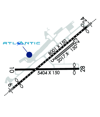
ACFT WITH WINGSPANS GTR THAN 93 FEET SHOULD USE EXTREME CARE WHEN TAXIING ON TWY T ADJ TO APRONS.
RWY 10 OPNS PROHIBITED FOR ACFT WITH APCH SPEEDS GTR THAN OR EQUAL TO 121 KNOTS AND/OR WINGSPANS GTR THAN OR EQUAL TO 118 FT .
COLD TEMPERATURE AIRPORT. ALTITUDE CORRECTION REQUIRED AT OR BELOW -22C.
TWY H, J, & L LTD TO DESIGN GROUP II ACFT.
TRML RAMP IS UNCONTROLLED. DO NOT CALL FOR PUSH/POWER BACK. ADVISE GC WHEN READY TO TAXI FOR DEP.
TWY T BTN TXY L AND TWY D NONMOVEMENT AREA.
FOR CD IF UNA TO CTC ON FSS FREQ, CTC NEW YORK ARTCC AT 631-468-1425.
EXTSV GLIDER ACT ON & INVOF ARPT.
BIRDS & DEER ON & INVOF ARPT.
RWY 05/23 (SOUTHEAST OF RWY 06/24) UNMARKED SEASONAL USE TURF RWY CLSD 1 DEC THROUGH 30 APR.
FOR LAND SIDE ACCESS FM APRON WHEN FBO CLSD CTC ELM ARPT ATTENDANT AT 607-426-5621.
WINTER DE-ICING ON GLYCOL APRON ONLY.
BLIMP ACT RQRS PPR, CTC ARPT MGMT AT 607-426-5621.
Airport Communications & Frequencies:
ATIS Frequencies:   Hours(local) of Operation: CONTINUOUS
125.475
ELMIRA Tower Frequencies:   Hours(local) of operation: 0600-0000   
121.1
257.8
ELMIRA Ground Frequencies:
121.9
Clearance Delivery Frequencies:
121.9
Emergency Frequencies:
121.5
243.0
CTAF Frequency:
121.100
Unicom Frequency:
122.950
Remarks
  • APCH/DEP SVC PRVDD BY NEW YORK ARTCC ON FREQS 133.35/372.0 (SAYRE RCAG) WHEN ELMIRA APCH CTL CLSD.
  • FOR CLNC DEL WHEN ATCT CLSD CTC BUFFALO RADIO ON 122.2
  • ELMIRA Primary Approach Frequencies:   Hours(local) of operation: 0600-0000   
    128.425
    257.8
    NEW YORK ARTCC Part-time Approach Frequencies:   Hours(local) of operation: 0000-0600   
    118.15
    ELMIRA Primary Departure Frequencies:   Hours(local) of operation: 0600-0000   
    128.425
    257.8
    NEW YORK ARTCC Part-time Departure Frequencies:   Hours(local) of operation: 0000-0600   
    118.15
    Runway Identifications
    Runway Identification: 05/23
    Length: 2016 ft
    Width: 150 ft
    Surface: GRASS-GOOD CONDITION
    Edge lights:

    Treatment: NONE

     Runway: 05   Runway: 23
    Mag heading: 62°Mag heading: 242°
    Rwy Slope: .00% UpRwy Slope: .00% Down
    Approach: Approach:
    Pattern: Left TrafficPattern: Left Traffic
    Markings: Markings:
    Marking Condition: RWY 05/23 MKD WITH ASPH "L" CORNER MARKERS.Marking Condition:
    Arresting Dev: Arresting Dev:
    Lat & Long: N4209.6  W07653.4Lat. & Long.: N4209.8  W07653.1
    Elev: 943.5 ft. MSLElev: 943.6 ft. MSL
    TCH: TCH:
    Visual Glide Path: Visual Glide Path:
    Displaced Threshold: NoDisplaced Threshold: No
    Touchdown Zone: YESTouchdown Zone: YES
    Touchdown Elev.: 944.4 feetTouchdown Elev.: 944.4 feet
    Visual Glide Slope: Visual Glide Slope:
    RVR Equipment: RVR Equipment:
    RVV Equipment: NORVV Equipment: NO
    Approach Lights: Approach Lights:
    REIL: NOREIL: NO
    Centerline Lights: NOCenterline Lights: NO
    Touchdown lights: NOTouchdown lights: NO
    Runway Category: Runway with a Visual ApproachRunway Category: Runway with a Visual Approach
    Declared Distances: TORA:2017' TODA:2017' ASDA:2017' LDA:2017'Declared Distances: TORA:2017' TODA:2017' ASDA:2017' LDA:2017'
    Runway Identification: 06/24
    Length: 8001 ft
    Width: 150 ft
    Surface: ASPHALT-GOOD CONDITION
    Edge lights: High Intensity

    Treatment: GROOVED
    Weight: PCN 50 /F/C/X/T

     Runway: 06   Runway: 24
    Mag heading: 62°Mag heading: 242°
    Rwy Slope: .15% UpRwy Slope: -.15% Down
    Approach: ILSApproach: ILS
    Pattern: Left TrafficPattern: Left Traffic
    Markings: PRECISION INSTRUMENTMarkings: PRECISION INSTRUMENT
    Marking Condition: GOODMarking Condition: GOOD
    Arresting Dev: EMAS; ENGINEERED MATERIALS ARRESTING SYSTEM (EMAS) 259 FT IN LENGTH BY 170 FT IN WIDTH LCTD AT DER 06.Arresting Dev:
    Lat & Long: N4209.2  W07654.2Lat. & Long.: N4210.1  W07652.8
    Elev: 942.8 ft. MSLElev: 955.0 ft. MSL
    TCH: 51 ft. AGLTCH: 52 ft. AGL
    Visual Glide Path: 3.00 degreesVisual Glide Path: 3.00 degrees
    Displaced Threshold: 600 feetDisplaced Threshold: 202 feet
    Touchdown Zone: YESTouchdown Zone: YES
    Touchdown Elev.: 943.7 feetTouchdown Elev.: 954.8 feet
    Visual Glide Slope: 4-BOX VASI ON LEFT SIDE OF RUNWAYVisual Glide Slope: 4-Light PAPI on LEFT side of Runway; PAPI UNUSBL BYD 9 DEGS RIGHT OF CNTRLN.
    RVR Equipment: TOUCHDOWN-MIDFIELD-ROLLOUTRVR Equipment: TOUCHDOWN-MIDFIELD-ROLLOUT
    RVV Equipment: NORVV Equipment: NO
    Approach Lights: MALSR - 1,400 foot medium intensity approach lighting system with runway alignment indicator lightsApproach Lights: MALSR - 1,400 foot medium intensity approach lighting system with runway alignment indicator lights
    REIL: YESREIL: YES
    Centerline Lights: YESCenterline Lights: YES
    Touchdown lights: NOTouchdown lights: NO
    Runway Category: Precision Instrument RunwayRunway Category: Precision Instrument Runway
    Declared Distances: TORA:8001' TODA:8001' ASDA:8001' LDA:7401'Declared Distances: TORA:8001' TODA:8001' ASDA:8001' LDA:7799'
    Obstructions: TREEObstructions: TREE
    Marked: NOT Marked/LightedMarked: NOT Marked/Lighted
    Clearance slope: 34:1Clearance slope: 31:1
    Obstruction height: 790 feet AGLObstruction height: 382 feet AGL
    Dist. from runway: 27250 feetDist. from runway: 12329 feet
    Centerline offset: 1800 right of centerlineCenterline offset: 2123 feet right of centerline
    Comments: Comments:
    Runway Identification: 10/28
    Length: 5404 ft
    Width: 150 ft
    Surface: ASPHALT-GOOD CONDITION
    Edge lights: Medium Intensity

    Treatment: GROOVED
    Weight: PCN 17 /F/C/X/T

     Runway: 10   Runway: 28
    Mag heading: 101°Mag heading: 281°
    Rwy Slope: .19% UpRwy Slope: -.19% Down
    Approach: Approach:
    Pattern: Left TrafficPattern: Left Traffic
    Markings: NONPRECISION INSTRUMENTMarkings: NONPRECISION INSTRUMENT
    Marking Condition: GOODMarking Condition: GOOD
    Arresting Dev: Arresting Dev:
    Lat & Long: N4209.5  W07654.2Lat. & Long.: N4209.5  W07653.0
    Elev: 934.3 ft. MSLElev: 944.4 ft. MSL
    TCH: TCH: 40 ft. AGL
    Visual Glide Path: Visual Glide Path: 3.00 degrees
    Displaced Threshold: NoDisplaced Threshold: 402 feet
    Touchdown Zone: YESTouchdown Zone: YES
    Touchdown Elev.: 941.6 feetTouchdown Elev.: 943.7 feet
    Visual Glide Slope: Visual Glide Slope: 4-Light PAPI on LEFT side of Runway
    RVR Equipment: RVR Equipment:
    RVV Equipment: NORVV Equipment: NO
    Approach Lights: Approach Lights:
    REIL: NOREIL: NO
    Centerline Lights: NOCenterline Lights: NO
    Touchdown lights: NOTouchdown lights: NO
    Runway Category: Runway with a Non-precision Approach having visibility minimums greater than 3/4 mileRunway Category: Runway with a Non-precision Approach having visibility minimums greater than 3/4 mile
    Declared Distances: TORA:5404' TODA:5404' ASDA:5004' LDA:5004'Declared Distances: TORA:5404' TODA:5404' ASDA:5404' LDA:5002'
    Obstructions: TREESObstructions: POLE
    Marked: NOT Marked/LightedMarked: NOT Marked/Lighted
    Clearance slope: 13:1Clearance slope: 21:1
    Obstruction height: 632 feet AGLObstruction height: 54 feet AGL
    Dist. from runway: 8761 feetDist. from runway: 1351 feet
    Centerline offset: 1488 left of centerlineCenterline offset: 264 feet left of centerline
    Comments: Comments:
    C:26/P: