Current Weather/Notams (Metars, TAFs, Notams, NWS Forecast, PIREPS, and nearby weather)
Customs Information Send updates to Support@FltPlan.com
Customs Not Available
Database effective 05/16/2024
Airport Diagram might not be current.
|
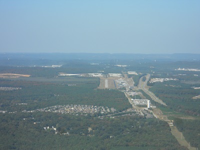
| Facility Name: | SHELBY COUNTY |
| City Name: | ALABASTER |
| County: | SHELBY |
| State abbrev: | AL |
| State Name: | ALABAMA |
| | |
| Ownership: | PUBLICLY OWNED |
| Use: | OPEN TO THE PUBLIC |
| Owner's Name: | SHELBY COUNTY COMMISSION; CHAD SCROGGINS, COUNTY MANAGER |
| Address: | P.O. BOX 467 |
| | COLUMBIANA, AL 35051 |
| Owner's Phone: | 205-670-6359 |
| | |
| Manager's Name: | TERRY FRANKLIN |
| Address: | 265 WEATHER VANE ROAD |
| | CALERA, AL 35040 |
| Phone: | 205 670 6359 |
| | |
| FAA Region: | SOUTHERN |
| FAA Field Office: | JAN |
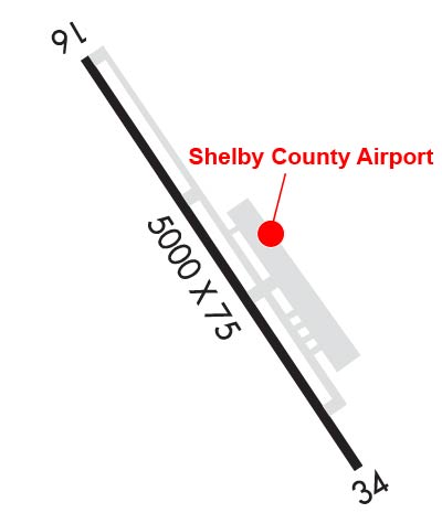
Runway Identifications
Runway Identification: 16/34Length: 5000 ft
Width: 75 ft
Surface: ASPHALT-FAIR CONDITION
Edge lights: Medium IntensityTreatment: NONE
| | Runway: 16 | | Runway: 34 |
| Mag heading: | 160° | Mag heading: | 340° |
| Rwy Slope: | .26% Up | Rwy Slope: | -.26% Down |
| Approach: | | Approach: | |
| Pattern: | Left Traffic | Pattern: | Right Traffic |
| Markings: | NONPRECISION INSTRUMENT | Markings: | NONPRECISION INSTRUMENT |
| Marking Condition: | GOOD | Marking Condition: | GOOD |
| Arresting Dev: | | Arresting Dev: | |
| Lat & Long: | N3311.0 W08647.2 | Lat. & Long.: | N3310.3 W08646.8 |
| Elev: | 572.7 ft. MSL | Elev: | 585.6 ft. MSL |
| TCH: | 57 ft. AGL | TCH: | 44 ft. AGL |
| Visual Glide Path: | 3.50 degrees | Visual Glide Path: | 4.00 degrees |
| Displaced Threshold: | No | Displaced Threshold: | No |
| Touchdown Zone: | YES | Touchdown Zone: | YES |
| Touchdown Elev.: | 572.7 feet | Touchdown Elev.: | 585.6 feet |
| Visual Glide Slope: | 4-Light PAPI on LEFT side of Runway | Visual Glide Slope: | 4-Light PAPI on LEFT side of Runway |
| RVR Equipment: | | RVR Equipment: | |
| RVV Equipment: | NO | RVV Equipment: | NO |
| Approach Lights: | | Approach Lights: | |
| REIL: | YES | REIL: | YES |
| Centerline Lights: | NO | Centerline Lights: | NO |
| Touchdown lights: | NO | Touchdown lights: | NO |
| Runway Category: | Runway with a Non-precision Approach having visibility minimums greater than 3/4 mile | Runway Category: | Runway with a Non-precision Approach having visibility minimums greater than 3/4 mile |
| Declared Distances: | | Declared Distances: | |
| Obstructions: | BLDG | Obstructions: | BLDG |
| Marked: | NOT Marked/Lighted | Marked: | NOT Marked/Lighted |
| Clearance slope: | 7:1 | Clearance slope: | 17:1 |
| Obstruction height: | 22 feet AGL | Obstruction height: | 18 feet AGL |
| Dist. from runway: | 362 feet | Dist. from runway: | 517 feet |
| Centerline offset: | 12 right of centerline | Centerline offset: | 69 feet left of centerline |
| Comments: | | Comments: | |