| |||||||||||||||||||||||||||||||||||||||||||||||||||||||||||||
| |||||||||||||||||||||||||||||||||||||||||||||||||||||||||||||
| |||||||||||||||||||||||||||||||||||||||||||||||||||||||||||||
| Rwy | Rwy | |||||||
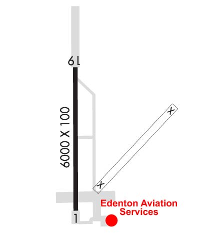
| 6001x100 | 6001' | 6001x100 | 6001' | 110.95 - 189° | ||||
| Runway ID | Single Wheel | Double Wheel | Double Tandem Wheel | Dual Double Wheel |
| 01/19 | 60,000 | 80,000 | N/A | N/A |
| These numbers are Advisory and are not limits. The Airport Manager should have more accurate Weight Limits | ||||
 Airport Diagram might not be current. | |
| Facility Name: | NORTHEASTERN RGNL |
| City Name: | EDENTON |
| County: | CHOWAN |
| State abbrev: | NC |
| State Name: | NORTH CAROLINA |
| Ownership: | PUBLICLY OWNED |
| Use: | OPEN TO THE PUBLIC |
| Owner's Name: | TOWN OF EDENTON |
| Address: | PO BOX 300 |
| EDENTON, NC 27932 | |
| Owner's Phone: | (252) 482-2155 |
| Manager's Name: | HARRY DAVIS |
| Address: | 113 AIRPORT ROAD |
| EDENTON, NC 27932 | |
| Phone: | 252-482-4664 |
| FAA Region: | SOUTHERN |
| FAA Field Office: | MEM |
| Date | Sunrise | Sunset |
|---|---|---|
| 04/19/24 Friday | 6:27 | 19:44 |
| 04/20/24 Saturday | 6:26 | 19:45 |
| 04/21/24 Sunday | 6:25 | 19:46 |
| 04/22/24 Monday | 6:23 | 19:47 |
| 04/23/24 Tuesday | 6:22 | 19:47 |
| 04/24/24 Wednesday | 6:21 | 19:48 |
| 04/25/24 Thursday | 6:20 | 19:49 |
| 04/26/24 Friday | 6:18 | 19:50 |
| 04/27/24 Saturday | 6:17 | 19:51 |
| 04/28/24 Sunday | 6:16 | 19:52 |
| 04/29/24 Monday | 6:15 | 19:53 |
| 04/30/24 Tuesday | 6:14 | 19:53 |
| 05/01/24 Wednesday | 6:13 | 19:54 |
| 05/02/24 Thursday | 6:12 | 19:55 |
| Airport Attendance Schedule | 7 Days A Week 0800-1700; FOR AFTER HOURS SERVICE CALL 252-217-4975. |
| Airport Status | OPERATIONAL (This Status can change at any time - please check NOTAMS) |
| Airport Lighting Schedule | PAPI RYS 01& 19 OPER CONT. ACTVT MIRL RY 1/19 AND REIL RYS 01 & 19 - CTAF. |
| Airport Storage Available | Tie Downs, Hanger |
| Extra Services Available | Crop Dusting, Flight Instruction |
| Wind Indicator | YES - (lighted) |
| Control Tower | NO |
| CTAF Frequency | 123.000 |
| Unicom Frequency | 123.000 |
| Rotating Beacon Color | WG |
| Segmented Circle | YES |
| Landing Fee | NO |
| Airport Inspected | STATE - performed by STATE AERONAUTICAL PERSONNEL |
| Inspection Date | 07/08/2023 |
| Type of Fuel Available | Grade 100LL, JET A-1 (icing inhibitor, freeze point -50C); -A1JET A TRUCK AVAILABLE WITH SINGLE POINT AND OVER THE WING FILLING; -10AFTER HRS SELF SERVICE FUEL FOR 100LL AND A1+ AVBL WITH CREDIT CARD. |
| Airframe Repair Service | MAJOR |
| Power Plant Repair Service | MAJOR |
| Latitude | N3601.7 |
| Longitude | W07634.2 (ESTIMATED) |
| Arpt Elevation | 18ft (SURVEYED) |
| Magnetic Variation | 10W |
| 3 miles SE | of EDENTON |
| Traffic Pattern Altitude | |
| Sectional Chart | WASHINGTON |
| Operations (Reported) | Yearly | Avg. Daily |
|---|---|---|
| General Aviation Transient | 7000 | 19 |
| General Aviation Local | 6000 | 16 |
| Air Taxi | 500 | 1 |
| Commerical | 0 | 0 |
| Commuter | 0 | 0 |
| Military | 500 | 1 |
| Aircraft based on Field | |
|---|---|
| General Aviation Singles | 17 |
| General Aviation Multi | 1 |
| Jet Aircraft | 0 |
| General Aviation Helicopters | 1 |
| Military Aircraft | 0 |
| Gliders | 0 |
| Ultralights | 0 |
| FSS on field | NO |
| FSS tie-in | RALEIGH |
| FSS Phone | 1-800-WX-BRIEF |
| Who issues Notams | EDE |
| Notam D service at airport | YES |
| ARTCC Name | WASHINGTON |
| Airport Certification | |
| Aircraft Rescue & Firefighting Index | None |
| Airport of Entry | No |
| Custom Landing Rights | No |
| Joint Civil/Military | No |
| Military Landing rights | YES |
| NATIONAL PLAN OF INTEGRATED AIRPORT SYSTEMS (NPIAS) |
| GRANT AGREEMENTS UNDER FAAP/ADAP/AIP |
| SURPLUS PROPERTY AGREEMENT UNDER PUBLIC LAW 289 |
| ASSURANCES PURSUANT TO TITLE VI, CIVIL RIGHTS ACT OF 1964 |
| SEASONAL PROBLEM WITH BIRDS & DEER ON & INVOF ARPT. |
| TWYS SERVING RY 01/19 HAVE GREEN CNTRLN REFLECTORS AND NSTD SOLAR LGTS. |
| FOR CD CTC WASHINGTON ARTCC AT 703-771-3587. |
| RWY 01/1 9 RY 01/19 HAS 1500 FT STOPWAY AT N END & 500 FT STOPWAY AT S END. |
Airport Communications & Frequencies:
| |||||||||
| Runway: 01 | Runway: 19 | ||
| Mag heading: | 10° | Mag heading: | 190° |
| Rwy Slope: | .00% Down | Rwy Slope: | .00% Up |
| Approach: | Approach: | ILS/DME | |
| Pattern: | Left Traffic | Pattern: | Left Traffic |
| Markings: | NONPRECISION INSTRUMENT | Markings: | PRECISION INSTRUMENT |
| Marking Condition: | GOOD | Marking Condition: | GOOD |
| Arresting Dev: | Arresting Dev: | ||
| Lat & Long: | N3601.2 W07634.2 | Lat. & Long.: | N3602.2 W07634.2 |
| Elev: | 17.5 ft. MSL | Elev: | 17.3 ft. MSL |
| TCH: | 39 ft. AGL | TCH: | 48 ft. AGL |
| Visual Glide Path: | 3.00 degrees | Visual Glide Path: | 3.00 degrees |
| Displaced Threshold: | No | Displaced Threshold: | No |
| Touchdown Zone: | YES | Touchdown Zone: | YES |
| Touchdown Elev.: | 18.7 feet | Touchdown Elev.: | 18.7 feet |
| Visual Glide Slope: | 2-Light PAPI on LEFT side of Runway | Visual Glide Slope: | 2-Light PAPI on RIGHT side of Runway |
| RVR Equipment: | RVR Equipment: | ||
| RVV Equipment: | NO | RVV Equipment: | NO |
| Approach Lights: | Approach Lights: | ||
| REIL: | YES | REIL: | YES |
| Centerline Lights: | NO | Centerline Lights: | NO |
| Touchdown lights: | NO | Touchdown lights: | NO |
| Runway Category: | Runway with a Non-precision Approach having visibility minimums greater than 3/4 mile | Runway Category: | Precision Instrument Runway |
| Declared Distances: | Declared Distances: | ||
| Obstructions: | TREES | Obstructions: | TREES |
| Marked: | NOT Marked/Lighted | Marked: | NOT Marked/Lighted |
| Clearance slope: | 25:1 | Clearance slope: | 25:1 |
| Obstruction height: | 78 feet AGL | Obstruction height: | 36 feet AGL |
| Dist. from runway: | 2182 feet | Dist. from runway: | 1131 feet |
| Centerline offset: | 272 left of centerline | Centerline offset: | 561 feet right of centerline |
| Comments: | Comments: |