Air Freight, Crop Dusting, Air Ambulance, Charter, Flight Instruction, Aircraft Rental, Aircraft Sales
Wind Indicator
YES - (lighted)
Control Tower
NO
CTAF Frequency
123.000
Unicom Frequency
123.000
Rotating Beacon Color
WG
Segmented Circle
YES
Landing Fee
NO
Airport Inspection Data
Airport Inspected
STATE - performed by FAA AIRPORTS FIELD PERSONNEL
Inspection Date
01/29/2024
Airport Services
Type of Fuel Available
Grade 100LL, JET A (freeze point -40C)
Airframe Repair Service
MAJOR
Power Plant Repair Service
MAJOR
Geographic Data
Latitude
N4043.6
Longitude
W09900.4 (ESTIMATED)
Arpt Elevation
2131ft (SURVEYED)
Magnetic Variation
05E
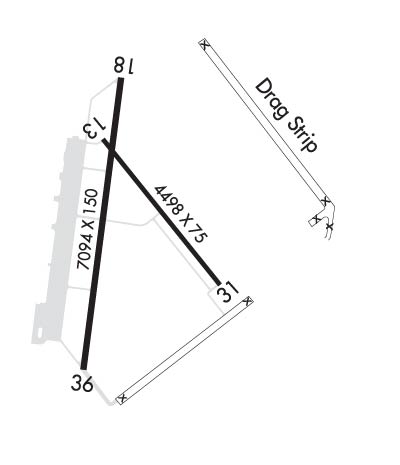
4 miles NE
of KEARNEY
Traffic Pattern Altitude
Sectional Chart
OMAHA
Aircraft Data
Operations (Reported)
Yearly
Avg. Daily
General Aviation Transient
9000
25
General Aviation Local
10000
27
Air Taxi
550
2
Commerical
2190
6
Commuter
0
0
Military
30
0
Aircraft based on Field
General Aviation Singles
25
General Aviation Multi
3
Jet Aircraft
3
General Aviation Helicopters
2
Military Aircraft
0
Gliders
0
Ultralights
0
FAA Services
FSS on field
NO
FSS tie-in
COLUMBUS
FSS Phone
1-800-WX-BRIEF
Who issues Notams
EAR
Notam D service at airport
YES
ARTCC Name
MINNEAPOLIS
Federal Status
Airport Certification
AIRPORT RECEIVING SCHEDULED AIR CARRIER SERVICE FROM CARRIERS CERTIFICATED BY THE CIVIL AERONAUTICS BOARD; ARFF INDEX B EQUIPMENT PROVIDED. PPR 48 HRS FOR AIR CARRIER OPS WITH MORE THAN 30 PASSENGER SEATS. CALL ARPT MGR 308-234-2318 OR 308-440-6069.
Aircraft Rescue & Firefighting Index
AIRPORT HAS A CERTIFICATE UNDER CFR PART 139
Airport of Entry
No
Custom Landing Rights
No
Joint Civil/Military
No
Military Landing rights
YES
Federal Agreements
NATIONAL PLAN OF INTEGRATED AIRPORT SYSTEMS (NPIAS)
GRANT AGREEMENTS UNDER FAAP/ADAP/AIP
SURPLUS PROPERTY AGREEMENT UNDER PUBLIC LAW 289
ASSURANCES PURSUANT TO TITLE VI, CIVIL RIGHTS ACT OF 1964
Remarks
BE ALERT WHEN TAXIING ON APRON DUE TO SEVERAL CLOSED AREAS.
AIR CARRIER OPS ARE NOT AUTHORIZED IN EXCESS OF 15 MINUTES BEFORE OR AFTER SCHEDULED ARRIVAL/DEPARTURE TIMES WITHOUT PRIOR COORDINATION WITH AMGR AND CONFIRMATION THAT ARFF IS AVBL PRIOR TO LDNG OR TKOF.
FOR CD IF UNA TO CTC ON FSS FREQ, CTC MINNEAPOLIS ARTCC AT 651-463-5588.
Airport Communications & Frequencies:
CTAF Frequency:
123.000
Unicom Frequency:
123.000
Remarks
APCH/DEP SVC PRVDD BY MINNEAPOLIS ARTCC ON FREQS 119.4/278.8 (HASTINGS RCAG).