| |||||||||||||||||||||||||||||||||||||||||||||||||||||||||||||
| |||||||||||||||||||||||||||||||||||||||||||||||||||||||||||||
| |||||||||||||||||||||||||||||||||||||||||||||||||||||||||||||
| |||||||||||||||||||||||||||||||||||||||||||||||||||||||||||||
| |||||||||||||||||||||||||||||||||||||||||||||||||||||||||||||
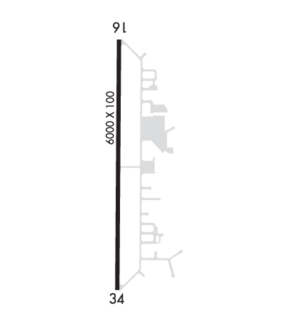
| Rwy | Rwy | |||||||
| 6000x100 | 6000' | 6000x100 | 6000' | |||||
| Runway ID | Single Wheel | Double Wheel | Double Tandem Wheel | Dual Double Wheel |
| 16/34 | 45,000 | 60,000 | N/A | N/A |
| These numbers are Advisory and are not limits. The Airport Manager should have more accurate Weight Limits | ||||
 Airport Diagram might not be current. | |
| Facility Name: | YOLO COUNTY |
| City Name: | DAVIS/WOODLAND/WINTERS |
| County: | YOLO |
| State abbrev: | CA |
| State Name: | CALIFORNIA |
| Ownership: | PUBLICLY OWNED |
| Use: | OPEN TO THE PUBLIC |
| Owner's Name: | YOLO COUNTY |
| Address: | 120 WEST MAIN STREET, SUITE G |
| WOODLAND, CA 95695-2998 | |
| Owner's Phone: | 530-406-5005 |
| Manager's Name: | RYAN PISTOCHINI |
| Address: | 120 WEST MAIN, SUITE G, RM 202 |
| WOODLAND, CA 95695-2598 | |
| Phone: | 530-406-5044 |
| FAA Region: | WESTERN-PACIFIC |
| FAA Field Office: | SFO |
| Date | Sunrise | Sunset |
|---|---|---|
| 04/24/24 Wednesday | 6:18 | 19:54 |
| 04/25/24 Thursday | 6:17 | 19:55 |
| 04/26/24 Friday | 6:15 | 19:55 |
| 04/27/24 Saturday | 6:14 | 19:56 |
| 04/28/24 Sunday | 6:13 | 19:57 |
| 04/29/24 Monday | 6:12 | 19:58 |
| 04/30/24 Tuesday | 6:10 | 19:59 |
| 05/01/24 Wednesday | 6:09 | 20:00 |
| 05/02/24 Thursday | 6:08 | 20:01 |
| 05/03/24 Friday | 6:07 | 20:02 |
| 05/04/24 Saturday | 6:06 | 20:03 |
| 05/05/24 Sunday | 6:05 | 20:04 |
| 05/06/24 Monday | 6:04 | 20:05 |
| 05/07/24 Tuesday | 6:03 | 20:06 |
| Airport Attendance Schedule | 7 Days A Week 0600-1800 |
| Airport Status | OPERATIONAL (This Status can change at any time - please check NOTAMS) |
| Airport Lighting Schedule | MIRL RY 16/34 PRESET LOW INTST; TO INCR INTST AND ACTVT PAPI RYS 16 & 34 - CTAF. |
| Airport Storage Available | Tie Downs |
| Extra Services Available | Crop Dusting, Avionics, Charter, Flight Instruction, Parachute Jumping, Aircraft Sales |
| Wind Indicator | YES - (lighted) |
| Control Tower | NO |
| CTAF Frequency | 123.000 |
| Unicom Frequency | 123.000 |
| Rotating Beacon Color | WG |
| Segmented Circle | YES |
| Landing Fee | NO |
| Airport Inspected | STATE - performed by STATE AERONAUTICAL PERSONNEL |
| Inspection Date | 01/12/2024 |
| Type of Fuel Available | Grade 100LL, JET A (freeze point -40C), JET A; -10FUEL AVBL 24 HRS. |
| Airframe Repair Service | MAJOR |
| Power Plant Repair Service | MAJOR |
| Latitude | N3834.8 |
| Longitude | W12151.4 (ESTIMATED) |
| Arpt Elevation | 100ft (SURVEYED) |
| Magnetic Variation | 16E |
| 6 miles NE; DSTC TO WINTERS. | of DAVIS/WOODLAND/WINTERS |
| Traffic Pattern Altitude | |
| Sectional Chart | SAN FRANCISCO |
| Operations (Reported) | Yearly | Avg. Daily |
|---|---|---|
| General Aviation Transient | 30000 | 82 |
| General Aviation Local | 30000 | 82 |
| Air Taxi | 500 | 1 |
| Commerical | 0 | 0 |
| Commuter | 0 | 0 |
| Military | 20 | 0 |
| Aircraft based on Field | |
|---|---|
| General Aviation Singles | 38 |
| General Aviation Multi | 0 |
| Jet Aircraft | 0 |
| General Aviation Helicopters | 1 |
| Military Aircraft | 0 |
| Gliders | 0 |
| Ultralights | 2 |
| FSS on field | NO |
| FSS tie-in | RANCHO MURIETA |
| FSS Phone | 1-800-WX-BRIEF |
| Who issues Notams | RIU |
| Notam D service at airport | YES |
| ARTCC Name | OAKLAND |
| Airport Certification | |
| Aircraft Rescue & Firefighting Index | None |
| Airport of Entry | No |
| Custom Landing Rights | No |
| Joint Civil/Military | No |
| Military Landing rights | YES |
| NATIONAL PLAN OF INTEGRATED AIRPORT SYSTEMS (NPIAS) |
| GRANT AGREEMENTS UNDER FAAP/ADAP/AIP |
| SURPLUS PROPERTY AGREEMENT UNDER PUBLIC LAW 289 |
| ASSURANCES PURSUANT TO TITLE VI, CIVIL RIGHTS ACT OF 1964 |
| NON-RADIO AIRCRAFT BASED AT KDWA. |
| 95 FT AGL UNLIT WIND TURBINE 1000 FT WEST OF RY CNTRLN. |
| APT OPS: (530) 759-8766 |
| FOR CD CTC OAKLAND ARTCC AT 510-745-3380. |
| NO TGL 2200L TO 0600L. |
| RY 34 CALM WIND RY. |
| NOISE ABATEMENT: NO TURNS TO CROSSWIND PRIOR TO ARPT BOUNDARY. STRAIGHT OUT DEP NO EAST TURNS ON COURSE PRIOR TO 2 MIS. AVOID OVERFLIGHT OF OFF-ARPT STRUCTURES. |
| UNLIT 40 FT POWER LINE & 120 FT TREES 500 FT WEST OF RY CNTRLN. |
| BIRDS ON AND INVOF ARPT. |
| PARACHUTE ACTIVITY EAST OF RY. |
| CROP DUSTER OPNS ON AND INVOF ARPT. |
Airport Communications & Frequencies:
| ||||||||||||||
| Runway: 16 | Runway: 34 | ||
| Mag heading: | 164° | Mag heading: | 344° |
| Rwy Slope: | .03% Up | Rwy Slope: | -.03% Down |
| Approach: | Approach: | ||
| Pattern: | Right Traffic | Pattern: | Left Traffic |
| Markings: | NONPRECISION INSTRUMENT | Markings: | NONPRECISION INSTRUMENT |
| Marking Condition: | GOOD | Marking Condition: | GOOD |
| Arresting Dev: | Arresting Dev: | ||
| Lat & Long: | N3835.3 W12151.4 | Lat. & Long.: | N3834.3 W12151.4 |
| Elev: | 98.2 ft. MSL | Elev: | 100.0 ft. MSL |
| TCH: | 40 ft. AGL | TCH: | 40 ft. AGL |
| Visual Glide Path: | 3.00 degrees | Visual Glide Path: | 3.00 degrees |
| Displaced Threshold: | No | Displaced Threshold: | No |
| Touchdown Zone: | YES | Touchdown Zone: | YES |
| Touchdown Elev.: | 99.1 feet | Touchdown Elev.: | 100.0 feet |
| Visual Glide Slope: | 2-Light PAPI on LEFT side of Runway | Visual Glide Slope: | 2-Light PAPI on LEFT side of Runway |
| RVR Equipment: | RVR Equipment: | ||
| RVV Equipment: | NO | RVV Equipment: | NO |
| Approach Lights: | Approach Lights: | ||
| REIL: | NO | REIL: | NO |
| Centerline Lights: | NO | Centerline Lights: | NO |
| Touchdown lights: | NO | Touchdown lights: | NO |
| Runway Category: | Runway with a Non-precision Approach having visibility minimums greater than 3/4 mile | Runway Category: | Runway with a Non-precision Approach having visibility minimums greater than 3/4 mile |
| Declared Distances: | Declared Distances: | ||
| Obstructions: | Obstructions: | TREES | |
| Marked: | Marked: | NOT Marked/Lighted | |
| Clearance slope: | 50:1 | Clearance slope: | 30:1 |
| Obstruction height: | Obstruction height: | 110 feet AGL | |
| Dist. from runway: | Dist. from runway: | 3500 feet | |
| Centerline offset: | Centerline offset: | ||
| Comments: | Comments: |