Current Weather/Notams (Metars, TAFs, Notams, NWS Forecast, PIREPS, and nearby weather)
Customs Information Send updates to Support@FltPlan.com
Customs Not Available
Database effective 05/16/2024
Airport Diagram might not be current.
|
| Facility Name: | SLAYTON MUNI |
| City Name: | SLAYTON |
| County: | MURRAY |
| State abbrev: | MN |
| State Name: | MINNESOTA |
| | |
| Ownership: | PUBLICLY OWNED |
| Use: | OPEN TO THE PUBLIC |
| Owner's Name: | CITY OF SLAYTON |
| Address: | 2424 26TH ST |
| | SLAYTON, MN 56172-1244 |
| Owner's Phone: | 507-836-8534 |
| | |
| Manager's Name: | JOSH MALCHOW |
| Address: | 2424 26TH ST |
| | SLAYTON, MN 56172-1244 |
| Phone: | 507-836-8534 |
| | |
| FAA Region: | GREAT LAKES |
| FAA Field Office: | DMA |
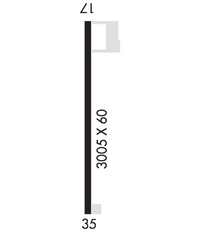
Runway Identifications
Runway Identification: 17/35Length: 3005 ft
Width: 60 ft
Surface: ASPHALT-GOOD CONDITION
Edge lights: Medium IntensityTreatment: NONE
| | Runway: 17 | | Runway: 35 |
| Mag heading: | 176° | Mag heading: | 356° |
| Rwy Slope: | .27% Up | Rwy Slope: | -.27% Down |
| Approach: | | Approach: | |
| Pattern: | Left Traffic | Pattern: | Left Traffic |
| Markings: | NONPRECISION INSTRUMENT | Markings: | NONPRECISION INSTRUMENT |
| Marking Condition: | GOOD | Marking Condition: | GOOD |
| Arresting Dev: | | Arresting Dev: | |
| Lat & Long: | N4359.5 W09547.0 | Lat. & Long.: | N4359.0 W09547.0 |
| Elev: | 1614.7 ft. MSL | Elev: | 1622.9 ft. MSL |
| TCH: | 22 ft. AGL | TCH: | 22 ft. AGL |
| Visual Glide Path: | 3.00 degrees | Visual Glide Path: | 3.00 degrees |
| Displaced Threshold: | No | Displaced Threshold: | No |
| Touchdown Zone: | YES | Touchdown Zone: | YES |
| Touchdown Elev.: | 1623.0 feet | Touchdown Elev.: | 1623.0 feet |
| Visual Glide Slope: | 2-Light PAPI on LEFT side of Runway | Visual Glide Slope: | 2-Light PAPI on LEFT side of Runway |
| RVR Equipment: | | RVR Equipment: | |
| RVV Equipment: | NO | RVV Equipment: | NO |
| Approach Lights: | | Approach Lights: | |
| REIL: | YES | REIL: | YES |
| Centerline Lights: | NO | Centerline Lights: | NO |
| Touchdown lights: | NO | Touchdown lights: | NO |
| Runway Category: | Runway with a Non-precision Approach | Runway Category: | Runway with a Non-precision Approach |
| Declared Distances: | | Declared Distances: | |
| Obstructions: | ROAD | Obstructions: | ROAD |
| Marked: | NOT Marked/Lighted | Marked: | NOT Marked/Lighted |
| Clearance slope: | +44 FT TREES, 1356 FT DIST, 0 FT B, 26:1. | Clearance slope: | +30 FT PLINE, 1400 FT DIST, 0 FT B, 34:1. |
| Obstruction height: | 15 feet AGL | Obstruction height: | 15 feet AGL |
| Dist. from runway: | 201 feet | Dist. from runway: | 201 feet |
| Centerline offset: | 235 right of centerline | Centerline offset: | 235 feet left of centerline |
| Comments: | +15 FT ROAD, 0-200 FT DIST, 235 FT R. | Comments: | +15 FT ROAD, 0-200 FT DIST, 235 FT L. |

